
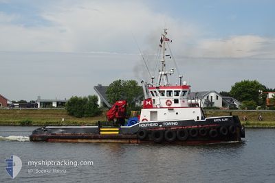
AFON ALAW
Tug
Current Trip
| Time Travelled | 2 days |
|---|---|
| Remaining Time | 11 h, 52 mins |
| Distance Travelled | 359.38 nm |
| Remaining Distance | 90.21 nm |
| AVG Speed | 8.5 Knots |
| MAX Speed | 13.5 Knots |
| AVG Wind | 9.6 knots |
| MAX Wind | 17.8 knots |
| MIN Temp | 3.6°C / 38.48°F |
| MAX Temp | 11.7°C / 53.06°F |
| Draught | 2.7 m |
| Position Received | Now |
Current Position
| Longitude | -5.48177° |
|---|---|
| Latitude | 50.60958° |
| Status | Towing Astern |
| Speed | 5.8 Knots |
| Course | 232.1° |
| Area | Celtic Sea |
| Station | T-AIS |
| Position Received | Now |
Info
Information
The current position of AFON ALAW is in Celtic Sea with coordinates 50.60958° / -5.48177° as reported on 2024-04-24 02:11 by AIS to our vessel tracker app. The vessel's current speed is 5.8 Knots and is heading at the port of FALMOUTH. The estimated time of arrival as calculated by MyShipTracking vessel tracking app is 2024-04-24 14:04 LT
The vessel AFON ALAW (IMO: 9298935, MMSI: 235090202) is a Tug that was built in 2004 ( 20 years old ). It's sailing under the flag of [GB] United Kingdom.
In this page you can find informations about the vessels current position, last detected port calls, and current voyage information. If the vessels is not in coverage by AIS you will find the latest position.
The current position of AFON ALAW is detected by our AIS receivers and we are not responsible for the reliability of the data. The last position was recorded while the vessel was in Coverage by the Ais receivers of our vessel tracking app.
The current draught of AFON ALAW as reported by AIS is 2.7 meters
Weather
| Temperature | 10.1°C / 50.18°F |
|---|---|
| Wind Speed | 11 knots |
| Direction | 347° NNW |
| Pressure | 1022.2 hPa |
| Humidity | 76.3 % |
| Cloud Coverage | 6 % |
Featured Company
Last Port Calls
| Port | Arrival | Departure | Time In Port |
|---|---|---|---|
| 2024-03-31 12:14 | 2024-04-21 23:14 | 21 d | |
| 2024-03-21 13:23 | 2024-03-29 20:45 | 8 d | |
| 2024-03-15 14:48 | 2024-03-15 21:35 | 6 h | |
| 2024-03-12 15:17 | 2024-03-15 14:41 | 2 d | |
| 2024-03-12 12:21 | 2024-03-12 13:26 | 1 h | |
| 2024-02-18 11:22 | 2024-03-02 00:29 | 12 d | |
| 2024-02-16 15:10 | 2024-02-17 01:12 | 10 h | |
| 2024-02-15 16:42 | 2024-02-16 00:21 | 7 h | |
| 2024-02-14 13:41 | 2024-02-14 16:19 | 2 h | |
| 2024-02-14 10:16 | 2024-02-14 12:54 | 2 h |
Most Visited Ports (Last year)
| Port | Arrivals | |
|---|---|---|
| 61 | ||
| 28 | ||
| 22 | ||
| 17 | ||
| 4 | ||
| 2 |
Last Trips
| Origin | Departure | Destination | Arrival | Distance | |
|---|---|---|---|---|---|
| 2024-03-29 21:45 | 2024-03-31 13:14 | 328.56 nm | |||
| 2024-03-15 22:35 | 2024-03-21 14:23 | 579.22 nm | |||
| 2024-03-15 15:41 | 2024-03-15 15:48 | 0.30 nm | |||
| 2024-03-12 14:26 | 2024-03-12 16:17 | 18.51 nm | |||
| 2024-03-02 00:29 | 2024-03-12 13:21 | 842.66 nm | |||
| 2024-02-17 01:12 | 2024-02-18 11:22 | 22.05 nm | |||
| 2024-02-16 00:21 | 2024-02-16 15:10 | 16.67 nm | |||
| 2024-02-14 16:19 | 2024-02-15 16:42 | 8.34 nm | |||
| 2024-02-14 12:54 | 2024-02-14 13:41 | 3.87 nm | |||
| 2024-02-14 09:18 | 2024-02-14 10:16 | 3.76 nm |
Events
| Time | Event | Details | Position / Dest | Info |
|---|---|---|---|---|
| 2024-04-23 20:07 | Change Sea Area | United Kingdom part of the Celtic Sea United Kingdom part of the Bristol Channel |
51.05841 / -4.56525
Celtic Sea
GBFAL
|
Speed: 8.5 kn Course: 249.8° |
| 2024-04-23 19:55 | Destination Changed | GBFAL APPLEDOR |
51.06683 / -4.52522
GBFAL
|
Speed: 7.7 kn Course: 255.8° |
| 2024-04-23 19:55 | ETA Changed | 2024/04/24 20:00 2024/04/23 14:00 |
51.06683 / -4.52522
GBFAL
|
Speed: 7.7 kn Course: 255.8° |
| 2024-04-23 19:54 | Status Changed | Towing Astern Default |
51.06769 / -4.51977
APPLEDOR
|
Speed: 7.6 kn Course: 257° |
| 2024-04-23 19:46 | IN Coverage |
51.06692 / -4.52467
Bristol Channel
|
Speed: 7.6 kn Course: 256.2° |
|
| 2024-04-23 18:58 | Status Changed | Default Towing Astern |
51.08700 / -4.35452
APPLEDOR
|
Speed: 6 kn Course: 259.9° |
| 2024-04-23 18:53 | OUT of Coverage |
51.08857 / -4.34131
Bristol Channel
|
Speed: 6 kn Course: 259.9° |
|
| 2024-04-23 18:47 | Status Changed | Towing Astern Default |
51.09040 / -4.32527
APPLEDOR
|
Speed: 5.8 kn Course: 259° |
| 2024-04-23 18:23 | Status Changed | Default Towing Astern |
51.09019 / -4.27126
APPLEDOR
|
Speed: 0.9 kn Course: 307° |
| 2024-04-23 18:12 | Status Changed | Towing Astern Default |
51.08861 / -4.26348
APPLEDOR
|
Speed: 4.2 kn Course: 297° |