
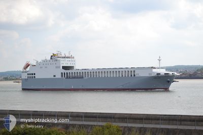
ADELINE
Ro-Ro Cargo
Current Trip
| Time Travelled | 5 h, 55 mins |
|---|---|
| Remaining Time | 4 h, 16 mins |
| Distance Travelled | 81.70 nm |
| Remaining Distance | 61.87 nm |
| AVG Speed | 13.9 Knots |
| MAX Speed | 15.5 Knots |
| AVG Wind | 24.5 knots |
| MAX Wind | 28 knots |
| MIN Temp | 8.6°C / 47.48°F |
| MAX Temp | 10.2°C / 50.36°F |
| Draught | 5.3 m |
| Position Received | Now |
Current Position
| Longitude | 1.63556° |
|---|---|
| Latitude | 51.52589° |
| Status | Under way using engine |
| Speed | 14.1 Knots |
| Course | 248.2° |
| Area | North Sea |
| Station | T-AIS |
| Position Received | Now |
Info
Information
The current position of ADELINE is in North Sea with coordinates 51.52589° / 1.63556° as reported on 2024-04-19 09:10 by AIS to our vessel tracker app. The vessel's current speed is 14.1 Knots and is heading at the port of DAGENHAM. The estimated time of arrival as calculated by MyShipTracking vessel tracking app is 2024-04-19 13:27 LT
The vessel ADELINE (IMO: 9539092, MMSI: 256284000) is a Ro-Ro Cargo that was built in 2012 ( 12 years old ). It's sailing under the flag of [MT] Malta.
In this page you can find informations about the vessels current position, last detected port calls, and current voyage information. If the vessels is not in coverage by AIS you will find the latest position.
The current position of ADELINE is detected by our AIS receivers and we are not responsible for the reliability of the data. The last position was recorded while the vessel was in Coverage by the Ais receivers of our vessel tracking app.
The current draught of ADELINE as reported by AIS is 5.3 meters
Weather
| Temperature | 10.2°C / 50.36°F |
|---|---|
| Wind Speed | 24 knots |
| Direction | 303° WNW |
| Pressure | 1013.1 hPa |
| Humidity | 80.3 % |
| Cloud Coverage | 100 % |
Featured Company
Last Port Calls
| Port | Arrival | Departure | Time In Port |
|---|---|---|---|
| 2024-04-18 19:14 | 2024-04-19 03:16 | 8 h | |
| 2024-04-18 03:01 | 2024-04-18 08:56 | 5 h | |
| 2024-04-17 08:11 | 2024-04-17 15:45 | 7 h | |
| 2024-04-15 14:09 | 2024-04-16 22:06 | 1 d | |
| 2024-04-13 07:18 | 2024-04-15 03:02 | 1 d | |
| 2024-04-12 13:46 | 2024-04-12 20:34 | 6 h | |
| 2024-04-11 19:45 | 2024-04-12 03:05 | 7 h | |
| 2024-04-11 02:13 | 2024-04-11 09:10 | 6 h | |
| 2024-04-10 07:54 | 2024-04-10 15:16 | 7 h | |
| 2024-04-09 13:12 | 2024-04-09 21:03 | 7 h |
Most Visited Ports (Last year)
| Port | Arrivals | |
|---|---|---|
| 167 | ||
| 166 |
Last Trips
| Origin | Departure | Destination | Arrival | Distance | |
|---|---|---|---|---|---|
| 2024-04-18 09:56 | 2024-04-18 21:14 | 142.93 nm | |||
| 2024-04-17 17:45 | 2024-04-18 04:01 | 143.24 nm | |||
| 2024-04-16 23:06 | 2024-04-17 10:11 | 142.83 nm | |||
| 2024-04-15 05:02 | 2024-04-15 15:09 | 138.20 nm | |||
| 2024-04-12 21:34 | 2024-04-13 09:18 | 142.39 nm | |||
| 2024-04-12 05:05 | 2024-04-12 14:46 | 143.13 nm | |||
| 2024-04-11 10:10 | 2024-04-11 21:45 | 139.31 nm | |||
| 2024-04-10 17:16 | 2024-04-11 03:13 | 149.46 nm | |||
| 2024-04-09 22:03 | 2024-04-10 09:54 | 142.67 nm | |||
| 2024-04-09 05:12 | 2024-04-09 14:12 | 138.76 nm |
Events
| Time | Event | Details | Position / Dest | Info |
|---|---|---|---|---|
| 2024-04-19 08:19 | ETA Changed | 2024/04/19 14:00 2024/04/19 13:00 |
51.60881 / 1.93467
GBDAG
|
Speed: 14.3 kn Course: 246.7° |
| 2024-04-19 07:19 | Detected in Sea | United Kingdom part of the North Sea |
51.64134 / 2.27459
North Sea
GBDAG
|
Speed: 13.5 kn Course: 303.7° |
| 2024-04-19 04:07 | Change Sea Area | Belgian part of the North Sea Dutch part of the North Sea |
51.40588 / 3.33102
North Sea
GBDAG
|
Speed: 15.4 kn Course: 271.8° |
| 2024-04-19 03:16 | PORT DEPARTURE |
|
51.44693 / 3.67031
GBDAG
|
Speed: 10.8 kn Course: 234° |
| 2024-04-19 03:10 | START Moving |
51.45913 / 3.68116
[NL] VLISSINGEN
|
Speed: 3.2 kn Course: 203° |
|
| 2024-04-19 02:39 | Status Changed | Under way using engine Moored |
51.46155 / 3.68167
[NL] VLISSINGEN
|
Speed: Course: 180° |
| 2024-04-19 02:39 | Draught Changed | 5.3 5 |
51.46159 / 3.68167
[NL] VLISSINGEN
|
Speed: Course: 180° |
| 2024-04-19 02:12 | ETA Changed | 2024/04/19 13:00 2024/04/19 22:00 |
51.46155 / 3.68167
[NL] VLISSINGEN
|
Speed: Course: 180° |
| 2024-04-19 02:06 | Destination Changed | GBDAG NLVLI |
51.46155 / 3.68167
[NL] VLISSINGEN
|
Speed: Course: 180° |
| 2024-04-19 02:06 | ETA Changed | 2024/04/19 22:00 2024/04/18 22:00 |
51.46155 / 3.68167
[NL] VLISSINGEN
|
Speed: Course: 180° |