
WES GESA
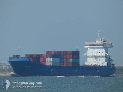
Container Ship
Current Trip
| Time Travelled | 17 h, 58 mins |
|---|---|
| Remaining Time | 1 day |
| Distance Travelled | 208.44 nm |
| Remaining Distance | 429.66 nm |
| AVG Speed | 12.5 Knop |
| MAX Speed | 17 Knop |
| AVG Wind | 11.8 knots |
| MAX Wind | 15.9 knots |
| MIN Temp | 8.2°C / 46.76°F |
| MAX Temp | 11.5°C / 52.7°F |
| Djupgående | 6.8 m |
| Position mottagen | 10 h, 52 m sen |
Current Position
| Longitud | -5.90532° |
|---|---|
| Latitude | 51.93701° |
| Status | Under way using engine |
| Fart | 12.8 Knop |
| Kurs | 183.3° |
| Område | Celtic Sea |
| Station | T-AIS |
| Position mottagen | 10 h, 52 m sen |
Info
Information
The current position of WES GESA is in Celtic Sea with coordinates 51.93701° / -5.90532° as reported on 2024-04-19 06:40 by AIS to our vessel tracker app. The vessel's current speed is 12.8 Knop and is heading at the port of ROTTERDAM. The estimated time of arrival as calculated by MyShipTracking vessel tracking app is 2024-04-20 19:29 LT
The vessel WES GESA (IMO: 9504061, MMSI: 212963000) is a Container Ship that was built in 2012 ( 12 År gammal ). It's sailing under the flag of [CY] Cyprus.
In this page you can find informations about the vessels current position, last detected port calls, and current voyage information. If the vessels is not in coverage by AIS you will find the latest position.
The current position of WES GESA is detected by our AIS receivers and we are not responsible for the reliability of the data. The last position was recorded while the vessel was in Coverage by the Ais receivers of our vessel tracking app.
The current draught of WES GESA as reported by AIS is 6.8 meters
Weather
| Temperature | 11.2°C / 52.16°F |
|---|---|
| Wind Speed | 12 knots |
| Direction | 338° NNW |
| Pressure | 1023.8 hPa |
| Humidity | 88.2 % |
| Cloud Coverage | 29 % |
Featured Company
Last Port Calls
| Port | Arrival | Departure | Time In Port |
|---|---|---|---|
| 2024-04-17 12:58 | 2024-04-18 23:34 | 1 d | |
| 2024-04-13 12:52 | 2024-04-14 02:04 | 13 h | |
| 2024-04-12 04:35 | 2024-04-13 11:26 | 1 d | |
| 2024-04-11 11:32 | 2024-04-12 02:41 | 15 h | |
| 2024-04-10 00:24 | 2024-04-11 11:25 | 1 d | |
| 2024-04-06 04:45 | 2024-04-06 18:15 | 13 h | |
| 2024-04-04 10:36 | 2024-04-05 19:13 | 1 d | |
| 2024-04-01 09:33 | 2024-04-01 21:54 | 12 h | |
| 2024-03-30 00:30 | 2024-04-01 09:31 | 2 d | |
| 2024-03-19 03:23 | 2024-03-20 18:13 | 1 d |
Last Trips
| Origin | Departure | Destination | Arrival | Distance | |
|---|---|---|---|---|---|
| 2024-04-14 04:04 | 2024-04-17 13:58 | 630.00 nm | |||
| 2024-04-13 13:26 | 2024-04-13 14:52 | 16.72 nm | |||
| 2024-04-12 04:41 | 2024-04-12 06:35 | 17.59 nm | |||
| 2024-04-11 13:25 | 2024-04-11 13:32 | 0.41 nm | |||
| 2024-04-06 20:15 | 2024-04-10 02:24 | 753.91 nm | |||
| 2024-04-05 21:13 | 2024-04-06 06:45 | 116.79 nm | |||
| 2024-04-01 23:54 | 2024-04-04 12:36 | 794.35 nm | |||
| 2024-04-01 11:31 | 2024-04-01 11:33 | 0.34 nm | |||
| 2024-03-20 19:13 | 2024-03-30 01:30 | 54.78 nm | |||
| 2024-03-18 08:08 | 2024-03-19 04:23 | 142.30 nm |
Events
| Tid | Event | Detaljer | Position / Dest | Information |
|---|---|---|---|---|
| 2024-04-19 06:40 | UTANFÖR täckningsområde |
51.93701 / -5.90532
Celtic Sea
NLRTM
|
Fart: 12.8 kn Kurs: 183.3° |
|
| 2024-04-19 06:25 | Status ändrad | Under way using engine Default |
51.98820 / -5.90111
NLRTM
|
Fart: 12 kn Kurs: 183° |
| 2024-04-19 06:08 | Status ändrad | Default Under way using engine |
52.04833 / -5.89833
NLRTM
|
Fart: 12.4 kn Kurs: 181.9° |
| 2024-04-19 06:01 | Byter havsområde | Irish part of the Celtic Sea Irish part of the Irish Sea and St. George's Channel |
52.06953 / -5.89804
Celtic Sea
NLRTM
|
Fart: 12.3 kn Kurs: 181° |
| 2024-04-18 23:34 | AVGÅTT HAMN |
|
53.34358 / -6.17484
NLRTM
|
Fart: 9.6 kn Kurs: 90° |
| 2024-04-18 23:24 | STARTAR förflyttning |
53.34475 / -6.20845
[IE] DUBLIN
|
Fart: 4.2 kn Kurs: 123° |
|
| 2024-04-18 23:19 | Destination ändrad | NLRTM IEDUB |
53.34687 / -6.21063
[IE] DUBLIN
|
Fart: 0.2 kn Kurs: 124° |
| 2024-04-18 23:18 | Status ändrad | Under way using engine Moored |
53.34687 / -6.21061
[IE] DUBLIN
|
Fart: Kurs: 94° |
| 2024-04-18 21:49 | Djupgående ändrat | 6.8 7.5 |
53.34698 / -6.21026
[IE] DUBLIN
|
Fart: Kurs: 94° |
| 2024-04-18 21:49 | ETA ändrat | 2024/04/20 04:00 2024/04/16 10:00 |
53.34698 / -6.21026
[IE] DUBLIN
|
Fart: Kurs: 94° |