
TYDA KYRA
Wing in ground
Current Trip
DELFT
| Time Travelled | 1 day |
|---|---|
| Remaining Time | --- |
| Distance Travelled | 46.28 nm |
| Remaining Distance | --- |
| AVG Speed | 6.1 Knop |
| MAX Speed | 8.4 Knop |
| AVG Wind | 9.4 knots |
| MAX Wind | 16.8 knots |
| MIN Temp | 5.4°C / 41.72°F |
| MAX Temp | 10.8°C / 51.44°F |
| Djupgående | 0 m |
| Position mottagen | Nu |
Current Position
| Longitud | 5.81955° |
|---|---|
| Latitude | 51.07244° |
| Status | Under way using engine |
| Fart | 6.4 Knop |
| Kurs | 28° |
| Område | North Sea |
| Station | T-AIS |
| Position mottagen | Nu |
Info
Information
The current position of TYDA KYRA is in North Sea with coordinates 51.07244° / 5.81955° as reported on 2024-04-17 13:18 by AIS to our vessel tracker app. The vessel's current speed is 6.4 Knop
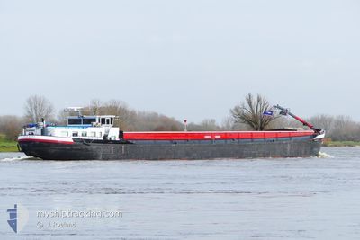
The vessel TYDA KYRA (MMSI: 244660200) is a Wing in ground It's sailing under the flag of [NL] Netherlands.
In this page you can find informations about the vessels current position, last detected port calls, and current voyage information. If the vessels is not in coverage by AIS you will find the latest position.
The current position of TYDA KYRA is detected by our AIS receivers and we are not responsible for the reliability of the data. The last position was recorded while the vessel was in Coverage by the Ais receivers of our vessel tracking app.
Weather
| Temperature | 9°C / 48.2°F |
|---|---|
| Wind Speed | 8 knots |
| Direction | 290° WNW |
| Pressure | 1011.3 hPa |
| Humidity | 67.9 % |
| Cloud Coverage | 100 % |
Featured Company
Last Port Calls
| Port | Arrival | Departure | Time In Port |
|---|---|---|---|
| 2024-04-16 12:52 | 2024-04-16 13:08 | 15 m | |
| 2024-04-16 07:01 | 2024-04-16 07:13 | 12 m | |
| 2024-04-15 23:08 | 2024-04-16 06:08 | 7 h | |
| 2024-04-15 21:03 | 2024-04-15 21:19 | 16 m | |
| 2024-04-12 06:40 | 2024-04-12 06:51 | 11 m | |
| 2024-04-11 18:12 | 2024-04-12 05:36 | 11 h | |
| 2024-04-11 15:14 | 2024-04-11 16:14 | 1 h | |
| 2024-04-09 17:35 | 2024-04-10 09:13 | 15 h | |
| 2024-04-08 09:54 | 2024-04-08 10:05 | 11 m | |
| 2024-04-08 06:25 | 2024-04-08 08:59 | 2 h |
Most Visited Ports (Last year)
| Port | Arrivals | |
|---|---|---|
| 173 | ||
| 80 | ||
| 35 | ||
| 26 | ||
| 13 | ||
| 11 |
Last Trips
| Origin | Departure | Destination | Arrival | Distance | |
|---|---|---|---|---|---|
| 2024-04-16 09:13 | 2024-04-16 14:52 | 49.04 nm | |||
| 2024-04-16 08:08 | 2024-04-16 09:01 | 5.97 nm | |||
| 2024-04-15 23:19 | 2024-04-16 01:08 | 6.36 nm | |||
| 2024-04-12 08:51 | 2024-04-15 23:03 | 152.35 nm | |||
| 2024-04-12 07:36 | 2024-04-12 08:40 | 2.46 nm | |||
| 2024-04-11 18:14 | 2024-04-11 20:12 | 6.70 nm | |||
| 2024-04-10 11:13 | 2024-04-11 17:14 | 93.37 nm | |||
| 2024-04-08 12:05 | 2024-04-09 19:35 | 97.53 nm | |||
| 2024-04-08 10:59 | 2024-04-08 11:54 | 5.74 nm | |||
| 2024-04-08 06:31 | 2024-04-08 08:25 | 6.36 nm |
Events
| Tid | Event | Detaljer | Position / Dest | Information |
|---|---|---|---|---|
| 2024-04-17 13:00 | STARTAR förflyttning | 0.84 nm, South West of BARGE TERMINAL BORN |
51.04915 / 5.80071
DELFT
|
Fart: 4.8 kn Kurs: 178.1° |
| 2024-04-17 12:19 | I täckningsområde |
51.05118 / 5.80136
North Sea
DELFT
|
Fart: Kurs: 44.4° |
|
| 2024-04-17 10:51 | UTANFÖR täckningsområde |
51.04999 / 5.80126
North Sea
DELFT
|
Fart: 0.9 kn Kurs: 14.2° |
|
| 2024-04-17 10:50 | STOPPAR förflyttning | 0.8 nm, South West of BARGE TERMINAL BORN |
51.04981 / 5.80119
DELFT
|
Fart: 0.3 kn Kurs: 511° |
| 2024-04-17 10:15 | I täckningsområde |
51.10050 / 5.84365
North Sea
DELFT
|
Fart: 8.2 kn Kurs: 208.4° |
|
| 2024-04-17 07:58 | UTANFÖR täckningsområde |
51.22156 / 5.81034
North Sea
DELFT
|
Fart: 7 kn Kurs: 150.9° |
|
| 2024-04-17 06:51 | STARTAR förflyttning | 9.49 nm, South of HELMOND |
51.32736 / 5.74733
DELFT
|
Fart: 3.6 kn Kurs: 173.7° |
| 2024-04-16 19:52 | STOPPAR förflyttning | 9.3 nm, South of HELMOND |
51.33063 / 5.74660
DELFT
|
Fart: Kurs: 511° |
| 2024-04-16 19:09 | I täckningsområde |
51.35242 / 5.74296
North Sea
DELFT
|
Fart: 5.5 kn Kurs: 172.9° |
|
| 2024-04-16 17:53 | UTANFÖR täckningsområde |
51.44216 / 5.69231
North Sea
DELFT
|
Fart: 7.7 kn Kurs: 171.8° |