
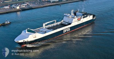
SUECIA SEAWAYS
Ro-Ro Cargo
Current Trip
| Trip Time | 8 h, 54 mins |
|---|---|
| Trip Distance | 125.17 nm |
| AVG Speed | 13.1 Knop |
| MAX Speed | 13.1 Knop |
| Djupgående | 6.4 m |
| AVG Wind | 21.3 knots |
| MAX Wind | 26 knots |
| MIN Temp | 7.7°C / 45.86°F |
| MAX Temp | 9.9°C / 49.82°F |
| Position mottagen | 1 m sen |
Current Position
| Longitud | 4.36188° |
|---|---|
| Latitude | 51.90674° |
| Status | Moored |
| Fart | |
| Kurs | 165° |
| Område | North Sea |
| Station | T-AIS |
| Position mottagen | 1 m sen |
Info
Information
The current position of SUECIA SEAWAYS is in North Sea with coordinates 51.90674° / 4.36188° as reported on 2024-04-19 09:54 by AIS to our vessel tracker app. The vessel's current speed is 0 Knop and is currently inside the port of VLAARDINGEN - ROTTERDAM.
The vessel SUECIA SEAWAYS (IMO: 9153020, MMSI: 220284000) is a Ro-Ro Cargo that was built in 1999 ( 25 År gammal ). It's sailing under the flag of [DK] Denmark.
In this page you can find informations about the vessels current position, last detected port calls, and current voyage information. If the vessels is not in coverage by AIS you will find the latest position.
The current position of SUECIA SEAWAYS is detected by our AIS receivers and we are not responsible for the reliability of the data. The last position was recorded while the vessel was in Coverage by the Ais receivers of our vessel tracking app.
The current draught of SUECIA SEAWAYS as reported by AIS is 6.4 meters
Weather
| Temperature | 9.9°C / 49.82°F |
|---|---|
| Wind Speed | 18 knots |
| Direction | 306° NW |
| Pressure | 1009.1 hPa |
| Humidity | 83.2 % |
| Cloud Coverage | 100 % |
Featured Company
Last Port Calls
| Port | Arrival | Departure | Time In Port |
|---|---|---|---|
| 2024-04-19 09:29 | |||
| 2024-04-18 20:36 | 2024-04-19 00:35 | 3 h | |
| 2024-04-18 09:34 | 2024-04-18 13:27 | 3 h | |
| 2024-04-17 20:46 | 2024-04-18 00:24 | 3 h | |
| 2024-04-17 09:40 | 2024-04-17 13:35 | 3 h | |
| 2024-04-16 20:43 | 2024-04-17 00:25 | 3 h | |
| 2024-04-16 09:39 | 2024-04-16 13:27 | 3 h | |
| 2024-04-15 20:47 | 2024-04-16 00:22 | 3 h | |
| 2024-04-13 09:09 | 2024-04-15 13:26 | 2 d | |
| 2024-04-12 21:08 | 2024-04-13 01:33 | 4 h |
Most Visited Ports (Last year)
| Port | Arrivals | |
|---|---|---|
| 157 | ||
| 155 | ||
| 31 | ||
| 19 | ||
| 15 | ||
| 11 |
Last Trips
| Origin | Departure | Destination | Arrival | Distance | |
|---|---|---|---|---|---|
| 2024-04-19 01:35 | 2024-04-19 11:29 | 125.17 nm | |||
| 2024-04-18 15:27 | 2024-04-18 21:36 | 119.49 nm | |||
| 2024-04-18 01:24 | 2024-04-18 11:34 | 122.35 nm | |||
| 2024-04-17 15:35 | 2024-04-17 21:46 | 119.53 nm | |||
| 2024-04-17 01:25 | 2024-04-17 11:40 | 122.62 nm | |||
| 2024-04-16 15:27 | 2024-04-16 21:43 | 120.92 nm | |||
| 2024-04-16 01:22 | 2024-04-16 11:39 | 122.56 nm | |||
| 2024-04-15 15:26 | 2024-04-15 21:47 | 119.71 nm | |||
| 2024-04-13 02:33 | 2024-04-13 11:09 | 121.54 nm | |||
| 2024-04-12 15:19 | 2024-04-12 22:08 | 119.99 nm |
Events
| Tid | Event | Detaljer | Position / Dest | Information |
|---|---|---|---|---|
| 2024-04-19 09:42 | Status ändrad | Moored Under way using engine |
51.90674 / 4.36188
[NL] VLAARDINGEN - ROTTERDAM
|
Fart: Kurs: 164° |
| 2024-04-19 09:39 | Status ändrad | Under way using engine Moored |
51.90674 / 4.36188
[NL] VLAARDINGEN - ROTTERDAM
|
Fart: Kurs: 164° |
| 2024-04-19 09:38 | Status ändrad | Moored Under way using engine |
51.90674 / 4.36188
[NL] VLAARDINGEN - ROTTERDAM
|
Fart: Kurs: 164° |
| 2024-04-19 09:29 | ANLÄNDER HAMN |
|
51.90660 / 4.36214
[NL] VLAARDINGEN - ROTTERDAM
|
Fart: 0.6 kn Kurs: 158° |
| 2024-04-19 09:13 | STOPPAR förflyttning | 0.82 nm, East of VLAARDINGEN - ROTTERDAM |
51.90010 / 4.36186
FXT<->RTM
|
Fart: 0.1 kn Kurs: 260° |
| 2024-04-19 04:13 | Byter havsområde | Dutch part of the North Sea United Kingdom part of the North Sea |
51.92220 / 2.58471
North Sea
FXT<->RTM
|
Fart: 14.9 kn Kurs: 116.9° |
| 2024-04-19 00:35 | STARTAR förflyttning | 0.52 nm, South East of FELIXSTOWE |
51.95195 / 1.30801
FXT<->RTM
|
Fart: 3.1 kn Kurs: 192° |
| 2024-04-19 00:35 | AVGÅTT HAMN |
|
51.95195 / 1.30801
FXT<->RTM
|
Fart: 3 kn Kurs: 194° |
| 2024-04-18 23:53 | Djupgående ändrat | 6.4 7.1 |
51.95297 / 1.31184
[GB] FELIXSTOWE
|
Fart: Kurs: 306° |
| 2024-04-18 23:53 | Status ändrad | Under way using engine Moored |
51.95297 / 1.31184
[GB] FELIXSTOWE
|
Fart: Kurs: 306° |