
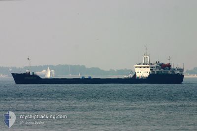
SORMOVSKIY 3053
General Cargo
Current Trip
IZMIR
| Time Travelled | 18 days |
|---|---|
| Remaining Time | --- |
| Distance Travelled | 1187.95 nm |
| Remaining Distance | --- |
| AVG Speed | 7.8 Knop |
| MAX Speed | 7.8 Knop |
| AVG Wind | 10.3 knots |
| MAX Wind | 27.1 knots |
| MIN Temp | 8.4°C / 47.12°F |
| MAX Temp | 17°C / 62.6°F |
| Djupgående | 4.2 m |
| Position mottagen | 49 m sen |
Current Position
| Longitud | 28.49619° |
|---|---|
| Latitude | 40.88354° |
| Status | Under way using engine |
| Fart | 7.4 Knop |
| Kurs | 263.9° |
| Område | Sea of Marmara |
| Station | T-AIS |
| Position mottagen | 49 m sen |
Info
Information
The current position of SORMOVSKIY 3053 is in Sea of Marmara with coordinates 40.88354° / 28.49619° as reported on 2024-04-20 11:16 by AIS to our vessel tracker app. The vessel's current speed is 7.4 Knop
The vessel SORMOVSKIY 3053 (IMO: 8222381, MMSI: 273329500) is a General Cargo that was built in 1985 ( 39 År gammal ). It's sailing under the flag of [RU] Russia.
In this page you can find informations about the vessels current position, last detected port calls, and current voyage information. If the vessels is not in coverage by AIS you will find the latest position.
The current position of SORMOVSKIY 3053 is detected by our AIS receivers and we are not responsible for the reliability of the data. The last position was recorded while the vessel was in Coverage by the Ais receivers of our vessel tracking app.
The current draught of SORMOVSKIY 3053 as reported by AIS is 4.2 meters
Weather
| Temperature | 13.8°C / 56.84°F |
|---|---|
| Wind Speed | 11 knots |
| Direction | 263° W |
| Pressure | 1002.3 hPa |
| Humidity | 77.3 % |
| Cloud Coverage | 100 % |
Featured Company
Last Port Calls
| Port | Arrival | Departure | Time In Port |
|---|---|---|---|
| 2024-03-30 16:26 | 2024-04-01 21:20 | 2 d | |
| 2024-02-29 00:44 | 2024-03-01 15:25 | 1 d | |
| 2024-02-01 06:22 |
Most Visited Ports (Last year)
| Port | Arrivals | |
|---|---|---|
| 6 | ||
| 4 | ||
| 4 | ||
| 2 | ||
| 1 | ||
| 1 |
Last Trips
| Origin | Departure | Destination | Arrival | Distance | |
|---|---|---|---|---|---|
| 2024-03-01 18:25 | 2024-03-30 19:26 | 2006.39 nm | |||
| 2024-02-01 09:22 | 2024-02-29 03:44 | 1677.09 nm |
Events
| Tid | Event | Detaljer | Position / Dest | Information |
|---|---|---|---|---|
| 2024-04-20 11:23 | Status ändrad | Default Under way using engine |
40.88201 / 28.47685
IZMIR
|
Fart: 7.4 kn Kurs: 263.9° |
| 2024-04-20 11:05 | Status ändrad | Under way using engine Default |
40.88633 / 28.52450
IZMIR
|
Fart: 7.4 kn Kurs: 262° |
| 2024-04-20 10:21 | Status ändrad | Default Under way using engine |
40.89965 / 28.64277
IZMIR
|
Fart: 7.1 kn Kurs: 258° |
| 2024-04-20 05:55 | Byter havsområde | Turkish part of the Sea of Marmara Turkish part of the Black Sea |
41.22907 / 29.12524
Sea of Marmara
|
Fart: 8 kn Kurs: 194.9° |
| 2024-04-20 03:20 | Djupgående ändrat | 4.2 3.4 |
41.40476 / 29.43578
IZMIR
|
Fart: 8.2 kn Kurs: 251.4° |
| 2024-04-20 03:20 | Destination ändrad | IZMIR RUAZO |
41.40476 / 29.43578
IZMIR
|
Fart: 8.2 kn Kurs: 251.4° |
| 2024-04-20 03:20 | ETA ändrat | 2024/04/05 12:00 2024/03/10 12:00 |
41.40476 / 29.43578
IZMIR
|
Fart: 8.2 kn Kurs: 251.4° |
| 2024-04-20 03:02 | Status ändrad | Under way using engine Default |
41.41470 / 29.48679
RUAZO
|
Fart: 8 kn Kurs: 260° |
| 2024-04-20 03:02 | I täckningsområde |
41.41433 / 29.48480
Black Sea
|
Fart: 8.2 kn Kurs: 256.8° |