
SEA AND LAND NO.11
Towing
Current Trip
Unknown
| Time Travelled | 3 days |
|---|---|
| Remaining Time | --- |
| Distance Travelled | 38.76 nm |
| Remaining Distance | --- |
| AVG Speed | 7.8 Knop |
| MAX Speed | 11.6 Knop |
| AVG Wind | 7.3 knots |
| MAX Wind | 10.1 knots |
| MIN Temp | 25.7°C / 78.26°F |
| MAX Temp | 28.3°C / 82.94°F |
| Djupgående | --- |
| Position mottagen | 2 d sen |
Current Position
| Longitud | 120.28681° |
|---|---|
| Latitude | 22.59445° |
| Status | Default |
| Fart | 5.6 Knop |
| Kurs | 78.8° |
| Område | South China Sea |
| Station | T-AIS |
| Position mottagen | 2 d sen |
Info
Information
The current position of SEA AND LAND NO.11 is in South China Sea with coordinates 22.59445° / 120.28681° as reported on 2024-04-16 23:18 by AIS to our vessel tracker app. The vessel's current speed is 5.6 Knop
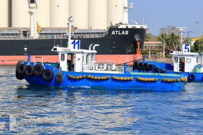
The vessel SEA AND LAND NO.11 (MMSI: 416008962) is a Towing It's sailing under the flag of [TW] Taiwan.
In this page you can find informations about the vessels current position, last detected port calls, and current voyage information. If the vessels is not in coverage by AIS you will find the latest position.
The current position of SEA AND LAND NO.11 is detected by our AIS receivers and we are not responsible for the reliability of the data. The last position was recorded while the vessel was in Coverage by the Ais receivers of our vessel tracking app.
Weather
| Temperature | 26.2°C / 79.16°F |
|---|---|
| Wind Speed | 7 knots |
| Direction | 189° S |
| Pressure | 1012.1 hPa |
| Humidity | 78.7 % |
| Cloud Coverage | --- |
Featured Company
Last Port Calls
| Port | Arrival | Departure | Time In Port |
|---|---|---|---|
| 2024-04-15 10:05 | |||
| 2024-03-14 02:53 | 2024-03-27 10:49 | 13 d | |
| 2024-03-13 01:57 | 2024-03-13 04:14 | 2 h | |
| 2024-03-09 05:12 | 2024-03-10 03:06 | 21 h | |
| 2024-03-05 01:40 | 2024-03-07 03:09 | 2 d | |
| 2024-02-25 04:40 | 2024-03-03 09:29 | 7 d | |
| 2024-02-22 01:29 | |||
| 2024-02-17 01:16 |
Last Trips
| Origin | Departure | Destination | Arrival | Distance | |
|---|---|---|---|---|---|
| 2024-03-13 12:14 | 2024-03-14 10:53 | 31.18 nm | |||
| 2024-03-10 11:06 | 2024-03-13 09:57 | 31.15 nm | |||
| 2024-03-07 11:09 | 2024-03-09 13:12 | 28.48 nm | |||
| 2024-03-03 17:29 | 2024-03-05 09:40 | 33.22 nm | |||
| 2024-02-22 09:29 | 2024-02-25 12:40 | 36.21 nm |
Events
| Tid | Event | Detaljer | Position / Dest | Information |
|---|---|---|---|---|
| 2024-04-16 23:18 | UTANFÖR täckningsområde |
22.59445 / 120.28681
South China Sea
|
Fart: 5.6 kn Kurs: 78.8° |
|
| 2024-04-16 22:51 | I täckningsområde |
22.64379 / 120.24272
South China Sea
|
Fart: 11.3 kn Kurs: 155.1° |
|
| 2024-04-16 21:31 | STARTAR förflyttning | 2.03 nm, North of YUNG AN |
22.84605 / 120.19080
|
Fart: 3.8 kn Kurs: -1° |
| 2024-04-15 23:24 | STOPPAR förflyttning | 1.63 nm, North West of YUNG AN |
22.83554 / 120.18150
|
Fart: Kurs: -1° |
| 2024-04-15 11:57 | UTANFÖR täckningsområde |
22.65850 / 120.20311
South China Sea
|
Fart: 5.8 kn Kurs: 358.5° |
|
| 2024-04-15 10:05 | AVGÅTT HAMN |
|
22.55815 / 120.27543
|
Fart: 5.8 kn Kurs: 267.9° |
| 2024-04-15 09:30 | STARTAR förflyttning |
22.55698 / 120.32524
[TW] KAOHSIUNG
|
Fart: 4.4 kn Kurs: 238.3° |
|
| 2024-04-15 09:16 | STOPPAR förflyttning |
22.55964 / 120.32908
[TW] KAOHSIUNG
|
Fart: Kurs: 511° |
|
| 2024-04-15 09:04 | I täckningsområde |
22.55975 / 120.32895
South China Sea
[TW] KAOHSIUNG
|
Fart: 2.9 kn Kurs: 93.6° |
|
| 2024-04-15 06:30 | UTANFÖR täckningsområde |
22.55974 / 120.32909
South China Sea
[TW] KAOHSIUNG
|
Fart: 0.7 kn Kurs: 71.3° |