
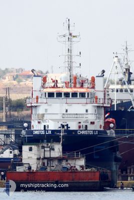
SANTORINI
Oil Products Tanker
Current Trip
| Time Travelled | 28 days |
|---|---|
| Remaining Time | --- |
| Distance Travelled | 1547.05 nm |
| Remaining Distance | --- |
| AVG Speed | 9.7 Knop |
| MAX Speed | 12.8 Knop |
| AVG Wind | 6.7 knots |
| MAX Wind | 14 knots |
| MIN Temp | 22.6°C / 72.68°F |
| MAX Temp | 29°C / 84.2°F |
| Djupgående | 5.9 m |
| Position mottagen | 8 d sen |
Current Position
| Longitud | -79.46017° |
|---|---|
| Latitude | 8.44931° |
| Status | Under way using engine |
| Fart | 9.6 Knop |
| Kurs | 182.7° |
| Område | North Pacific Ocean |
| Station | T-AIS |
| Position mottagen | 8 d sen |
Info
Information
The current position of SANTORINI is in North Pacific Ocean with coordinates 8.44931° / -79.46017° as reported on 2024-04-11 22:25 by AIS to our vessel tracker app. The vessel's current speed is 9.6 Knop and is heading at the port of LA LIBERTAD. The estimated time of arrival as calculated by MyShipTracking vessel tracking app is 2024-04-14 13:00 LT
The vessel SANTORINI (IMO: 9371311, MMSI: 735060181) is a Oil Products Tanker that was built in 2008 ( 16 År gammal ). It's sailing under the flag of [EC] Ecuador.
In this page you can find informations about the vessels current position, last detected port calls, and current voyage information. If the vessels is not in coverage by AIS you will find the latest position.
The current position of SANTORINI is detected by our AIS receivers and we are not responsible for the reliability of the data. The last position was recorded while the vessel was in Coverage by the Ais receivers of our vessel tracking app.
The current draught of SANTORINI as reported by AIS is 5.9 meters
Weather
| Temperature | 24.5°C / 76.1°F |
|---|---|
| Wind Speed | 8 knots |
| Direction | 250° WSW |
| Pressure | 1010.3 hPa |
| Humidity | 81.3 % |
| Cloud Coverage | 98 % |
Featured Company
Events
| Tid | Event | Detaljer | Position / Dest | Information |
|---|---|---|---|---|
| 2024-04-18 23:41 | STOPPAR förflyttning | 2.23 nm, North East of LA LUCIA |
-2.18833 / -80.89667
LA LIBERTAD
|
Fart: Kurs: -1° |
| 2024-04-14 12:54 | STOPPAR förflyttning | 2.56 nm, North East of LA LUCIA |
-2.18031 / -80.89857
LA LIBERTAD
|
Fart: 0.2 kn Kurs: 137° |
| 2024-04-11 22:30 | Status ändrad | Default Under way using engine |
8.43500 / -79.46000
LA LIBERTAD
|
Fart: 9.6 kn Kurs: 182.7° |
| 2024-04-11 22:25 | UTANFÖR täckningsområde |
8.44931 / -79.46017
North Pacific Ocean
LA LIBERTAD
|
Fart: 9.6 kn Kurs: 182.7° |
|
| 2024-04-11 22:17 | Status ändrad | Under way using engine Default |
8.47191 / -79.45956
LA LIBERTAD
|
Fart: 9 kn Kurs: 179° |
| 2024-04-11 22:15 | Status ändrad | Default Under way using engine |
8.47500 / -79.45834
LA LIBERTAD
|
Fart: 9.3 kn Kurs: 179.7° |
| 2024-04-11 21:49 | Status ändrad | Under way using engine Default |
8.54459 / -79.46051
LA LIBERTAD
|
Fart: 9.1 kn Kurs: 178° |
| 2024-04-11 21:46 | Status ändrad | Default Under way using engine |
8.55234 / -79.46075
LA LIBERTAD
|
Fart: 9.1 kn Kurs: 176.9° |
| 2024-04-11 20:53 | Status ändrad | Under way using engine Default |
8.69581 / -79.46712
LA LIBERTAD
|
Fart: 10 kn Kurs: 181° |
| 2024-04-11 20:49 | Status ändrad | Default Under way using engine |
8.70752 / -79.46703
LA LIBERTAD
|
Fart: 9.5 kn Kurs: 185.2° |