
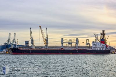
SAINT VASSILIOS
Bulk Carrier
Current Trip
| Trip Time | 22 days |
|---|---|
| Trip Distance | 5359.68 nm |
| AVG Speed | 9.8 Knop |
| MAX Speed | 12.9 Knop |
| Djupgående | 10.2 m |
| AVG Wind | 16.4 knots |
| MAX Wind | 39 knots |
| MIN Temp | 12.1°C / 53.78°F |
| MAX Temp | 26.3°C / 79.34°F |
| Position mottagen | 3 m sen |
Current Position
| Longitud | -95.18543° |
|---|---|
| Latitude | 29.74680° |
| Status | Moored |
| Fart | 0.1 Knop |
| Kurs | 88° |
| Område | Gulf of Mexico |
| Station | T-AIS |
| Position mottagen | 3 m sen |
Info
Information
The current position of SAINT VASSILIOS is in Gulf of Mexico with coordinates 29.74680° / -95.18543° as reported on 2024-04-19 02:32 by AIS to our vessel tracker app. The vessel's current speed is 0.1 Knop and is currently inside the port of HOUSTON.
The vessel SAINT VASSILIOS (IMO: 9486403, MMSI: 538004639) is a Bulk Carrier that was built in 2012 ( 12 År gammal ). It's sailing under the flag of [MH] Marshall Is.
In this page you can find informations about the vessels current position, last detected port calls, and current voyage information. If the vessels is not in coverage by AIS you will find the latest position.
The current position of SAINT VASSILIOS is detected by our AIS receivers and we are not responsible for the reliability of the data. The last position was recorded while the vessel was in Coverage by the Ais receivers of our vessel tracking app.
The current draught of SAINT VASSILIOS as reported by AIS is 10.2 meters
Weather
| Temperature | 23.9°C / 75.02°F |
|---|---|
| Wind Speed | 7 knots |
| Direction | 163° SSE |
| Pressure | 1014.9 hPa |
| Humidity | 81.5 % |
| Cloud Coverage | 100 % |
Featured Company
Most Visited Ports (Last year)
| Port | Arrivals | |
|---|---|---|
| 3 | ||
| 2 | ||
| 2 | ||
| 2 | ||
| 2 | ||
| 2 |
Last Trips
| Origin | Departure | Destination | Arrival | Distance | |
|---|---|---|---|---|---|
| 2024-03-26 14:19 | 2024-04-17 13:11 | 5359.68 nm | |||
| 2024-03-05 13:38 | 2024-03-13 16:08 | 910.61 nm | |||
| 2024-02-06 09:58 | 2024-02-28 16:09 | 4279.95 nm | |||
| 2024-01-14 06:36 | 2024-02-05 02:38 | 1485.20 nm |
Events
| Tid | Event | Detaljer | Position / Dest | Information |
|---|---|---|---|---|
| 2024-04-18 14:47 | Status ändrad | Moored Under way using engine |
29.74675 / -95.18545
[US] HOUSTON
|
Fart: 0.1 kn Kurs: 88° |
| 2024-04-17 20:57 | STOPPAR förflyttning |
29.74658 / -95.18542
[US] HOUSTON
|
Fart: 0.3 kn Kurs: 87° |
|
| 2024-04-17 18:11 | ANLÄNDER HAMN |
|
29.59202 / -94.94125
[US] HOUSTON
|
Fart: 10.2 kn Kurs: 324.9° |
| 2024-04-17 16:35 | Status ändrad | Under way using engine Default |
29.34339 / -94.74970
US HOU
|
Fart: 12.3 kn Kurs: 266° |
| 2024-04-17 16:31 | Status ändrad | Default Under way using engine |
29.34449 / -94.73325
US HOU
|
Fart: 12.2 kn Kurs: 281° |
| 2024-04-17 16:25 | Status ändrad | Under way using engine Default |
29.34534 / -94.71030
US HOU
|
Fart: 12.1 kn Kurs: 283° |
| 2024-04-17 16:15 | I täckningsområde |
29.34534 / -94.71030
Gulf of Mexico
US HOU
|
Fart: 12.2 kn Kurs: 281° |
|
| 2024-04-17 12:22 | Status ändrad | Default Under way using engine |
28.98389 / -94.09783
US HOU
|
Fart: 12.3 kn Kurs: 304.3° |
| 2024-04-17 12:15 | UTANFÖR täckningsområde |
28.96833 / -94.07297
Gulf of Mexico
US HOU
|
Fart: 12.3 kn Kurs: 304.3° |
|
| 2024-04-17 12:10 | Status ändrad | Under way using engine Default |
28.95862 / -94.05717
US HOU
|
Fart: 12 kn Kurs: 305° |