
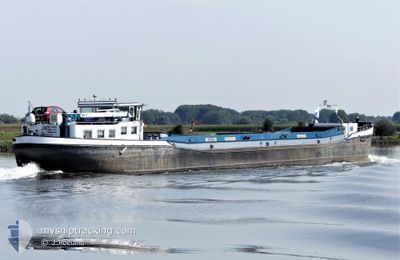
KYRA
Not available
Current Trip
| Trip Time | 17 h, 15 mins |
|---|---|
| Trip Distance | 58.12 nm |
| AVG Speed | 7.2 Knop |
| MAX Speed | 9.4 Knop |
| Djupgående | 1 m |
| AVG Wind | 9.9 knots |
| MAX Wind | 18 knots |
| MIN Temp | 2.3°C / 36.14°F |
| MAX Temp | 10°C / 50°F |
| Position mottagen | 1 m sen |
Current Position
| Longitud | 4.86458° |
|---|---|
| Latitude | 52.36972° |
| Status | Under way using engine |
| Fart | 2.6 Knop |
| Kurs | --- |
| Område | North Sea |
| Station | T-AIS |
| Position mottagen | 1 m sen |
Info
Information
The current position of KYRA is in North Sea with coordinates 52.36972° / 4.86458° as reported on 2024-04-23 07:57 by AIS to our vessel tracker app. The vessel's current speed is 2.6 Knop and is currently inside the port of AMSTERDAM.
The vessel KYRA (MMSI: 244670958) is a Not available It's sailing under the flag of [NL] Netherlands.
In this page you can find informations about the vessels current position, last detected port calls, and current voyage information. If the vessels is not in coverage by AIS you will find the latest position.
The current position of KYRA is detected by our AIS receivers and we are not responsible for the reliability of the data. The last position was recorded while the vessel was in Coverage by the Ais receivers of our vessel tracking app.
The current draught of KYRA as reported by AIS is 1 meters
Weather
| Temperature | 5.4°C / 41.72°F |
|---|---|
| Wind Speed | 2 knots |
| Direction | 40° NE |
| Pressure | 1022.4 hPa |
| Humidity | 60.2 % |
| Cloud Coverage | 100 % |
Featured Company
Last Port Calls
| Port | Arrival | Departure | Time In Port |
|---|---|---|---|
| 2024-04-23 06:55 | |||
| 2024-04-22 12:23 | 2024-04-22 13:40 | 1 h | |
| 2024-04-22 10:59 | 2024-04-22 11:19 | 20 m | |
| 2024-04-22 09:36 | 2024-04-22 09:50 | 13 m | |
| 2024-04-19 11:07 | 2024-04-19 11:16 | 9 m | |
| 2024-04-19 07:43 | 2024-04-19 09:04 | 1 h | |
| 2024-04-18 13:53 | 2024-04-18 14:30 | 36 m | |
| 2024-04-18 11:19 | 2024-04-18 11:36 | 17 m | |
| 2024-04-17 15:35 | 2024-04-17 16:09 | 33 m | |
| 2024-04-17 11:33 | 2024-04-17 13:23 | 1 h |
Last Trips
| Origin | Departure | Destination | Arrival | Distance | |
|---|---|---|---|---|---|
| 2024-04-22 15:40 | 2024-04-23 08:55 | 58.12 nm | |||
| 2024-04-22 13:19 | 2024-04-22 14:23 | 1.25 nm | |||
| 2024-04-22 11:50 | 2024-04-22 12:59 | 5.85 nm | |||
| 2024-04-19 13:16 | 2024-04-22 11:36 | 36.19 nm | |||
| 2024-04-19 11:04 | 2024-04-19 13:07 | 7.13 nm | |||
| 2024-04-18 16:30 | 2024-04-19 09:43 | 60.86 nm | |||
| 2024-04-18 13:36 | 2024-04-18 15:53 | 8.74 nm | |||
| 2024-04-17 18:09 | 2024-04-18 13:19 | 36.07 nm | |||
| 2024-04-17 15:23 | 2024-04-17 17:35 | 7.23 nm | |||
| 2024-04-16 21:36 | 2024-04-17 13:33 | 57.47 nm |
Events
| Tid | Event | Detaljer | Position / Dest | Information |
|---|---|---|---|---|
| 2024-04-23 07:26 | STARTAR förflyttning |
52.38972 / 4.88511
[NL] AMSTERDAM
|
Fart: 3.2 kn Kurs: 199° |
|
| 2024-04-23 07:19 | STOPPAR förflyttning |
52.39203 / 4.88672
[NL] AMSTERDAM
|
Fart: 0.2 kn Kurs: 221° |
|
| 2024-04-23 06:55 | ANLÄNDER HAMN |
|
52.38300 / 4.93754
[NL] AMSTERDAM
|
Fart: 6.7 kn Kurs: 269° |
| 2024-04-23 06:48 | STARTAR förflyttning | 0.25 nm, West of SCHELLINGWOUDE |
52.38261 / 4.95836
NOORDWIJKSCHE VAART
|
Fart: 3.9 kn Kurs: 279.6° |
| 2024-04-23 06:36 | STOPPAR förflyttning | 0.14 nm, West of SCHELLINGWOUDE |
52.38173 / 4.96110
NOORDWIJKSCHE VAART
|
Fart: 0.3 kn Kurs: 308° |
| 2024-04-23 03:42 | STARTAR förflyttning | 0.18 nm, West of LELYSTAD |
52.52620 / 5.43393
NOORDWIJKSCHE VAART
|
Fart: 3.3 kn Kurs: 181.7° |
| 2024-04-23 03:35 | STOPPAR förflyttning | 0.2 nm, North West of LELYSTAD |
52.52804 / 5.43410
NOORDWIJKSCHE VAART
|
Fart: 0.3 kn Kurs: 511° |
| 2024-04-23 03:20 | I täckningsområde |
52.54061 / 5.43874
North Sea
|
Fart: 4.2 kn Kurs: 178.5° |
|
| 2024-04-23 01:57 | UTANFÖR täckningsområde |
52.54434 / 5.43904
North Sea
|
Fart: Kurs: 511° |
|
| 2024-04-23 01:57 | I täckningsområde |
52.54434 / 5.43904
North Sea
|
Fart: Kurs: 511° |