
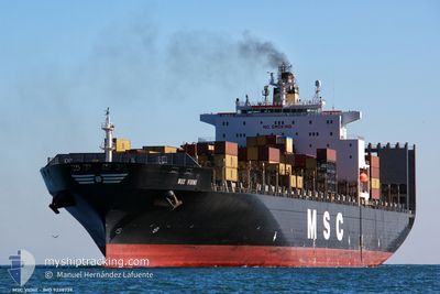
MSC VIDHI
Container Ship
Current Trip
| Time Travelled | 20 h, 42 mins |
|---|---|
| Remaining Time | 8 h, 26 mins |
| Distance Travelled | 166.95 nm |
| Remaining Distance | 189.39 nm |
| AVG Speed | 13 Knop |
| MAX Speed | 13.4 Knop |
| AVG Wind | 10.5 knots |
| MAX Wind | 15.1 knots |
| MIN Temp | 18.6°C / 65.48°F |
| MAX Temp | 20.6°C / 69.08°F |
| Djupgående | 9.7 m |
| Position mottagen | 6 h, 16 m sen |
Current Position
| Longitud | 33.42167° |
|---|---|
| Latitude | 33.91200° |
| Status | Under way using engine |
| Fart | 13.4 Knop |
| Kurs | 37° |
| Område | Mediterranean Sea - Eastern Basin |
| Station | T-AIS |
| Position mottagen | 6 h, 16 m sen |
Info
Information
The current position of MSC VIDHI is in Mediterranean Sea - Eastern Basin with coordinates 33.91200° / 33.42167° as reported on 2024-04-19 03:12 by AIS to our vessel tracker app. The vessel's current speed is 13.4 Knop and is heading at the port of MERSIN. The estimated time of arrival as calculated by MyShipTracking vessel tracking app is 2024-04-19 17:54 LT
The vessel MSC VIDHI (IMO: 9238739, MMSI: 636016433) is a Container Ship that was built in 2001 ( 23 År gammal ). It's sailing under the flag of [LR] Liberia.
In this page you can find informations about the vessels current position, last detected port calls, and current voyage information. If the vessels is not in coverage by AIS you will find the latest position.
The current position of MSC VIDHI is detected by our AIS receivers and we are not responsible for the reliability of the data. The last position was recorded while the vessel was in Coverage by the Ais receivers of our vessel tracking app.
The current draught of MSC VIDHI as reported by AIS is 9.7 meters
Weather
| Temperature | 18.8°C / 65.84°F |
|---|---|
| Wind Speed | 11 knots |
| Direction | 272° W |
| Pressure | 1012.4 hPa |
| Humidity | 80.8 % |
| Cloud Coverage | --- |
Featured Company
Last Port Calls
| Port | Arrival | Departure | Time In Port |
|---|---|---|---|
| 2024-04-17 18:35 | 2024-04-18 12:46 | 18 h | |
| 2024-04-14 01:52 | 2024-04-14 17:21 | 15 h | |
| 2024-04-12 03:06 | 2024-04-12 08:47 | 5 h | |
| 2024-04-07 21:02 | 2024-04-08 13:48 | 16 h | |
| 2024-04-04 23:47 | 2024-04-05 23:16 | 23 h | |
| 2024-03-31 18:55 | 2024-04-01 19:13 | 1 d | |
| 2024-03-28 16:53 | 2024-03-30 14:41 | 1 d | |
| 2024-03-22 09:35 | 2024-03-23 07:55 | 22 h | |
| 2024-03-16 20:10 | 2024-03-17 21:03 | 1 d | |
| 2024-03-11 18:47 | 2024-03-13 14:08 | 1 d |
Most Visited Ports (Last year)
| Port | Arrivals | |
|---|---|---|
| 11 | ||
| 11 | ||
| 9 | ||
| 8 | ||
| 7 | ||
| 7 |
Last Trips
| Origin | Departure | Destination | Arrival | Distance | |
|---|---|---|---|---|---|
| 2024-04-14 19:21 | 2024-04-17 20:35 | 959.66 nm | |||
| 2024-04-12 10:47 | 2024-04-14 03:52 | 629.07 nm | |||
| 2024-04-08 14:48 | 2024-04-12 05:06 | 1411.70 nm | |||
| 2024-04-05 23:16 | 2024-04-07 22:02 | 866.73 nm | |||
| 2024-04-01 19:13 | 2024-04-04 23:47 | 1208.13 nm | |||
| 2024-03-30 14:41 | 2024-03-31 18:55 | 406.83 nm | |||
| 2024-03-23 07:55 | 2024-03-28 16:53 | 1573.02 nm | |||
| 2024-03-17 21:03 | 2024-03-22 09:35 | 902.14 nm | |||
| 2024-03-13 15:08 | 2024-03-16 20:10 | 1116.74 nm | |||
| 2024-03-10 16:23 | 2024-03-11 19:47 | 354.75 nm |
Events
| Tid | Event | Detaljer | Position / Dest | Information |
|---|---|---|---|---|
| 2024-04-19 03:12 | UTANFÖR täckningsområde |
33.91200 / 33.42167
Mediterranean Sea - Eastern Basin
TR MER
|
Fart: 13.4 kn Kurs: 37° |
|
| 2024-04-19 03:11 | I täckningsområde |
33.91200 / 33.42167
Mediterranean Sea - Eastern Basin
TR MER
|
Fart: 13.4 kn Kurs: 37° |
|
| 2024-04-19 00:52 | UTANFÖR täckningsområde |
33.47250 / 33.16233
Mediterranean Sea - Eastern Basin
TR MER
|
Fart: 12.5 kn Kurs: 18° |
|
| 2024-04-18 22:38 | Djupgående ändrat | 9.7 9.5 |
33.03767 / 32.92467
TR MER
|
Fart: 13 kn Kurs: 20° |
| 2024-04-18 22:38 | ETA ändrat | 2024/04/19 20:00 2024/04/19 10:00 |
33.03767 / 32.92467
TR MER
|
Fart: 13 kn Kurs: 20° |
| 2024-04-18 22:14 | Upptäckt i hav | Cypriote part of the Mediterranean Sea - Eastern Basin |
32.95500 / 32.88833
Mediterranean Sea - Eastern Basin
TR MER
|
Fart: 13.3 kn Kurs: 24° |
| 2024-04-18 20:38 | I täckningsområde |
32.70000 / 32.62650
Mediterranean Sea - Eastern Basin
TR MER
|
Fart: 13 kn Kurs: 54° |
|
| 2024-04-18 12:46 | AVGÅTT HAMN |
|
31.53067 / 31.76900
TR MER
|
Fart: Kurs: 316° |
| 2024-04-17 22:26 | Status ändrad | Default Moored |
31.46309 / 31.75759
[EG] DAMIETTA
|
Fart: Kurs: 316° |
| 2024-04-17 21:44 | UTANFÖR täckningsområde |
31.46183 / 31.75767
Mediterranean Sea - Eastern Basin
[EG] DAMIETTA
|
Fart: Kurs: 110° |