
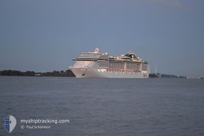
MSC PREZIOSA
Passengers Ship
Current Trip
| Time Travelled | 1 day |
|---|---|
| Remaining Time | 8 h, 56 mins |
| Distance Travelled | 470.73 nm |
| Remaining Distance | 175.88 nm |
| AVG Speed | 18.4 Knop |
| MAX Speed | 20.3 Knop |
| AVG Wind | 6.7 knots |
| MAX Wind | 13.8 knots |
| MIN Temp | 22.3°C / 72.14°F |
| MAX Temp | 28.1°C / 82.58°F |
| Djupgående | 8.7 m |
| Position mottagen | 23 h, 6 m sen |
Current Position
| Longitud | -42.67690° |
|---|---|
| Latitude | -23.05630° |
| Status | Under way using engine |
| Fart | 18 Knop |
| Kurs | 88.9° |
| Område | South Atlantic Ocean |
| Station | T-AIS |
| Position mottagen | 23 h, 6 m sen |
Info
Information
The current position of MSC PREZIOSA is in South Atlantic Ocean with coordinates -23.05630° / -42.67690° as reported on 2024-04-23 01:22 by AIS to our vessel tracker app. The vessel's current speed is 18 Knop and is heading at the port of ILHEUS. The estimated time of arrival as calculated by MyShipTracking vessel tracking app is 2024-04-24 09:25 LT
The vessel MSC PREZIOSA (IMO: 9595321, MMSI: 371861000) is a Passengers Ship that was built in 2013 ( 11 År gammal ). It's sailing under the flag of [PA] Panama.
In this page you can find informations about the vessels current position, last detected port calls, and current voyage information. If the vessels is not in coverage by AIS you will find the latest position.
The current position of MSC PREZIOSA is detected by our AIS receivers and we are not responsible for the reliability of the data. The last position was recorded while the vessel was in Coverage by the Ais receivers of our vessel tracking app.
The current draught of MSC PREZIOSA as reported by AIS is 8.7 meters
Weather
| Temperature | 28.1°C / 82.58°F |
|---|---|
| Wind Speed | 10 knots |
| Direction | 70° ENE |
| Pressure | 1015.2 hPa |
| Humidity | 75.9 % |
| Cloud Coverage | 13 % |
Featured Company
Last Port Calls
| Port | Arrival | Departure | Time In Port |
|---|---|---|---|
| 2024-04-22 11:07 | 2024-04-22 23:19 | 12 h | |
| 2024-04-21 10:02 | 2024-04-21 22:22 | 12 h | |
| 2024-04-17 10:05 | 2024-04-17 21:15 | 11 h | |
| 2024-04-14 10:02 | 2024-04-14 21:22 | 11 h | |
| 2024-04-11 10:11 | 2024-04-11 21:21 | 11 h | |
| 2024-04-08 09:18 | 2024-04-08 21:22 | 12 h | |
| 2024-04-06 10:35 | 2024-04-06 21:24 | 10 h | |
| 2024-04-05 10:10 | 2024-04-05 21:54 | 11 h | |
| 2024-04-01 10:05 | 2024-04-01 21:44 | 11 h | |
| 2024-03-29 10:05 | 2024-03-29 21:21 | 11 h |
Most Visited Ports (Last year)
| Port | Arrivals | |
|---|---|---|
| 44 | ||
| 14 | ||
| 6 | ||
| 6 | ||
| 6 | ||
| 6 |
Last Trips
| Origin | Departure | Destination | Arrival | Distance | |
|---|---|---|---|---|---|
| 2024-04-21 19:22 | 2024-04-22 08:07 | 202.90 nm | |||
| 2024-04-17 18:15 | 2024-04-21 07:02 | 587.83 nm | |||
| 2024-04-14 18:22 | 2024-04-17 07:05 | 588.76 nm | |||
| 2024-04-11 18:21 | 2024-04-14 07:02 | 531.28 nm | |||
| 2024-04-08 18:22 | 2024-04-11 07:11 | 835.56 nm | |||
| 2024-04-06 18:24 | 2024-04-08 06:18 | 643.36 nm | |||
| 2024-04-05 18:54 | 2024-04-06 07:35 | 214.69 nm | |||
| 2024-04-01 18:44 | 2024-04-05 07:10 | 597.73 nm | |||
| 2024-03-29 18:21 | 2024-04-01 07:05 | 559.70 nm | |||
| 2024-03-25 20:52 | 2024-03-29 07:05 | 708.16 nm |
Events
| Tid | Event | Detaljer | Position / Dest | Information |
|---|---|---|---|---|
| 2024-04-23 01:29 | Status ändrad | Default Under way using engine |
-23.05607 / -42.64008
BR IOS
|
Fart: 18 kn Kurs: 88.9° |
| 2024-04-23 01:22 | UTANFÖR täckningsområde |
-23.05630 / -42.67690
South Atlantic Ocean
BR IOS
|
Fart: 18 kn Kurs: 88.9° |
|
| 2024-04-23 01:12 | Status ändrad | Under way using engine Default |
-23.05662 / -42.73017
BR IOS
|
Fart: 17 kn Kurs: 92° |
| 2024-04-23 00:50 | Status ändrad | Default Under way using engine |
-23.05188 / -42.84722
BR IOS
|
Fart: 17.9 kn Kurs: 92.7° |
| 2024-04-22 23:19 | AVGÅTT HAMN |
|
-22.88962 / -43.17230
BR IOS
|
Fart: 8 kn Kurs: 77° |
| 2024-04-22 23:13 | STARTAR förflyttning |
-22.89168 / -43.18337
[BR] RIO DE JANEIRO
|
Fart: 3.7 kn Kurs: 80° |
|
| 2024-04-22 23:04 | Status ändrad | Under way using engine Moored |
-22.89382 / -43.18537
[BR] RIO DE JANEIRO
|
Fart: 0.1 kn Kurs: 110° |
| 2024-04-22 23:04 | Status ändrad | Moored Default |
-22.89383 / -43.18537
[BR] RIO DE JANEIRO
|
Fart: Kurs: 109° |
| 2024-04-22 22:58 | Status ändrad | Default Moored |
-22.89383 / -43.18537
[BR] RIO DE JANEIRO
|
Fart: Kurs: 109° |
| 2024-04-22 22:07 | Status ändrad | Moored Default |
-22.89382 / -43.18537
[BR] RIO DE JANEIRO
|
Fart: Kurs: 109° |