
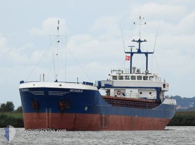
MONIKA
General Cargo
Current Trip
| Time Travelled | 12 h, 22 mins |
|---|---|
| Remaining Time | 4 h, 0 mins |
| Distance Travelled | 85.31 nm |
| Remaining Distance | 36.79 nm |
| AVG Speed | 7.3 Knop |
| MAX Speed | 9.5 Knop |
| AVG Wind | 19.2 knots |
| MAX Wind | 22 knots |
| MIN Temp | 7.8°C / 46.04°F |
| MAX Temp | 8.5°C / 47.3°F |
| Djupgående | 2.6 m |
| Position mottagen | 1 m sen |
Current Position
| Longitud | --- |
|---|---|
| Latitude | --- |
| Status | Under way using engine |
| Fart | 8.7 Knop |
| Kurs | 227.2° |
| Område | Baltic Sea |
| Station | T-AIS |
| Position mottagen | 1 m sen |
Info
Information
The current position of MONIKA is in Baltic Sea with coordinates 54.79719° / 19.17019° as reported on 2025-12-09 13:09 by AIS to our vessel tracker app. The vessel's current speed is 8.7 Knop and is heading at the port of GDANSK. The estimated time of arrival as calculated by MyShipTracking vessel tracking app is 2025-12-09 18:10 LT
The vessel MONIKA (IMO: 9115987, MMSI: 304482000) is a General Cargo that was built in 1995 ( 30 År gammal ). It's sailing under the flag of [AG] Antigua Barbuda.
In this page you can find informations about the vessels current position, last detected port calls, and current voyage information. If the vessels is not in coverage by AIS you will find the latest position.
The current position of MONIKA is detected by our AIS receivers and we are not responsible for the reliability of the data. The last position was recorded while the vessel was in Coverage by the Ais receivers of our vessel tracking app.
The current draught of MONIKA as reported by AIS is 2.6 meters
Weather
| Temperature | 8.4°C / 47.12°F |
|---|---|
| Wind Speed | 12 knots |
| Direction | 259° W |
| Pressure | 1011.8 hPa |
| Humidity | 90.7 % |
| Cloud Coverage | 84 % |
Featured Company
Last Port Calls
| Port | Arrival | Departure | Time In Port |
|---|---|---|---|
| 2025-12-07 15:36 | 2025-12-09 02:48 | 1 d | |
| 2025-12-04 06:04 | 2025-12-05 13:28 | 1 d | |
| 2025-12-02 14:13 | 2025-12-03 19:41 | 1 d | |
| 2025-11-28 23:00 | 2025-12-01 16:29 | 2 d | |
| 2025-11-24 19:36 | 2025-11-27 10:52 | 2 d | |
| 2025-11-21 14:17 | 2025-11-22 14:26 | 1 d | |
| 2025-11-20 09:28 | 2025-11-21 00:56 | 15 h | |
| 2025-11-17 06:48 | 2025-11-18 15:53 | 1 d | |
| 2025-11-14 18:57 | 2025-11-14 19:33 | 35 m | |
| 2025-11-12 07:28 | 2025-11-14 10:30 | 2 d |
Most Visited Ports (Last year)
| Port | Arrivals | |
|---|---|---|
| 2 | ||
| 2 | ||
| 2 | ||
| 2 | ||
| 2 | ||
| 2 |
Last Trips
| Origin | Departure | Destination | Arrival | Distance | |
|---|---|---|---|---|---|
| 2025-12-05 13:28 | 2025-12-07 15:36 | 429.91 nm | |||
| 2025-12-03 19:41 | 2025-12-04 06:04 | 92.70 nm | |||
| 2025-12-01 16:29 | 2025-12-02 14:13 | 183.15 nm | |||
| 2025-11-27 10:52 | 2025-11-28 23:00 | 120.78 nm | |||
| 2025-11-22 14:26 | 2025-11-24 19:36 | 438.72 nm | |||
| 2025-11-21 00:56 | 2025-11-21 14:17 | 118.15 nm | |||
| 2025-11-18 15:53 | 2025-11-20 09:28 | 422.35 nm | |||
| 2025-11-14 19:33 | 2025-11-17 06:48 | 519.32 nm | |||
| 2025-11-14 10:30 | 2025-11-14 18:57 | 65.04 nm | |||
| 2025-11-11 23:58 | 2025-11-12 07:28 | 65.83 nm |
Events
| Tid | Event | Detaljer | Position / Dest | Information |
|---|---|---|---|---|
| 2025-12-09 12:50 | ETA ändrat | 2025/12/09 16:00 2025/12/09 15:00 |
54.82958 / 19.22786
PLGDN
|
Fart: 9.3 kn Kurs: 225.2° |
| 2025-12-09 12:46 | Status ändrad | Under way using engine Default |
54.83616 / 19.23864
PLGDN
|
Fart: 9 kn Kurs: 223° |
| 2025-12-09 12:42 | Status ändrad | Default Under way using engine |
54.84167 / 19.24833
PLGDN
|
Fart: 9.3 kn Kurs: 217.5° |
| 2025-12-09 12:24 | Upptäckt i hav | Polish part of the Baltic Sea |
54.87835 / 19.30079
Baltic Sea
PLGDN
|
Fart: 9 kn Kurs: 216.8° |
| 2025-12-09 12:02 | Byter havsområde | Russian part of the Baltic Sea Lithuanian part of the Baltic Sea |
54.92433 / 19.36188
Baltic Sea
PLGDN
|
Fart: 9 kn Kurs: 217.4° |
| 2025-12-09 12:02 | Status ändrad | Under way using engine Default |
54.92433 / 19.36188
PLGDN
|
Fart: 9.1 kn Kurs: 217° |
| 2025-12-09 11:43 | I täckningsområde |
54.92433 / 19.36188
Baltic Sea
PLGDN
|
Fart: 9 kn Kurs: 217.4° |
|
| 2025-12-09 02:01 | Status ändrad | Default Under way using engine |
55.67807 / 20.85649
PLGDN
|
Fart: 6.3 kn Kurs: 240° |
| 2025-12-09 01:56 | UTANFÖR täckningsområde |
55.68271 / 20.87032
Baltic Sea
PLGDN
|
Fart: 6.3 kn Kurs: 240° |
|
| 2025-12-09 01:00 | Djupgående ändrat | 2.6 4.8 |
55.73252 / 21.04345
PLGDN
|
Fart: 7.4 kn Kurs: 245.1° |