
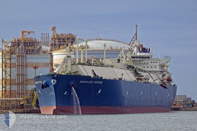
MARAN GAS VERGINA
Tanker
Current Trip
FOR ORDERS
| Time Travelled | 19 days |
|---|---|
| Remaining Time | --- |
| Distance Travelled | 8080.99 nm |
| Remaining Distance | --- |
| AVG Speed | 17.3 Knop |
| MAX Speed | 19.9 Knop |
| AVG Wind | 16.1 knots |
| MAX Wind | 35 knots |
| MIN Temp | 8.1°C / 46.58°F |
| MAX Temp | 29.4°C / 84.92°F |
| Djupgående | 11.2 m |
| Position mottagen | 2 d sen |
Current Position
| Longitud | 19.10879° |
|---|---|
| Latitude | -35.07267° |
| Status | Under way using engine |
| Fart | 16.6 Knop |
| Kurs | 93.2° |
| Område | South Atlantic Ocean |
| Station | T-AIS |
| Position mottagen | 2 d sen |
Info
Information
The current position of MARAN GAS VERGINA is in South Atlantic Ocean with coordinates -35.07267° / 19.10879° as reported on 2024-04-14 02:44 by AIS to our vessel tracker app. The vessel's current speed is 16.6 Knop
The vessel MARAN GAS VERGINA (IMO: 9732369, MMSI: 241467000) is a Tanker It's sailing under the flag of [GR] Greece.
In this page you can find informations about the vessels current position, last detected port calls, and current voyage information. If the vessels is not in coverage by AIS you will find the latest position.
The current position of MARAN GAS VERGINA is detected by our AIS receivers and we are not responsible for the reliability of the data. The last position was recorded while the vessel was in Coverage by the Ais receivers of our vessel tracking app.
The current draught of MARAN GAS VERGINA as reported by AIS is 11.2 meters
Weather
| Temperature | 21.4°C / 70.52°F |
|---|---|
| Wind Speed | 17 knots |
| Direction | 92° E |
| Pressure | 1027.1 hPa |
| Humidity | 58 % |
| Cloud Coverage | 100 % |
Featured Company
Last Port Calls
| Port | Arrival | Departure | Time In Port |
|---|---|---|---|
| 2024-03-27 11:25 | 2024-03-28 11:45 | 1 d | |
| 2024-03-03 22:57 | 2024-03-04 23:52 | 1 d | |
| 2024-02-03 12:57 | 2024-02-04 12:47 | 23 h |
Most Visited Ports (Last year)
| Port | Arrivals | |
|---|---|---|
| 4 | ||
| 2 | ||
| 2 | ||
| 1 | ||
| 1 | ||
| 1 |
Last Trips
| Origin | Departure | Destination | Arrival | Distance | |
|---|---|---|---|---|---|
| 2024-03-04 23:52 | 2024-03-27 07:25 | 3812.01 nm | |||
| 2024-02-04 13:47 | 2024-03-03 22:57 | 10282.90 nm | |||
| 2024-01-19 10:09 | 2024-02-03 13:57 | 5497.65 nm |
Events
| Tid | Event | Detaljer | Position / Dest | Information |
|---|---|---|---|---|
| 2024-04-14 02:51 | Status ändrad | Default Under way using engine |
-35.07596 / 19.14474
FOR ORDERS
|
Fart: 16.6 kn Kurs: 93.2° |
| 2024-04-14 02:44 | UTANFÖR täckningsområde |
-35.07267 / 19.10879
South Atlantic Ocean
FOR ORDERS
|
Fart: 16.6 kn Kurs: 93.2° |
|
| 2024-04-14 02:04 | Status ändrad | Under way using engine Default |
-35.05627 / 18.87617
FOR ORDERS
|
Fart: 17.1 kn Kurs: 99° |
| 2024-04-14 01:49 | Status ändrad | Default Under way using engine |
-35.04489 / 18.78694
FOR ORDERS
|
Fart: 16.7 kn Kurs: 96.8° |
| 2024-04-14 01:34 | Status ändrad | Under way using engine Default |
-35.03685 / 18.70639
FOR ORDERS
|
Fart: 16.7 kn Kurs: 93° |
| 2024-04-14 00:38 | Status ändrad | Default Under way using engine |
-35.00735 / 18.38725
FOR ORDERS
|
Fart: 16.7 kn Kurs: 95° |
| 2024-04-13 22:57 | Status ändrad | Under way using engine Default |
-34.76361 / 17.91018
FOR ORDERS
|
Fart: 16.7 kn Kurs: 131° |
| 2024-04-13 22:39 | Status ändrad | Default Under way using engine |
-34.71019 / 17.83453
FOR ORDERS
|
Fart: 16.6 kn Kurs: 131.2° |
| 2024-04-13 22:28 | Status ändrad | Under way using engine Default |
-34.67641 / 17.78656
FOR ORDERS
|
Fart: 16.2 kn Kurs: 128° |
| 2024-04-13 22:19 | Status ändrad | Default Under way using engine |
-34.65044 / 17.74723
FOR ORDERS
|
Fart: 16.2 kn Kurs: 128.8° |