
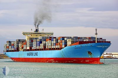
KOTKA
Container Ship
Current Trip
| Time Travelled | 1 day |
|---|---|
| Remaining Time | 7 days |
| Distance Travelled | 225.91 nm |
| Remaining Distance | 3255.29 nm |
| AVG Speed | 16.3 Knop |
| MAX Speed | 17.8 Knop |
| AVG Wind | 12 knots |
| MAX Wind | 16 knots |
| MIN Temp | 18.6°C / 65.48°F |
| MAX Temp | 20.6°C / 69.08°F |
| Djupgående | 13.4 m |
| Position mottagen | 19 h, 7 m sen |
Current Position
| Longitud | -15.93459° |
|---|---|
| Latitude | 29.28218° |
| Status | Under way using engine |
| Fart | 16.1 Knop |
| Kurs | 301.5° |
| Område | North Atlantic Ocean |
| Station | T-AIS |
| Position mottagen | 19 h, 7 m sen |
Info
Information
The current position of KOTKA is in North Atlantic Ocean with coordinates 29.28218° / -15.93459° as reported on 2024-04-24 15:20 by AIS to our vessel tracker app. The vessel's current speed is 16.1 Knop and is heading at the port of NEW YORK. The estimated time of arrival as calculated by MyShipTracking vessel tracking app is 2024-05-03 07:56 LT
The vessel KOTKA (IMO: 9085534, MMSI: 636018933) is a Container Ship that was built in 1996 ( 28 År gammal ). It's sailing under the flag of [LR] Liberia.
In this page you can find informations about the vessels current position, last detected port calls, and current voyage information. If the vessels is not in coverage by AIS you will find the latest position.
The current position of KOTKA is detected by our AIS receivers and we are not responsible for the reliability of the data. The last position was recorded while the vessel was in Coverage by the Ais receivers of our vessel tracking app.
The current draught of KOTKA as reported by AIS is 13.4 meters
Weather
| Temperature | 20°C / 68°F |
|---|---|
| Wind Speed | 13 knots |
| Direction | 47° NE |
| Pressure | 1018.7 hPa |
| Humidity | 64.9 % |
| Cloud Coverage | 23 % |
Featured Company
Last Port Calls
| Port | Arrival | Departure | Time In Port |
|---|---|---|---|
| 2024-04-23 13:53 | 2024-04-24 09:23 | 19 h | |
| 2024-03-30 00:33 | 2024-03-30 23:13 | 22 h | |
| 2024-03-13 16:53 | 2024-03-15 21:26 | 2 d | |
| 2024-02-29 06:56 | |||
| 2024-02-13 21:17 | 2024-02-21 20:32 | 7 d | |
| 2024-02-03 08:17 | 2024-02-04 08:09 | 23 h |
Last Trips
| Origin | Departure | Destination | Arrival | Distance | |
|---|---|---|---|---|---|
| 2024-03-31 04:43 | 2024-04-23 14:53 | 8904.66 nm | |||
| 2024-03-16 01:26 | 2024-03-30 06:03 | 2331.99 nm | |||
| 2024-02-21 22:32 | 2024-02-29 09:56 | 1787.15 nm | |||
| 2024-02-04 12:09 | 2024-02-13 23:17 | 1655.34 nm | |||
| 2024-01-08 17:49 | 2024-02-03 12:17 | 3248.95 nm |
Events
| Tid | Event | Detaljer | Position / Dest | Information |
|---|---|---|---|---|
| 2024-04-24 15:26 | Status ändrad | Default Under way using engine |
29.29577 / -15.95992
USNYK
|
Fart: 16.1 kn Kurs: 301.5° |
| 2024-04-24 15:20 | UTANFÖR täckningsområde |
29.28218 / -15.93459
North Atlantic Ocean
USNYK
|
Fart: 16.1 kn Kurs: 301.5° |
|
| 2024-04-24 15:09 | Status ändrad | Under way using engine Default |
29.25449 / -15.88445
USNYK
|
Fart: 16.3 kn Kurs: 303° |
| 2024-04-24 15:01 | Status ändrad | Default Under way using engine |
29.23563 / -15.85172
USNYK
|
Fart: 16.4 kn Kurs: 302.4° |
| 2024-04-24 14:23 | Status ändrad | Under way using engine Default |
29.14075 / -15.68595
USNYK
|
Fart: 16.5 kn Kurs: 303° |
| 2024-04-24 14:22 | Status ändrad | Default Under way using engine |
29.13849 / -15.68204
USNYK
|
Fart: 16.5 kn Kurs: 303.6° |
| 2024-04-24 14:22 | Status ändrad | Under way using engine Default |
29.13825 / -15.68160
USNYK
|
Fart: 17.1 kn Kurs: 304° |
| 2024-04-24 13:42 | Status ändrad | Default Under way using engine |
29.02620 / -15.50408
USNYK
|
Fart: 17.4 kn Kurs: 307.7° |
| 2024-04-24 13:10 | Status ändrad | Under way using engine Default |
28.92999 / -15.36671
USNYK
|
Fart: 17.6 kn Kurs: 310° |
| 2024-04-24 13:06 | I täckningsområde |
28.92999 / -15.36671
North Atlantic Ocean
USNYK
|
Fart: 17.5 kn Kurs: 310.5° |