
LOLA1
Cement Carrier
Current Trip
| Trip Time | 1 day |
|---|---|
| Trip Distance | 280.35 nm |
| AVG Speed | 8.4 Knop |
| MAX Speed | 9.7 Knop |
| Djupgående | 3.9 m |
| AVG Wind | 11.8 knots |
| MAX Wind | 22 knots |
| MIN Temp | 3.4°C / 38.12°F |
| MAX Temp | 6.2°C / 43.16°F |
| Position mottagen | 5 m sen |
Current Position
| Longitud | -2.08167° |
|---|---|
| Latitude | 57.14033° |
| Status | Moored |
| Fart | |
| Kurs | 273° |
| Område | North Sea |
| Station | T-AIS |
| Position mottagen | 5 m sen |
Info
Information
The current position of LOLA1 is in North Sea with coordinates 57.14033° / -2.08167° as reported on 2024-04-25 23:05 by AIS to our vessel tracker app. The vessel's current speed is 0 Knop and is currently inside the port of ABERDEEN.
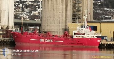
The vessel LOLA1 (IMO: 6721151, MMSI: 375219000) is a Cement Carrier that was built in 1967 ( 57 År gammal ). It's sailing under the flag of [VC] St Vincent Grenadines.
In this page you can find informations about the vessels current position, last detected port calls, and current voyage information. If the vessels is not in coverage by AIS you will find the latest position.
The current position of LOLA1 is detected by our AIS receivers and we are not responsible for the reliability of the data. The last position was recorded while the vessel was in Coverage by the Ais receivers of our vessel tracking app.
The current draught of LOLA1 as reported by AIS is 3.9 meters
Weather
| Temperature | 4.3°C / 39.74°F |
|---|---|
| Wind Speed | 8 knots |
| Direction | 333° NNW |
| Pressure | 1005.4 hPa |
| Humidity | 74.2 % |
| Cloud Coverage | 100 % |
Featured Company
Last Port Calls
| Port | Arrival | Departure | Time In Port |
|---|---|---|---|
| 2024-04-25 14:35 | |||
| 2024-04-23 06:34 | 2024-04-24 05:05 | 22 h | |
| 2024-04-16 03:20 | 2024-04-17 08:35 | 1 d | |
| 2024-04-12 11:09 | 2024-04-14 17:42 | 2 d | |
| 2024-04-09 23:55 | 2024-04-10 23:50 | 23 h | |
| 2024-04-07 04:28 | 2024-04-08 14:15 | 1 d | |
| 2024-04-05 01:05 | 2024-04-05 14:52 | 13 h | |
| 2024-04-01 14:08 | 2024-04-02 19:27 | 1 d | |
| 2024-03-30 18:30 | 2024-03-30 20:00 | 1 h | |
| 2024-03-29 20:57 | 2024-03-30 18:12 | 21 h |
Last Trips
| Origin | Departure | Destination | Arrival | Distance | |
|---|---|---|---|---|---|
| 2024-04-24 07:05 | 2024-04-25 15:35 | 280.35 nm | |||
| 2024-04-17 09:35 | 2024-04-23 08:34 | 287.06 nm | |||
| 2024-04-14 19:42 | 2024-04-16 04:20 | 280.82 nm | |||
| 2024-04-11 00:50 | 2024-04-12 13:09 | 287.28 nm | |||
| 2024-04-08 16:15 | 2024-04-10 00:55 | 282.17 nm | |||
| 2024-04-05 15:52 | 2024-04-07 06:28 | 308.70 nm | |||
| 2024-04-02 21:27 | 2024-04-05 02:05 | 459.94 nm | |||
| 2024-03-30 21:00 | 2024-04-01 16:08 | 406.27 nm | |||
| 2024-03-30 19:12 | 2024-03-30 19:30 | 0.74 nm | |||
| 2024-03-29 09:47 | 2024-03-29 21:57 | 107.69 nm |
Events
| Tid | Event | Detaljer | Position / Dest | Information |
|---|---|---|---|---|
| 2024-04-25 18:04 | Status ändrad | Moored Under way using engine |
57.14050 / -2.08167
[GB] ABERDEEN
|
Fart: 0.1 kn Kurs: 272° |
| 2024-04-25 14:48 | STOPPAR förflyttning |
57.14033 / -2.08167
[GB] ABERDEEN
|
Fart: 0.2 kn Kurs: 272° |
|
| 2024-04-25 14:35 | ANLÄNDER HAMN |
|
57.14550 / -2.05900
[GB] ABERDEEN
|
Fart: 7.4 kn Kurs: 236° |
| 2024-04-25 14:15 | STARTAR förflyttning | 1.82 nm, South of ABERDEEN ANCH |
57.16117 / -2.01817
ABERDEEN
|
Fart: 3.1 kn Kurs: 28° |
| 2024-04-25 14:06 | STOPPAR förflyttning | 1.96 nm, North East of ABERDEEN |
57.15683 / -2.02333
ABERDEEN
|
Fart: 0.3 kn Kurs: 35° |
| 2024-04-25 12:10 | ETA ändrat | 2024/04/25 15:00 2024/04/25 19:00 |
57.26633 / -1.61783
ABERDEEN
|
Fart: 9 kn Kurs: 243° |
| 2024-04-25 11:26 | Upptäckt i hav | United Kingdom part of the North Sea |
57.31350 / -1.43483
North Sea
ABERDEEN
|
Fart: 8.8 kn Kurs: 245° |
| 2024-04-25 11:26 | Status ändrad | Under way using engine Default |
57.31350 / -1.43483
ABERDEEN
|
Fart: 8 kn Kurs: 245° |
| 2024-04-25 11:26 | I täckningsområde |
57.31350 / -1.43483
North Sea
ABERDEEN
|
Fart: 8.8 kn Kurs: 245° |
|
| 2024-04-24 12:01 | UTANFÖR täckningsområde |
58.81867 / 4.10433
North Sea
ABERDEEN
|
Fart: 8.6 kn Kurs: 242° |