
LAUS DEO
Cargo
Current Trip
NULL
| Time Travelled | 7 days |
|---|---|
| Remaining Time | --- |
| Distance Travelled | 157.22 nm |
| Remaining Distance | --- |
| AVG Speed | 6.3 Knop |
| MAX Speed | 9.9 Knop |
| AVG Wind | 11 knots |
| MAX Wind | 18 knots |
| MIN Temp | 2.2°C / 35.96°F |
| MAX Temp | 11.1°C / 51.98°F |
| Djupgående | 2 m |
| Position mottagen | 3 d sen |
Current Position
| Longitud | 7.87311° |
|---|---|
| Latitude | 49.97655° |
| Status | Under way using engine |
| Fart | 9.8 Knop |
| Kurs | 307.9° |
| Område | North Sea |
| Station | T-AIS |
| Position mottagen | 3 d sen |
Info
Information
The current position of LAUS DEO is in North Sea with coordinates 49.97655° / 7.87311° as reported on 2024-04-20 05:47 by AIS to our vessel tracker app. The vessel's current speed is 9.8 Knop
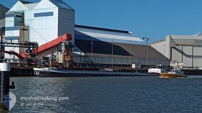
The vessel LAUS DEO (MMSI: 244010114) is a Cargo It's sailing under the flag of [NL] Netherlands.
In this page you can find informations about the vessels current position, last detected port calls, and current voyage information. If the vessels is not in coverage by AIS you will find the latest position.
The current position of LAUS DEO is detected by our AIS receivers and we are not responsible for the reliability of the data. The last position was recorded while the vessel was in Coverage by the Ais receivers of our vessel tracking app.
The current draught of LAUS DEO as reported by AIS is 2 meters
Weather
| Temperature | 1.7°C / 35.06°F |
|---|---|
| Wind Speed | 6 knots |
| Direction | 308° NW |
| Pressure | 1017.1 hPa |
| Humidity | 95.9 % |
| Cloud Coverage | 98 % |
Featured Company
Last Port Calls
| Port | Arrival | Departure | Time In Port |
|---|---|---|---|
| 2024-04-15 19:55 | 2024-04-16 03:50 | 7 h | |
| 2024-04-15 07:16 | 2024-04-15 19:04 | 11 h | |
| 2024-04-12 08:12 | 2024-04-14 21:06 | 2 d | |
| 2024-04-10 10:27 | 2024-04-11 12:12 | 1 d | |
| 2024-04-04 07:24 | 2024-04-04 08:21 | 56 m | |
| 2024-04-03 14:45 | 2024-04-03 15:26 | 40 m | |
| 2024-04-02 12:16 | 2024-04-03 09:45 | 21 h | |
| 2024-04-02 09:46 | 2024-04-02 11:57 | 2 h | |
| 2024-04-01 20:12 | 2024-04-02 09:39 | 13 h | |
| 2024-03-29 16:54 | 2024-04-01 11:43 | 2 d |
Most Visited Ports (Last year)
| Port | Arrivals | |
|---|---|---|
| 16 | ||
| 14 | ||
| 11 | ||
| 9 | ||
| 9 | ||
| 5 |
Last Trips
| Origin | Departure | Destination | Arrival | Distance | |
|---|---|---|---|---|---|
| 2024-04-15 21:04 | 2024-04-15 21:55 | 4.82 nm | |||
| 2024-04-14 23:06 | 2024-04-15 09:16 | 40.02 nm | |||
| 2024-04-11 14:12 | 2024-04-12 10:12 | 86.78 nm | |||
| 2024-04-04 10:21 | 2024-04-10 12:27 | 68.18 nm | |||
| 2024-04-03 17:26 | 2024-04-04 09:24 | 21.87 nm | |||
| 2024-04-03 11:45 | 2024-04-03 16:45 | 31.02 nm | |||
| 2024-04-02 13:57 | 2024-04-02 14:16 | 2.70 nm | |||
| 2024-04-02 11:39 | 2024-04-02 11:46 | 0.78 nm | |||
| 2024-04-01 13:43 | 2024-04-01 22:12 | 54.15 nm | |||
| 2024-03-29 15:16 | 2024-03-29 17:54 | 14.03 nm |
Events
| Tid | Event | Detaljer | Position / Dest | Information |
|---|---|---|---|---|
| 2024-04-20 05:47 | UTANFÖR täckningsområde |
49.97655 / 7.87311
North Sea
|
Fart: 9.8 kn Kurs: 307.9° |
|
| 2024-04-20 04:17 | STARTAR förflyttning | 1.72 nm, West of SCHIERSTEIN |
50.02835 / 8.15140
NULL
|
Fart: 4 kn Kurs: 228.9° |
| 2024-04-20 04:15 | Status ändrad | Under way using engine Moored |
50.02963 / 8.15355
NULL
|
Fart: Kurs: 511° |
| 2024-04-19 15:52 | Status ändrad | Moored Under way using engine |
50.02971 / 8.15375
NULL
|
Fart: Kurs: 511° |
| 2024-04-19 15:32 | STOPPAR förflyttning | 1.61 nm, West of SCHIERSTEIN |
50.02942 / 8.15391
NULL
|
Fart: 0.3 kn Kurs: 511° |
| 2024-04-19 11:36 | I täckningsområde |
49.68134 / 8.35444
North Sea
|
Fart: 8.6 kn Kurs: 358.3° |
|
| 2024-04-17 12:27 | UTANFÖR täckningsområde |
49.71785 / 8.42748
North Sea
|
Fart: 5.3 kn Kurs: 245.3° |
|
| 2024-04-17 05:37 | I täckningsområde |
49.97150 / 7.91035
North Sea
|
Fart: 2.8 kn Kurs: 69.2° |
|
| 2024-04-16 09:48 | UTANFÖR täckningsområde |
50.46816 / 7.35220
North Sea
|
Fart: 4.9 kn Kurs: 148° |
|
| 2024-04-16 03:50 | AVGÅTT HAMN |
|
50.89355 / 7.01085
NULL
|
Fart: 5.9 kn Kurs: 94.3° |