
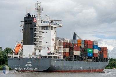
JAN
Container Ship
Current Trip
| Time Travelled | 12 h, 32 mins |
|---|---|
| Remaining Time | --- |
| Distance Travelled | 117.16 nm |
| Remaining Distance | 3.74 nm |
| AVG Speed | 11 Knop |
| MAX Speed | 14.8 Knop |
| AVG Wind | 7.7 knots |
| MAX Wind | 15.4 knots |
| MIN Temp | 6.1°C / 42.98°F |
| MAX Temp | 9°C / 48.2°F |
| Djupgående | 8.4 m |
| Position mottagen | 1 m sen |
Current Position
| Longitud | -6.09317° |
|---|---|
| Latitude | 53.31650° |
| Status | At anchor |
| Fart | 0.2 Knop |
| Kurs | 34° |
| Område | Irish Sea and St. George's Channel |
| Station | T-AIS |
| Position mottagen | 1 m sen |
Info
Information
The current position of JAN is in Irish Sea and St. George's Channel with coordinates 53.31650° / -6.09317° as reported on 2024-04-20 10:17 by AIS to our vessel tracker app. The vessel's current speed is 0.2 Knop and is heading at the port of DUBLIN. The estimated time of arrival as calculated by MyShipTracking vessel tracking app is 2024-04-20 07:00 LT
The vessel JAN (IMO: 9477335, MMSI: 255805788) is a Container Ship that was built in 2009 ( 15 År gammal ). It's sailing under the flag of [PT] Portugal.
In this page you can find informations about the vessels current position, last detected port calls, and current voyage information. If the vessels is not in coverage by AIS you will find the latest position.
The current position of JAN is detected by our AIS receivers and we are not responsible for the reliability of the data. The last position was recorded while the vessel was in Coverage by the Ais receivers of our vessel tracking app.
The current draught of JAN as reported by AIS is 8.4 meters
Weather
| Temperature | 7.4°C / 45.32°F |
|---|---|
| Wind Speed | 4 knots |
| Direction | 18° NNE |
| Pressure | 1030.6 hPa |
| Humidity | 72.6 % |
| Cloud Coverage | 29 % |
Featured Company
Last Port Calls
| Port | Arrival | Departure | Time In Port |
|---|---|---|---|
| 2024-04-18 05:49 | 2024-04-19 21:47 | 1 d | |
| 2024-04-14 15:06 | 2024-04-15 04:38 | 13 h | |
| 2024-04-12 07:58 | 2024-04-14 05:12 | 1 d | |
| 2024-04-09 07:18 | 2024-04-09 18:51 | 11 h | |
| 2024-04-07 00:03 | 2024-04-08 23:15 | 1 d | |
| 2024-04-04 05:41 | 2024-04-05 03:47 | 22 h | |
| 2024-04-03 03:49 | 2024-04-03 19:33 | 15 h | |
| 2024-03-31 05:45 | 2024-03-31 23:07 | 17 h | |
| 2024-03-30 01:32 | 2024-03-30 12:22 | 10 h | |
| 2024-03-29 09:17 | 2024-03-30 01:07 | 15 h |
Most Visited Ports (Last year)
| Port | Arrivals | |
|---|---|---|
| 23 | ||
| 20 | ||
| 18 | ||
| 17 | ||
| 14 | ||
| 13 |
Last Trips
| Origin | Departure | Destination | Arrival | Distance | |
|---|---|---|---|---|---|
| 2024-04-15 06:38 | 2024-04-18 06:49 | 620.62 nm | |||
| 2024-04-14 07:12 | 2024-04-14 17:06 | 142.68 nm | |||
| 2024-04-09 19:51 | 2024-04-12 09:58 | 833.92 nm | |||
| 2024-04-09 00:15 | 2024-04-09 08:18 | 92.90 nm | |||
| 2024-04-05 04:47 | 2024-04-07 01:03 | 115.51 nm | |||
| 2024-04-03 20:33 | 2024-04-04 06:41 | 117.92 nm | |||
| 2024-04-01 01:07 | 2024-04-03 04:49 | 614.41 nm | |||
| 2024-03-30 13:22 | 2024-03-31 07:45 | 143.30 nm | |||
| 2024-03-30 02:07 | 2024-03-30 02:32 | 2.10 nm | |||
| 2024-03-29 10:01 | 2024-03-29 10:17 | 2.04 nm |
Events
| Tid | Event | Detaljer | Position / Dest | Information |
|---|---|---|---|---|
| 2024-04-20 08:44 | STOPPAR förflyttning | 1.71 nm, North East of DUN LAOGHAIRE |
53.31650 / -6.09350
IEDUB
|
Fart: 0.3 kn Kurs: 28° |
| 2024-04-20 08:40 | Status ändrad | At anchor Under way using engine |
53.31720 / -6.09238
IEDUB
|
Fart: 1 kn Kurs: 23° |
| 2024-04-20 06:22 | Byter havsområde | Irish part of the Irish Sea and St. George's Channel United Kingdom part of the Irish Sea and St. George's Channel |
53.46894 / -5.58790
Irish Sea and St. George's Channel
IEDUB
|
Fart: 10.3 kn Kurs: 251° |
| 2024-04-20 06:20 | Status ändrad | Under way using engine Default |
53.47078 / -5.57877
IEDUB
|
Fart: 10.5 kn Kurs: 251° |
| 2024-04-20 06:06 | I täckningsområde |
53.46894 / -5.58790
Irish Sea and St. George's Channel
IEDUB
|
Fart: 10.3 kn Kurs: 251° |
|
| 2024-04-20 00:10 | Status ändrad | Default Under way using engine |
53.57062 / -3.73579
IEDUB
|
Fart: 11.8 kn Kurs: 276° |
| 2024-04-20 00:04 | Status ändrad | Under way using engine Default |
53.56852 / -3.69928
IEDUB
|
Fart: 11.9 kn Kurs: 277° |
| 2024-04-20 00:04 | UTANFÖR täckningsområde |
53.56852 / -3.69928
Irish Sea and St. George's Channel
IEDUB
|
Fart: 11.8 kn Kurs: 276° |
|
| 2024-04-19 23:58 | Status ändrad | Default Under way using engine |
53.56665 / -3.66927
IEDUB
|
Fart: 11.6 kn Kurs: 276° |
| 2024-04-19 22:55 | ETA ändrat | 2024/04/20 07:00 2024/04/20 05:00 |
53.53564 / -3.33684
IEDUB
|
Fart: 11.5 kn Kurs: 293° |