
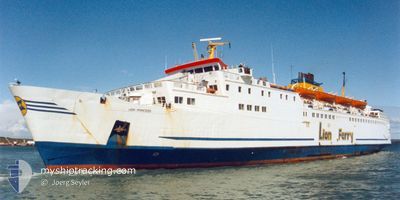
IONIAN STAR
Ro-Ro/Passenger Ship
Current Trip
IT BDS
| Time Travelled | 11 h, 53 mins |
|---|---|
| Remaining Time | --- |
| Distance Travelled | 22.43 nm |
| Remaining Distance | --- |
| AVG Speed | 10.9 Knop |
| MAX Speed | 11.3 Knop |
| AVG Wind | 16.7 knots |
| MAX Wind | 17 knots |
| MIN Temp | 13.6°C / 56.48°F |
| MAX Temp | 14.2°C / 57.56°F |
| Djupgående | 5.2 m |
| Position mottagen | 9 h, 31 m sen |
Current Position
| Longitud | 18.49623° |
|---|---|
| Latitude | 40.62949° |
| Status | Under way using engine |
| Fart | 10.9 Knop |
| Kurs | 106° |
| Område | Adriatic Sea |
| Station | T-AIS |
| Position mottagen | 9 h, 31 m sen |
Info
Information
The current position of IONIAN STAR is in Adriatic Sea with coordinates 40.62949° / 18.49623° as reported on 2024-04-18 00:35 by AIS to our vessel tracker app. The vessel's current speed is 10.9 Knop
The vessel IONIAN STAR (IMO: 7037806, MMSI: 373339000) is a Ro-Ro/Passenger Ship that was built in 1971 ( 53 År gammal ). It's sailing under the flag of [PA] Panama.
In this page you can find informations about the vessels current position, last detected port calls, and current voyage information. If the vessels is not in coverage by AIS you will find the latest position.
The current position of IONIAN STAR is detected by our AIS receivers and we are not responsible for the reliability of the data. The last position was recorded while the vessel was in Coverage by the Ais receivers of our vessel tracking app.
The current draught of IONIAN STAR as reported by AIS is 5.2 meters
Weather
| Temperature | 14.3°C / 57.74°F |
|---|---|
| Wind Speed | 15 knots |
| Direction | 308° NW |
| Pressure | 1005.4 hPa |
| Humidity | 65.8 % |
| Cloud Coverage | 65 % |
Featured Company
Last Port Calls
| Port | Arrival | Departure | Time In Port |
|---|---|---|---|
| 2024-04-17 04:57 | 2024-04-17 22:13 | 17 h | |
| 2024-04-16 05:32 | 2024-04-16 22:09 | 16 h | |
| 2024-04-15 04:31 | 2024-04-15 23:18 | 18 h | |
| 2024-04-14 05:54 | 2024-04-14 21:23 | 15 h | |
| 2024-04-13 18:34 | 2024-04-14 00:34 | 5 h | |
| 2024-04-13 05:01 | 2024-04-13 13:16 | 8 h | |
| 2024-04-12 04:42 | 2024-04-12 23:34 | 18 h | |
| 2024-04-11 05:11 | 2024-04-11 21:15 | 16 h | |
| 2024-04-10 04:38 | 2024-04-10 22:44 | 18 h | |
| 2024-04-09 04:54 | 2024-04-09 21:17 | 16 h |
Last Trips
| Origin | Departure | Destination | Arrival | Distance | |
|---|---|---|---|---|---|
| 2024-04-17 00:09 | 2024-04-17 06:57 | 61.77 nm | |||
| 2024-04-16 01:18 | 2024-04-16 07:32 | 69.46 nm | |||
| 2024-04-14 23:23 | 2024-04-15 06:31 | 70.23 nm | |||
| 2024-04-14 02:34 | 2024-04-14 07:54 | 69.82 nm | |||
| 2024-04-13 15:16 | 2024-04-13 20:34 | 68.06 nm | |||
| 2024-04-13 01:34 | 2024-04-13 07:01 | 68.60 nm | |||
| 2024-04-11 23:15 | 2024-04-12 06:42 | 68.58 nm | |||
| 2024-04-11 00:44 | 2024-04-11 07:11 | 69.22 nm | |||
| 2024-04-09 23:17 | 2024-04-10 06:38 | 64.06 nm | |||
| 2024-04-08 23:38 | 2024-04-09 06:54 | 70.90 nm |
Events
| Tid | Event | Detaljer | Position / Dest | Information |
|---|---|---|---|---|
| 2024-04-18 00:35 | UTANFÖR täckningsområde |
40.62949 / 18.49623
Adriatic Sea
|
Fart: 10.9 kn Kurs: 106° |
|
| 2024-04-17 23:30 | Status ändrad | Under way using engine Default |
40.67988 / 18.24496
IT BDS
|
Fart: 11.1 kn Kurs: 107° |
| 2024-04-17 23:12 | I täckningsområde |
40.67858 / 18.25084
Adriatic Sea
|
Fart: 11.1 kn Kurs: 102° |
|
| 2024-04-17 22:13 | AVGÅTT HAMN |
|
40.67086 / 18.01574
IT BDS
|
Fart: 8.3 kn Kurs: 80° |
| 2024-04-17 04:57 | ANLÄNDER HAMN |
|
40.64809 / 17.96252
[IT] BRINDISI
|
Fart: 10.7 kn Kurs: 286° |
| 2024-04-17 03:51 | UTANFÖR täckningsområde |
40.65506 / 18.22245
Adriatic Sea
IT BDS
|
Fart: 10.7 kn Kurs: 286° |
|
| 2024-04-17 01:22 | Byter havsområde | Italian part of the Adriatic Sea Albanian part of the Adriatic Sea |
40.55150 / 18.77165
Adriatic Sea
IT BDS
|
Fart: 10.5 kn Kurs: 286° |
| 2024-04-17 00:20 | Destination ändrad | IT BDS AL VOA |
40.50632 / 19.00374
IT BDS
|
Fart: 10.3 kn Kurs: 277° |
| 2024-04-17 00:20 | ETA ändrat | 2024/04/17 06:00 2024/04/16 06:00 |
40.50632 / 19.00374
IT BDS
|
Fart: 10.3 kn Kurs: 277° |
| 2024-04-17 00:00 | Status ändrad | Under way using engine Default |
40.49361 / 19.07505
AL VOA
|
Fart: 10.2 kn Kurs: 284° |