
INLAND SEA
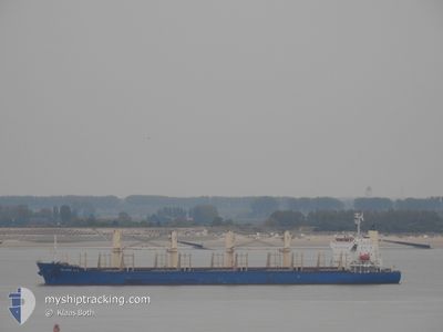
Cargo
Current Trip
| Trip Time | 8 days |
|---|---|
| Trip Distance | 1366.91 nm |
| AVG Speed | 10.5 Knop |
| MAX Speed | 14.3 Knop |
| Djupgående | 4.5 m |
| AVG Wind | 8.4 knots |
| MAX Wind | 16.8 knots |
| MIN Temp | 25.6°C / 78.08°F |
| MAX Temp | 30.9°C / 87.62°F |
| Position mottagen | 1 m sen |
Current Position
| Longitud | 103.87201° |
|---|---|
| Latitude | 1.45836° |
| Status | Default |
| Fart | |
| Kurs | 235° |
| Område | Singapore Strait |
| Station | T-AIS |
| Position mottagen | 1 m sen |
Info
Information
The current position of INLAND SEA is in Singapore Strait with coordinates 1.45836° / 103.87201° as reported on 2024-04-20 07:00 by AIS to our vessel tracker app. The vessel's current speed is 0 Knop and is currently inside the port of PASIR GUDANG.
The vessel INLAND SEA (IMO: 9675731, MMSI: 538005430) is a Cargo It's sailing under the flag of [MH] Marshall Is.
In this page you can find informations about the vessels current position, last detected port calls, and current voyage information. If the vessels is not in coverage by AIS you will find the latest position.
The current position of INLAND SEA is detected by our AIS receivers and we are not responsible for the reliability of the data. The last position was recorded while the vessel was in Coverage by the Ais receivers of our vessel tracking app.
The current draught of INLAND SEA as reported by AIS is 4.5 meters
Weather
| Temperature | 30.4°C / 86.72°F |
|---|---|
| Wind Speed | 4 knots |
| Direction | 217° SW |
| Pressure | 1007 hPa |
| Humidity | 69 % |
| Cloud Coverage | 100 % |
Featured Company
Last Port Calls
| Port | Arrival | Departure | Time In Port |
|---|---|---|---|
| 2024-04-12 02:47 | |||
| 2024-03-30 09:17 | 2024-04-03 04:01 | 3 d | |
| 2024-03-24 04:09 | 2024-03-27 23:01 | 3 d | |
| 2024-03-19 02:29 | 2024-03-23 21:05 | 4 d | |
| 2024-02-01 18:30 |
Most Visited Ports (Last year)
| Port | Arrivals | |
|---|---|---|
| 2 | ||
| 1 | ||
| 1 | ||
| 1 | ||
| 1 | ||
| 1 |
Last Trips
| Origin | Departure | Destination | Arrival | Distance | |
|---|---|---|---|---|---|
| 2024-04-03 12:01 | 2024-04-12 10:47 | 1366.91 nm | |||
| 2024-03-28 07:01 | 2024-03-30 17:17 | 673.18 nm | |||
| 2024-03-24 05:05 | 2024-03-24 12:09 | 18.91 nm | |||
| 2024-02-01 15:30 | 2024-03-19 10:29 | 10309.29 nm |
Events
| Tid | Event | Detaljer | Position / Dest | Information |
|---|---|---|---|---|
| 2024-04-12 04:17 | Status ändrad | Default Under way using engine |
1.45482 / 103.87604
[MY] PASIR GUDANG
|
Fart: 0.1 kn Kurs: 55° |
| 2024-04-12 02:47 | ANLÄNDER HAMN |
|
1.44891 / 103.87386
[MY] PASIR GUDANG
|
Fart: 1.7 kn Kurs: 15° |
| 2024-04-12 02:29 | STOPPAR förflyttning | 1.25 nm, North West of PASIR GUDANG |
1.44329 / 103.87690
MYPGU
|
Fart: 0.3 kn Kurs: 303° |
| 2024-04-12 01:41 | Byter havsområde | Malaysian part of the Singapore Strait Singaporean part of the Singapore Strait |
1.41567 / 103.92699
Singapore Strait
MYPGU
|
Fart: 8.1 kn Kurs: 314.9° |
| 2024-04-12 00:50 | Byter havsområde | Singaporean part of the Singapore Strait Malaysian part of the Singapore Strait |
1.35869 / 104.04741
Singapore Strait
MYPGU
|
Fart: 10.7 kn Kurs: 310.4° |
| 2024-04-12 00:20 | STARTAR förflyttning | 3.8 nm, West of PENGERANG |
1.31247 / 104.11008
MYPGU
|
Fart: 3.1 kn Kurs: 290° |
| 2024-04-12 00:20 | Djupgående ändrat | 4.5 6 |
1.31231 / 104.11048
MYPGU
|
Fart: 2.5 kn Kurs: 290° |
| 2024-04-12 00:20 | Status ändrad | Under way using engine At anchor |
1.31231 / 104.11048
MYPGU
|
Fart: 1.3 kn Kurs: 303° |
| 2024-04-11 22:17 | ETA ändrat | 2024/04/12 07:30 2024/04/08 01:00 |
1.31096 / 104.11253
MYPGU
|
Fart: 0.1 kn Kurs: 280° |
| 2024-04-11 20:24 | Status ändrad | At anchor Default |
1.31033 / 104.11226
MYPGU
|
Fart: 0.1 kn Kurs: 290° |