
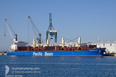
INCHEON BAY
Cargo
Current Trip
| Time Travelled | 15 days |
|---|---|
| Remaining Time | --- |
| Distance Travelled | 2078.07 nm |
| Remaining Distance | --- |
| AVG Speed | 12.2 Knop |
| MAX Speed | 12.2 Knop |
| AVG Wind | 8.9 knots |
| MAX Wind | 30 knots |
| MIN Temp | 7.4°C / 45.32°F |
| MAX Temp | 21.5°C / 70.7°F |
| Djupgående | 9.5 m |
| Position mottagen | 3 d sen |
Current Position
| Longitud | 3.23442° |
|---|---|
| Latitude | 36.91737° |
| Status | Under way using engine |
| Fart | 0.9 Knop |
| Kurs | 89° |
| Område | Mediterranean Sea - Western Basin |
| Station | T-AIS |
| Position mottagen | 3 d sen |
Info
Information
The current position of INCHEON BAY is in Mediterranean Sea - Western Basin with coordinates 36.91737° / 3.23442° as reported on 2024-04-16 11:51 by AIS to our vessel tracker app. The vessel's current speed is 0.9 Knop
The vessel INCHEON BAY (IMO: 9791963, MMSI: 477333700) is a Cargo It's sailing under the flag of [HK] Hong Kong.
In this page you can find informations about the vessels current position, last detected port calls, and current voyage information. If the vessels is not in coverage by AIS you will find the latest position.
The current position of INCHEON BAY is detected by our AIS receivers and we are not responsible for the reliability of the data. The last position was recorded while the vessel was in Coverage by the Ais receivers of our vessel tracking app.
The current draught of INCHEON BAY as reported by AIS is 9.5 meters
Weather
| Temperature | 13.7°C / 56.66°F |
|---|---|
| Wind Speed | 5 knots |
| Direction | 68° ENE |
| Pressure | 1014.7 hPa |
| Humidity | 68.3 % |
| Cloud Coverage | 81 % |
Featured Company
Most Visited Ports (Last year)
| Port | Arrivals | |
|---|---|---|
| 3 | ||
| 3 | ||
| 2 | ||
| 1 | ||
| 1 | ||
| 1 |
Events
| Tid | Event | Detaljer | Position / Dest | Information |
|---|---|---|---|---|
| 2024-04-19 20:30 | STOPPAR förflyttning | 1.89 nm, North of ALGER |
36.79975 / 3.08566
ALGIERS
|
Fart: 0.1 kn Kurs: 53° |
| 2024-04-16 21:31 | STARTAR förflyttning | 7.02 nm, North of EL DJAMILA |
36.91577 / 2.91635
ALGIERS
|
Fart: 4.6 kn Kurs: 90° |
| 2024-04-16 12:03 | STOPPAR förflyttning | 6.63 nm, North of EL MARSA TAMANFOUSST |
36.91629 / 3.23780
ALGIERS
|
Fart: 0.3 kn Kurs: 77° |
| 2024-04-16 11:55 | Status ändrad | Default Under way using engine |
36.91703 / 3.23611
ALGIERS
|
Fart: 0.9 kn Kurs: 89° |
| 2024-04-16 11:51 | Status ändrad | Under way using engine Default |
36.91737 / 3.23442
ALGIERS
|
Fart: 2.1 kn Kurs: 83° |
| 2024-04-16 11:51 | UTANFÖR täckningsområde |
36.91737 / 3.23442
Mediterranean Sea - Western Basin
|
Fart: 0.9 kn Kurs: 79° |
|
| 2024-04-16 11:47 | Status ändrad | Default Under way using engine |
36.91707 / 3.23197
ALGIERS
|
Fart: 1.9 kn Kurs: 84° |
| 2024-04-16 11:38 | Status ändrad | Under way using engine Default |
36.91630 / 3.22267
ALGIERS
|
Fart: 4.5 kn Kurs: 83° |
| 2024-04-16 11:23 | I täckningsområde |
36.91630 / 3.22267
Mediterranean Sea - Western Basin
|
Fart: 3.9 kn Kurs: 84° |
|
| 2024-04-16 10:06 | UTANFÖR täckningsområde |
36.89206 / 2.90877
Mediterranean Sea - Western Basin
|
Fart: 11.1 kn Kurs: 92.6° |