
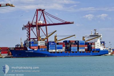
HELLE RITSCHER
Container Ship
Current Trip
| Time Travelled | 2 days |
|---|---|
| Remaining Time | 10 h, 12 mins |
| Distance Travelled | 965.24 nm |
| Remaining Distance | 246.09 nm |
| AVG Speed | 18.8 Knop |
| MAX Speed | 21.5 Knop |
| AVG Wind | 11.4 knots |
| MAX Wind | 17.9 knots |
| MIN Temp | 25.2°C / 77.36°F |
| MAX Temp | 28.3°C / 82.94°F |
| Djupgående | 9.5 m |
| Position mottagen | 2 h, 5 m sen |
Current Position
| Longitud | -83.29583° |
|---|---|
| Latitude | 23.39032° |
| Status | Under way using engine |
| Fart | 21.4 Knop |
| Kurs | 64.2° |
| Område | Gulf of Mexico |
| Station | T-AIS |
| Position mottagen | 2 h, 5 m sen |
Info
Information
The current position of HELLE RITSCHER is in Gulf of Mexico with coordinates 23.39032° / -83.29583° as reported on 2024-04-25 03:34 by AIS to our vessel tracker app. The vessel's current speed is 21.4 Knop and is heading at the port of MIAMI. The estimated time of arrival as calculated by MyShipTracking vessel tracking app is 2024-04-25 15:51 LT
The vessel HELLE RITSCHER (IMO: 9333371, MMSI: 636091030) is a Container Ship that was built in 2006 ( 18 År gammal ). It's sailing under the flag of [LR] Liberia.
In this page you can find informations about the vessels current position, last detected port calls, and current voyage information. If the vessels is not in coverage by AIS you will find the latest position.
The current position of HELLE RITSCHER is detected by our AIS receivers and we are not responsible for the reliability of the data. The last position was recorded while the vessel was in Coverage by the Ais receivers of our vessel tracking app.
The current draught of HELLE RITSCHER as reported by AIS is 9.5 meters
Weather
| Temperature | 25.2°C / 77.36°F |
|---|---|
| Wind Speed | 14 knots |
| Direction | 89° E |
| Pressure | 1019.1 hPa |
| Humidity | 73 % |
| Cloud Coverage | 10 % |
Featured Company
Last Port Calls
| Port | Arrival | Departure | Time In Port |
|---|---|---|---|
| 2024-04-22 11:30 | 2024-04-23 00:28 | 12 h | |
| 2024-04-16 16:32 | 2024-04-17 09:21 | 16 h | |
| 2024-04-10 02:42 | 2024-04-10 17:42 | 15 h | |
| 2024-04-08 04:30 | 2024-04-08 17:59 | 13 h | |
| 2024-04-04 15:36 | 2024-04-05 19:30 | 1 d | |
| 2024-04-01 07:29 | 2024-04-01 23:40 | 16 h | |
| 2024-03-26 20:18 | 2024-03-27 07:25 | 11 h | |
| 2024-03-20 02:30 | 2024-03-20 17:30 | 15 h | |
| 2024-03-14 15:44 | 2024-03-15 19:42 | 1 d | |
| 2024-03-11 13:20 | 2024-03-11 23:39 | 10 h |
Most Visited Ports (Last year)
| Port | Arrivals | |
|---|---|---|
| 36 | ||
| 17 | ||
| 17 | ||
| 4 | ||
| 3 | ||
| 1 |
Last Trips
| Origin | Departure | Destination | Arrival | Distance | |
|---|---|---|---|---|---|
| 2024-04-17 04:21 | 2024-04-22 06:30 | 1554.26 nm | |||
| 2024-04-10 12:42 | 2024-04-16 11:32 | 1806.07 nm | |||
| 2024-04-08 12:59 | 2024-04-09 21:42 | 511.71 nm | |||
| 2024-04-05 15:30 | 2024-04-07 23:30 | 1042.32 nm | |||
| 2024-04-01 18:40 | 2024-04-04 11:36 | 1230.01 nm | |||
| 2024-03-27 02:25 | 2024-04-01 02:29 | 1552.97 nm | |||
| 2024-03-20 12:30 | 2024-03-26 15:18 | 1805.68 nm | |||
| 2024-03-15 15:42 | 2024-03-19 21:30 | 1434.43 nm | |||
| 2024-03-11 18:39 | 2024-03-14 11:44 | 1208.61 nm | |||
| 2024-02-28 06:22 | 2024-03-11 08:20 | 2842.42 nm |
Events
| Tid | Event | Detaljer | Position / Dest | Information |
|---|---|---|---|---|
| 2024-04-25 03:47 | Status ändrad | Default Under way using engine |
23.42384 / -83.22178
USMIA MARINA
|
Fart: 21.4 kn Kurs: 64.2° |
| 2024-04-25 03:34 | UTANFÖR täckningsområde |
23.39032 / -83.29583
Gulf of Mexico
USMIA MARINA
|
Fart: 21.4 kn Kurs: 64.2° |
|
| 2024-04-25 01:40 | Byter havsområde | Cuban part of the Gulf of Mexico Panamanian part of the North Pacific Ocean |
23.10271 / -83.93890
Gulf of Mexico
USMIA MARINA
|
Fart: 20.2 kn Kurs: 63.9° |
| 2024-04-25 01:40 | Status ändrad | Under way using engine Default |
23.10271 / -83.93890
USMIA MARINA
|
Fart: 19.9 kn Kurs: 54° |
| 2024-04-25 01:32 | I täckningsområde |
23.10271 / -83.93890
Gulf of Mexico
USMIA MARINA
|
Fart: 20.2 kn Kurs: 63.9° |
|
| 2024-04-23 00:34 | Status ändrad | Default Under way using engine |
9.37443 / -79.89697
USMIA MARINA
|
Fart: 5.7 kn Kurs: 314° |
| 2024-04-23 00:28 | UTANFÖR täckningsområde |
9.36729 / -79.89101
North Pacific Ocean
USMIA MARINA
|
Fart: 5.7 kn Kurs: 313.9° |
|
| 2024-04-23 00:28 | AVGÅTT HAMN |
|
9.36729 / -79.89101
USMIA MARINA
|
Fart: 6.3 kn Kurs: 321° |
| 2024-04-23 00:25 | STARTAR förflyttning |
9.36324 / -79.88708
[PA] MANZANILLO
|
Fart: 6.3 kn Kurs: 321° |
|
| 2024-04-23 00:14 | Djupgående ändrat | 9.5 10.4 |
9.35824 / -79.88338
[PA] MANZANILLO
|
Fart: 0.1 kn Kurs: 336° |