
ESPERANCE
Cargo
Current Trip
| Trip Time | 3 h, 19 mins |
|---|---|
| Trip Distance | 24.85 nm |
| AVG Speed | 8.5 Knop |
| MAX Speed | 9.5 Knop |
| Djupgående | 1 m |
| AVG Wind | 12.6 knots |
| MAX Wind | 13 knots |
| MIN Temp | 11.3°C / 52.34°F |
| MAX Temp | 12.3°C / 54.14°F |
| Position mottagen | 2 m sen |
Current Position
| Longitud | --- |
|---|---|
| Latitude | --- |
| Status | Moored |
| Fart | |
| Kurs | --- |
| Område | North Sea |
| Station | T-AIS |
| Position mottagen | 2 m sen |
Info
Information
The current position of ESPERANCE is in North Sea with coordinates 52.56586° / 5.90808° as reported on 2025-12-09 23:48 by AIS to our vessel tracker app. The vessel's current speed is 0 Knop and is currently inside the port of KAMPEN.
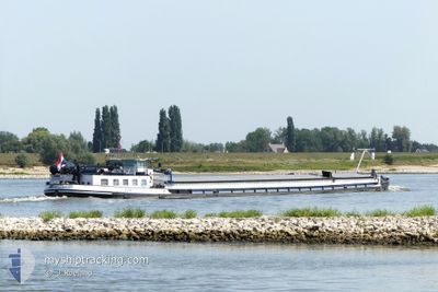
The vessel ESPERANCE (MMSI: 244255003) is a Cargo It's sailing under the flag of [NL] Netherlands.
In this page you can find informations about the vessels current position, last detected port calls, and current voyage information. If the vessels is not in coverage by AIS you will find the latest position.
The current position of ESPERANCE is detected by our AIS receivers and we are not responsible for the reliability of the data. The last position was recorded while the vessel was in Coverage by the Ais receivers of our vessel tracking app.
The current draught of ESPERANCE as reported by AIS is 1 meters
Weather
| Temperature | 11.9°C / 53.42°F |
|---|---|
| Wind Speed | 13 knots |
| Direction | 216° SW |
| Pressure | 1009.5 hPa |
| Humidity | 81.1 % |
| Cloud Coverage | 97 % |
Featured Company
Last Port Calls
| Port | Arrival | Departure | Time In Port |
|---|---|---|---|
| 2025-12-09 19:31 | |||
| 2025-12-08 09:54 | 2025-12-09 16:12 | 1 d | |
| 2025-12-08 07:34 | |||
| 2025-12-01 21:45 | 2025-12-02 07:52 | 10 h | |
| 2025-12-01 14:10 | 2025-12-01 19:27 | 5 h | |
| 2025-12-01 09:12 | 2025-12-01 09:42 | 29 m | |
| 2025-11-30 14:50 | 2025-12-01 08:42 | 17 h | |
| 2025-11-26 12:12 | 2025-11-29 13:06 | 3 d | |
| 2025-11-25 09:19 | 2025-11-26 08:46 | 23 h | |
| 2025-11-23 18:55 | 2025-11-24 10:40 | 15 h |
Most Visited Ports (Last year)
| Port | Arrivals | |
|---|---|---|
| 13 | ||
| 9 | ||
| 7 | ||
| 7 | ||
| 7 | ||
| 6 |
Last Trips
| Origin | Departure | Destination | Arrival | Distance | |
|---|---|---|---|---|---|
| 2025-12-09 16:12 | 2025-12-09 19:31 | 24.85 nm | |||
| 2025-12-08 07:34 | 2025-12-08 09:54 | 6.87 nm | |||
| 2025-12-01 19:27 | 2025-12-01 21:45 | 13.93 nm | |||
| 2025-12-01 09:42 | 2025-12-01 14:10 | 43.69 nm | |||
| 2025-12-01 08:42 | 2025-12-01 09:12 | 2.80 nm | |||
| 2025-11-29 13:06 | 2025-11-30 14:50 | 98.20 nm | |||
| 2025-11-26 08:46 | 2025-11-26 12:12 | 23.04 nm | |||
| 2025-11-24 10:40 | 2025-11-25 09:19 | 50.16 nm | |||
| 2025-11-23 07:00 | 2025-11-23 18:55 | 89.66 nm | |||
| 2025-11-22 22:09 | 2025-11-22 22:14 | 0.28 nm |
Events
| Tid | Event | Detaljer | Position / Dest | Information |
|---|---|---|---|---|
| 2025-12-09 18:51 | Status ändrad | Moored Under way using engine |
52.56584 / 5.90813
[NL] KAMPEN
|
Fart: Kurs: 511° |
| 2025-12-09 18:31 | STOPPAR förflyttning |
52.56591 / 5.90822
[NL] KAMPEN
|
Fart: 0.3 kn Kurs: 511° |
|
| 2025-12-09 18:31 | ANLÄNDER HAMN |
|
52.56593 / 5.90823
[NL] KAMPEN
|
Fart: 0.9 kn Kurs: 511° |
| 2025-12-09 17:17 | Destination ändrad | MERCURIUSHAVEN HAFEN NEUSS HAFENBE |
52.48154 / 6.07222
MERCURIUSHAVEN
|
Fart: 9.4 kn Kurs: 308.7° |
| 2025-12-09 17:17 | ETA ändrat | 2025/12/10 17:42 2026/07/16 12:08 |
52.48154 / 6.07222
MERCURIUSHAVEN
|
Fart: 9.4 kn Kurs: 308.7° |
| 2025-12-09 15:12 | AVGÅTT HAMN |
|
52.27470 / 6.11709
HAFEN NEUSS HAFENBE
|
Fart: 2.8 kn Kurs: 511° |
| 2025-12-09 14:37 | I täckningsområde |
52.24605 / 6.18541
North Sea
[NL] DEVENTER
|
Fart: 2.8 kn Kurs: 252.6° |
|
| 2025-12-09 09:23 | UTANFÖR täckningsområde |
52.24647 / 6.18661
North Sea
[NL] DEVENTER
|
Fart: Kurs: 355.2° |
|
| 2025-12-09 09:23 | I täckningsområde |
52.24647 / 6.18661
North Sea
[NL] DEVENTER
|
Fart: Kurs: 355.2° |
|
| 2025-12-08 10:56 | UTANFÖR täckningsområde |
52.24549 / 6.18835
North Sea
[NL] DEVENTER
|
Fart: Kurs: 120.8° |