
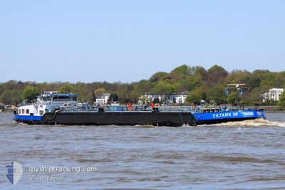
EILTANK 36
Tanker
Current Trip
| Time Travelled | 18 h, 31 mins |
|---|---|
| Remaining Time | 17 h, 23 mins |
| Distance Travelled | 88.00 nm |
| Remaining Distance | 90.51 nm |
| AVG Speed | 4.6 Knop |
| MAX Speed | 5.5 Knop |
| AVG Wind | 2.8 knots |
| MAX Wind | 11.9 knots |
| MIN Temp | 2°C / 35.6°F |
| MAX Temp | 9°C / 48.2°F |
| Djupgående | 2.4 m |
| Position mottagen | 1 m sen |
Current Position
| Longitud | 6.96611° |
|---|---|
| Latitude | 50.99245° |
| Status | Under way using engine |
| Fart | 5.2 Knop |
| Kurs | 153.9° |
| Område | North Sea |
| Station | T-AIS |
| Position mottagen | 1 m sen |
Info
Information
The current position of EILTANK 36 is in North Sea with coordinates 50.99245° / 6.96611° as reported on 2024-04-23 08:15 by AIS to our vessel tracker app. The vessel's current speed is 5.2 Knop and is heading at the port of MILLINGEN AAN DE RIJN. The estimated time of arrival as calculated by MyShipTracking vessel tracking app is 2024-04-24 01:39 LT
The vessel EILTANK 36 (MMSI: 211475070) is a Tanker It's sailing under the flag of [DE] Germany.
In this page you can find informations about the vessels current position, last detected port calls, and current voyage information. If the vessels is not in coverage by AIS you will find the latest position.
The current position of EILTANK 36 is detected by our AIS receivers and we are not responsible for the reliability of the data. The last position was recorded while the vessel was in Coverage by the Ais receivers of our vessel tracking app.
The current draught of EILTANK 36 as reported by AIS is 2.4 meters
Weather
| Temperature | 6.9°C / 44.42°F |
|---|---|
| Wind Speed | 1 knots |
| Direction | 208° SSW |
| Pressure | 1021.4 hPa |
| Humidity | 44.1 % |
| Cloud Coverage | 43 % |
Featured Company
Last Port Calls
| Port | Arrival | Departure | Time In Port |
|---|---|---|---|
| 2024-04-22 13:01 | 2024-04-22 13:45 | 43 m | |
| 2024-04-21 21:23 | 2024-04-21 21:39 | 16 m | |
| 2024-04-21 10:05 | 2024-04-21 19:20 | 9 h | |
| 2024-04-21 07:48 | 2024-04-21 08:11 | 22 m | |
| 2024-04-20 19:43 | 2024-04-20 20:24 | 40 m | |
| 2024-04-17 04:36 | 2024-04-17 12:08 | 7 h | |
| 2024-04-16 05:05 | 2024-04-16 06:04 | 58 m | |
| 2024-04-14 03:49 | 2024-04-14 04:58 | 1 h | |
| 2024-04-12 19:51 | 2024-04-13 23:07 | 1 d | |
| 2024-04-12 13:02 | 2024-04-12 13:58 | 56 m |
Last Trips
| Origin | Departure | Destination | Arrival | Distance | |
|---|---|---|---|---|---|
| 2024-04-21 23:39 | 2024-04-22 15:01 | 101.37 nm | |||
| 2024-04-21 21:20 | 2024-04-21 23:23 | 18.30 nm | |||
| 2024-04-21 10:11 | 2024-04-21 12:05 | 17.18 nm | |||
| 2024-04-20 22:24 | 2024-04-21 09:48 | 101.88 nm | |||
| 2024-04-17 14:08 | 2024-04-20 21:43 | 420.93 nm | |||
| 2024-04-16 08:04 | 2024-04-17 06:36 | 48.66 nm | |||
| 2024-04-14 06:58 | 2024-04-16 07:05 | 213.35 nm | |||
| 2024-04-14 01:07 | 2024-04-14 05:49 | 43.11 nm | |||
| 2024-04-12 15:58 | 2024-04-12 21:51 | 36.68 nm | |||
| 2024-04-09 08:01 | 2024-04-12 15:02 | 223.17 nm |
Events
| Tid | Event | Detaljer | Position / Dest | Information |
|---|---|---|---|---|
| 2024-04-22 20:46 | Status ändrad | Under way using engine Default |
51.54670 / 6.67651
SPEYER
|
Fart: 4 kn Kurs: -1° |
| 2024-04-22 20:39 | Status ändrad | Default Under way using engine |
51.55333 / 6.68167
SPEYER
|
Fart: 4.7 kn Kurs: 138.9° |
| 2024-04-22 20:09 | Status ändrad | Under way using engine Default |
51.57637 / 6.65063
SPEYER
|
Fart: 4 kn Kurs: -1° |
| 2024-04-22 19:57 | I täckningsområde |
51.57637 / 6.65063
North Sea
SPEYER
|
Fart: 4.7 kn Kurs: 70.7° |
|
| 2024-04-22 14:30 | Status ändrad | Default Under way using engine |
51.82667 / 6.20667
SPEYER
|
Fart: 5 kn Kurs: 117.2° |
| 2024-04-22 14:11 | UTANFÖR täckningsområde |
51.83846 / 6.17072
North Sea
SPEYER
|
Fart: 5 kn Kurs: 117.2° |
|
| 2024-04-22 13:45 | AVGÅTT HAMN |
|
51.84844 / 6.11456
SPEYER
|
Fart: 5.2 kn Kurs: 105° |
| 2024-04-22 13:43 | STARTAR förflyttning |
51.84906 / 6.10969
[NL] TOLKAMER
|
Fart: 4.7 kn Kurs: 99.9° |
|
| 2024-04-22 13:41 | Status ändrad | Under way using engine Moored |
51.84955 / 6.10680
[NL] TOLKAMER
|
Fart: 0.7 kn Kurs: 511° |
| 2024-04-22 13:02 | Status ändrad | Moored Under way using engine |
51.84965 / 6.10675
[NL] TOLKAMER
|
Fart: 0.2 kn Kurs: 511° |