
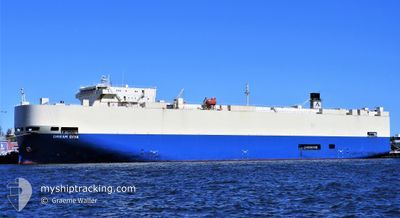
DREAM DIVA
Vehicles Carrier
Current Trip
| Time Travelled | 18 days |
|---|---|
| Remaining Time | --- |
| Distance Travelled | 6565.57 nm |
| Remaining Distance | --- |
| AVG Speed | 14.1 Knop |
| MAX Speed | 18.7 Knop |
| AVG Wind | 11.5 knots |
| MAX Wind | 28.5 knots |
| MIN Temp | 14.8°C / 58.64°F |
| MAX Temp | 31.6°C / 88.88°F |
| Djupgående | 8.4 m |
| Position mottagen | 6 h, 46 m sen |
Current Position
| Longitud | 17.94342° |
|---|---|
| Latitude | -34.38973° |
| Status | Under way using engine |
| Fart | 14.8 Knop |
| Kurs | 301.3° |
| Område | South Atlantic Ocean |
| Station | T-AIS |
| Position mottagen | 6 h, 46 m sen |
Info
Information
The current position of DREAM DIVA is in South Atlantic Ocean with coordinates -34.38973° / 17.94342° as reported on 2024-04-23 11:09 by AIS to our vessel tracker app. The vessel's current speed is 14.8 Knop and is heading at the port of ALGECIRAS. The estimated time of arrival as calculated by MyShipTracking vessel tracking app is 2024-05-07 19:30 LT
The vessel DREAM DIVA (IMO: 9325790, MMSI: 372856000) is a Vehicles Carrier that was built in 2007 ( 17 År gammal ). It's sailing under the flag of [PA] Panama.
In this page you can find informations about the vessels current position, last detected port calls, and current voyage information. If the vessels is not in coverage by AIS you will find the latest position.
The current position of DREAM DIVA is detected by our AIS receivers and we are not responsible for the reliability of the data. The last position was recorded while the vessel was in Coverage by the Ais receivers of our vessel tracking app.
The current draught of DREAM DIVA as reported by AIS is 8.4 meters
Weather
| Temperature | 17.9°C / 64.22°F |
|---|---|
| Wind Speed | 4 knots |
| Direction | 233° SW |
| Pressure | 1017.1 hPa |
| Humidity | 87.6 % |
| Cloud Coverage | 100 % |
Featured Company
Most Visited Ports (Last year)
| Port | Arrivals | |
|---|---|---|
| 4 | ||
| 3 | ||
| 2 | ||
| 2 | ||
| 2 | ||
| 2 |
Events
| Tid | Event | Detaljer | Position / Dest | Information |
|---|---|---|---|---|
| 2024-04-23 11:14 | Status ändrad | Default Under way using engine |
-34.37833 / 17.92167
ES ALG
|
Fart: 14.8 kn Kurs: 301.3° |
| 2024-04-23 11:09 | Status ändrad | Under way using engine Default |
-34.38973 / 17.94342
ES ALG
|
Fart: 14 kn Kurs: 299° |
| 2024-04-23 11:09 | UTANFÖR täckningsområde |
-34.38973 / 17.94342
South Atlantic Ocean
ES ALG
|
Fart: 14.8 kn Kurs: 301.3° |
|
| 2024-04-23 10:53 | Status ändrad | Default Under way using engine |
-34.42240 / 18.01052
ES ALG
|
Fart: 15 kn Kurs: 300.8° |
| 2024-04-23 10:45 | Status ändrad | Under way using engine Default |
-34.43968 / 18.04479
ES ALG
|
Fart: 15.2 kn Kurs: 302° |
| 2024-04-23 10:42 | Status ändrad | Default Under way using engine |
-34.44644 / 18.05828
ES ALG
|
Fart: 15.2 kn Kurs: 300.4° |
| 2024-04-23 08:39 | Destination ändrad | ES ALG IL HFA |
-34.65661 / 18.60885
ES ALG
|
Fart: 14.5 kn Kurs: 287.3° |
| 2024-04-23 08:39 | ETA ändrat | 2024/05/07 19:30 2024/05/12 17:00 |
-34.65661 / 18.60885
ES ALG
|
Fart: 14.5 kn Kurs: 287.3° |
| 2024-04-23 08:34 | Status ändrad | Under way using engine Default |
-34.66177 / 18.62935
IL HFA
|
Fart: 14.5 kn Kurs: 287° |
| 2024-04-23 07:25 | UTANFÖR täckningsområde |
-34.73825 / 18.95350
South Atlantic Ocean
IL HFA
|
Fart: 14.7 kn Kurs: 283.7° |