
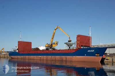
DOLFIJN
General Cargo
Current Trip
| Trip Time | 1 day |
|---|---|
| Trip Distance | 247.49 nm |
| AVG Speed | 8.9 Knop |
| MAX Speed | 10.2 Knop |
| Djupgående | 3.2 m |
| AVG Wind | 8.7 knots |
| MAX Wind | 14.6 knots |
| MIN Temp | -0.6°C / 30.92°F |
| MAX Temp | 5.9°C / 42.62°F |
| Position mottagen | 1 d sen |
Current Position
| Longitud | 19.93677° |
|---|---|
| Latitude | 54.63381° |
| Status | Under way using engine |
| Fart | 8.5 Knop |
| Kurs | 81.5° |
| Område | Baltic Sea |
| Station | T-AIS |
| Position mottagen | 1 d sen |
Info
Information
The current position of DOLFIJN is in Baltic Sea with coordinates 54.63381° / 19.93677° as reported on 2024-04-24 01:45 by AIS to our vessel tracker app. The vessel's current speed is 8.5 Knop and is currently inside the port of SVETLY.
The vessel DOLFIJN (IMO: 8815786, MMSI: 305198000) is a General Cargo that was built in 1989 ( 35 År gammal ). It's sailing under the flag of [AG] Antigua Barbuda.
In this page you can find informations about the vessels current position, last detected port calls, and current voyage information. If the vessels is not in coverage by AIS you will find the latest position.
The current position of DOLFIJN is detected by our AIS receivers and we are not responsible for the reliability of the data. The last position was recorded while the vessel was in Coverage by the Ais receivers of our vessel tracking app.
The current draught of DOLFIJN as reported by AIS is 3.2 meters
Weather
| Temperature | 5.1°C / 41.18°F |
|---|---|
| Wind Speed | 7 knots |
| Direction | 340° NNW |
| Pressure | 1004.6 hPa |
| Humidity | 94.2 % |
| Cloud Coverage | 100 % |
Featured Company
Last Port Calls
| Port | Arrival | Departure | Time In Port |
|---|---|---|---|
| 2024-04-24 03:20 | |||
| 2024-04-19 11:43 | 2024-04-22 19:24 | 3 d | |
| 2024-04-17 06:19 | 2024-04-18 11:07 | 1 d | |
| 2024-04-15 04:06 | 2024-04-16 06:06 | 1 d | |
| 2024-04-12 18:02 | 2024-04-13 22:38 | 1 d | |
| 2024-04-02 04:13 | 2024-04-03 08:11 | 1 d | |
| 2024-03-28 18:39 | 2024-03-29 15:51 | 21 h | |
| 2024-03-26 20:49 | 2024-03-28 09:23 | 1 d | |
| 2024-03-22 13:25 | 2024-03-25 18:38 | 3 d | |
| 2024-03-18 18:27 | 2024-03-21 01:31 | 2 d |
Most Visited Ports (Last year)
| Port | Arrivals | |
|---|---|---|
| 7 | ||
| 5 | ||
| 5 | ||
| 5 | ||
| 5 | ||
| 5 |
Last Trips
| Origin | Departure | Destination | Arrival | Distance | |
|---|---|---|---|---|---|
| 2024-04-22 21:24 | 2024-04-24 05:20 | 247.49 nm | |||
| 2024-04-18 13:07 | 2024-04-19 13:43 | 222.62 nm | |||
| 2024-04-16 08:06 | 2024-04-17 08:19 | 213.44 nm | |||
| 2024-04-14 00:38 | 2024-04-15 06:06 | 217.60 nm | |||
| 2024-04-03 10:11 | 2024-04-12 20:02 | 247.23 nm | |||
| 2024-03-29 16:51 | 2024-04-02 06:13 | 82.18 nm | |||
| 2024-03-28 10:23 | 2024-03-28 19:39 | 78.33 nm | |||
| 2024-03-25 19:38 | 2024-03-26 21:49 | 235.61 nm | |||
| 2024-03-21 02:31 | 2024-03-22 14:25 | 364.68 nm | |||
| 2024-03-11 17:05 | 2024-03-18 19:27 | 783.43 nm |
Events
| Tid | Event | Detaljer | Position / Dest | Information |
|---|---|---|---|---|
| 2024-04-24 03:20 | STOPPAR förflyttning |
54.69132 / 20.19963
[RU] SVETLY
|
Fart: Kurs: 107° |
|
| 2024-04-24 03:20 | ANLÄNDER HAMN |
|
54.69132 / 20.19963
[RU] SVETLY
|
Fart: 2.2 kn Kurs: 53° |
| 2024-04-24 02:04 | Status ändrad | Default Under way using engine |
54.64002 / 20.01714
RU KGD
|
Fart: 8.5 kn Kurs: 81.5° |
| 2024-04-24 01:45 | UTANFÖR täckningsområde |
54.63381 / 19.93677
Baltic Sea
RU KGD
|
Fart: 8.5 kn Kurs: 81.5° |
|
| 2024-04-24 00:55 | STARTAR förflyttning | 3.29 nm, North West of BALTIYSK |
54.66121 / 19.82221
RU KGD
|
Fart: 4.1 kn Kurs: 38° |
| 2024-04-24 00:45 | Status ändrad | Under way using engine Default |
54.64804 / 19.82829
RU KGD
|
Fart: Kurs: -1° |
| 2024-04-23 23:48 | Status ändrad | Default At anchor |
54.64887 / 19.82949
RU KGD
|
Fart: 0.2 kn Kurs: 171° |
| 2024-04-23 23:45 | I täckningsområde |
54.64891 / 19.82910
Baltic Sea
RU KGD
|
Fart: 0.2 kn Kurs: 88.6° |
|
| 2024-04-23 19:15 | STOPPAR förflyttning | 2.77 nm, West of BALTIYSK |
54.64834 / 19.82833
RU KGD
|
Fart: Kurs: -1° |
| 2024-04-23 17:42 | UTANFÖR täckningsområde |
54.74729 / 19.60091
Baltic Sea
RU KGD
|
Fart: 9.9 kn Kurs: 113.6° |