
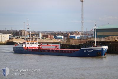
CM COAST
General Cargo
Current Trip
| Time Travelled | 2 days |
|---|---|
| Remaining Time | --- |
| Distance Travelled | 402.56 nm |
| Remaining Distance | --- |
| AVG Speed | 6.8 Knop |
| MAX Speed | 10.7 Knop |
| AVG Wind | 9.1 knots |
| MAX Wind | 17.5 knots |
| MIN Temp | 4.5°C / 40.1°F |
| MAX Temp | 10.6°C / 51.08°F |
| Djupgående | 3.3 m |
| Position mottagen | Nu |
Current Position
| Longitud | -3.73540° |
|---|---|
| Latitude | 50.07904° |
| Status | Under way using engine |
| Fart | 8.2 Knop |
| Kurs | 78.5° |
| Område | English Channel |
| Station | T-AIS |
| Position mottagen | Nu |
Info
Information
The current position of CM COAST is in English Channel with coordinates 50.07904° / -3.73540° as reported on 2024-04-25 16:10 by AIS to our vessel tracker app. The vessel's current speed is 8.2 Knop and is heading at the port of WHITSTABLE. The estimated time of arrival as calculated by MyShipTracking vessel tracking app is 2024-04-27 08:00 LT
The vessel CM COAST (IMO: 8418019, MMSI: 636021860) is a General Cargo that was built in 1985 ( 39 År gammal ). It's sailing under the flag of [LR] Liberia.
In this page you can find informations about the vessels current position, last detected port calls, and current voyage information. If the vessels is not in coverage by AIS you will find the latest position.
The current position of CM COAST is detected by our AIS receivers and we are not responsible for the reliability of the data. The last position was recorded while the vessel was in Coverage by the Ais receivers of our vessel tracking app.
The current draught of CM COAST as reported by AIS is 3.3 meters
Weather
| Temperature | 10.6°C / 51.08°F |
|---|---|
| Wind Speed | 16 knots |
| Direction | 248° WSW |
| Pressure | 1003.3 hPa |
| Humidity | 84.2 % |
| Cloud Coverage | 97 % |
Featured Company
Last Port Calls
| Port | Arrival | Departure | Time In Port |
|---|---|---|---|
| 2024-04-22 23:38 | 2024-04-23 10:30 | 10 h | |
| 2024-04-20 07:50 | 2024-04-20 20:14 | 12 h | |
| 2024-04-17 07:15 | 2024-04-18 17:44 | 1 d | |
| 2024-04-10 16:17 | 2024-04-11 18:59 | 1 d | |
| 2024-04-08 22:12 | 2024-04-10 02:20 | 1 d | |
| 2024-04-02 05:23 | 2024-04-02 14:59 | 9 h | |
| 2024-03-25 06:16 | 2024-03-25 17:15 | 10 h | |
| 2024-03-20 16:20 | 2024-03-21 20:30 | 1 d | |
| 2024-03-13 09:20 | 2024-03-17 19:03 | 4 d | |
| 2024-03-07 17:36 | 2024-03-08 18:52 | 1 d |
Last Trips
| Origin | Departure | Destination | Arrival | Distance | |
|---|---|---|---|---|---|
| 2024-04-20 21:14 | 2024-04-23 00:38 | 86.43 nm | |||
| 2024-04-18 18:44 | 2024-04-20 08:50 | 207.76 nm | |||
| 2024-04-11 20:59 | 2024-04-17 08:15 | 869.85 nm | |||
| 2024-04-10 04:20 | 2024-04-10 18:17 | 133.83 nm | |||
| 2024-04-02 15:59 | 2024-04-09 00:12 | 974.34 nm | |||
| 2024-03-25 17:15 | 2024-04-02 06:23 | 1092.13 nm | |||
| 2024-03-21 21:30 | 2024-03-25 06:16 | 319.10 nm | |||
| 2024-03-17 19:03 | 2024-03-20 17:20 | 535.20 nm | |||
| 2024-03-08 19:52 | 2024-03-13 09:20 | 686.83 nm | |||
| 2024-03-04 19:09 | 2024-03-07 18:36 | 537.32 nm |
Events
| Tid | Event | Detaljer | Position / Dest | Information |
|---|---|---|---|---|
| 2024-04-25 15:58 | Status ändrad | Under way using engine Default |
50.07296 / -3.77796
GB WTS
|
Fart: 7.9 kn Kurs: 76° |
| 2024-04-25 15:55 | Status ändrad | Default Under way using engine |
50.07111 / -3.78857
GB WTS
|
Fart: 7.8 kn Kurs: 74.6° |
| 2024-04-25 14:31 | Destination ändrad | GB WTS WHITSTABLE |
50.02247 / -4.05749
GB WTS
|
Fart: 7.5 kn Kurs: 73.5° |
| 2024-04-25 11:29 | Byter havsområde | United Kingdom part of the English Channel Irish part of the Celtic Sea |
49.91920 / -4.62761
English Channel
WHITSTABLE
|
Fart: 7.5 kn Kurs: 73.4° |
| 2024-04-25 11:29 | Status ändrad | Under way using engine Default |
49.91920 / -4.62761
WHITSTABLE
|
Fart: 7.4 kn Kurs: 73° |
| 2024-04-25 11:29 | I täckningsområde |
49.91920 / -4.62761
English Channel
WHITSTABLE
|
Fart: 7.5 kn Kurs: 73.4° |
|
| 2024-04-24 13:54 | Status ändrad | Default Under way using engine |
51.98034 / -6.21383
WHITSTABLE
|
Fart: 9.9 kn Kurs: 198.1° |
| 2024-04-24 13:12 | UTANFÖR täckningsområde |
52.09374 / -6.22865
Celtic Sea
WHITSTABLE
|
Fart: 9.9 kn Kurs: 198.1° |
|
| 2024-04-24 12:58 | Byter havsområde | Irish part of the Celtic Sea Irish part of the Irish Sea and St. George's Channel |
52.12276 / -6.18122
Celtic Sea
WHITSTABLE
|
Fart: 10.7 kn Kurs: 227.6° |
| 2024-04-24 11:03 | Status ändrad | Under way using engine Default |
52.40473 / -6.00790
WHITSTABLE
|
Fart: 7.5 kn Kurs: 192° |