
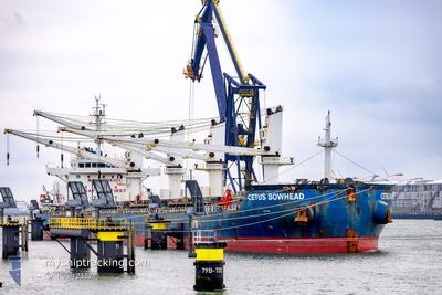
CETUS BOWHEAD
Cargo
Current Trip
| Time Travelled | 9 h, 58 mins |
|---|---|
| Remaining Time | --- |
| Distance Travelled | 104.33 nm |
| Remaining Distance | --- |
| AVG Speed | 10.6 Knop |
| MAX Speed | 11.3 Knop |
| AVG Wind | 10.6 knots |
| MAX Wind | 18 knots |
| MIN Temp | 8.9°C / 48.02°F |
| MAX Temp | 14.6°C / 58.28°F |
| Djupgående | 10.4 m |
| Position mottagen | 1 m sen |
Current Position
| Longitud | --- |
|---|---|
| Latitude | --- |
| Status | Under way using engine |
| Fart | 10.8 Knop |
| Kurs | 226.3° |
| Område | Aegean Sea |
| Station | T-AIS |
| Position mottagen | 1 m sen |
Info
Information
The current position of CETUS BOWHEAD is in Aegean Sea with coordinates 38.19264° / 24.88506° as reported on 2025-02-27 02:55 by AIS to our vessel tracker app. The vessel's current speed is 10.8 Knop and is heading at the port of HOUSTON. The estimated time of arrival as calculated by MyShipTracking vessel tracking app is 2025-03-24 12:00 LT
The vessel CETUS BOWHEAD (IMO: 9670755, MMSI: 538010821) is a Cargo It's sailing under the flag of [MH] Marshall Is.
In this page you can find informations about the vessels current position, last detected port calls, and current voyage information. If the vessels is not in coverage by AIS you will find the latest position.
The current position of CETUS BOWHEAD is detected by our AIS receivers and we are not responsible for the reliability of the data. The last position was recorded while the vessel was in Coverage by the Ais receivers of our vessel tracking app.
The current draught of CETUS BOWHEAD as reported by AIS is 10.4 meters
Weather
| Temperature | 14.3°C / 57.74°F |
|---|---|
| Wind Speed | 7 knots |
| Direction | 175° S |
| Pressure | 1020.1 hPa |
| Humidity | 73 % |
| Cloud Coverage | 100 % |
Featured Company
Last Port Calls
| Port | Arrival | Departure | Time In Port |
|---|---|---|---|
| 2025-02-19 08:02 | 2025-02-26 16:58 | 7 d | |
| 2025-02-10 06:17 | 2025-02-15 15:09 | 5 d | |
| 2025-01-25 02:00 | 2025-01-28 15:53 | 3 d | |
| 2025-01-23 05:37 | 2025-01-24 21:53 | 1 d | |
| 2025-01-20 15:51 | 2025-01-23 04:34 | 2 d | |
| 2025-01-12 05:27 | 2025-01-18 09:14 | 6 d |
Last Trips
| Origin | Departure | Destination | Arrival | Distance | |
|---|---|---|---|---|---|
| 2025-02-15 18:09 | 2025-02-19 11:02 | 232.86 nm | |||
| 2025-01-28 16:53 | 2025-02-10 09:17 | 3116.22 nm | |||
| 2025-01-24 22:53 | 2025-01-25 03:00 | 30.95 nm | |||
| 2025-01-23 05:34 | 2025-01-23 06:37 | 5.89 nm | |||
| 2025-01-18 09:14 | 2025-01-20 16:51 | 642.91 nm | |||
| 2024-11-30 19:27 | 2025-01-12 05:27 | 11405.72 nm |
Events
| Tid | Event | Detaljer | Position / Dest | Information |
|---|---|---|---|---|
| 2025-02-26 23:33 | Status ändrad | Under way using engine Default |
38.60128 / 25.42532
HOUSTON
|
Fart: 10.2 kn Kurs: 236° |
| 2025-02-26 22:43 | Status ändrad | Default Under way using engine |
38.66906 / 25.58739
HOUSTON
|
Fart: 10.8 kn Kurs: 263.2° |
| 2025-02-26 22:18 | Status ändrad | Under way using engine Default |
38.68174 / 25.68211
HOUSTON
|
Fart: 10.9 kn Kurs: 260° |
| 2025-02-26 22:18 | I täckningsområde |
38.68147 / 25.68007
Aegean Sea
HOUSTON
|
Fart: 10.9 kn Kurs: 260.5° |
|
| 2025-02-26 21:42 | Status ändrad | Default Under way using engine |
38.70130 / 25.82128
HOUSTON
|
Fart: 11.1 kn Kurs: 259° |
| 2025-02-26 20:55 | Status ändrad | Under way using engine Default |
38.73331 / 26.00483
HOUSTON
|
Fart: 11.3 kn Kurs: 262° |
| 2025-02-26 20:55 | UTANFÖR täckningsområde |
38.73331 / 26.00483
Aegean Sea
HOUSTON
|
Fart: 11.1 kn Kurs: 259° |
|
| 2025-02-26 20:41 | Status ändrad | Default Under way using engine |
38.74147 / 26.05994
HOUSTON
|
Fart: 11.3 kn Kurs: 260.9° |
| 2025-02-26 20:20 | Djupgående ändrat | 10.4 6.7 |
38.75239 / 26.14616
HOUSTON
|
Fart: 11.1 kn Kurs: 260.5° |
| 2025-02-26 20:20 | Destination ändrad | HOUSTON ALIAGA |
38.75239 / 26.14616
HOUSTON
|
Fart: 11.1 kn Kurs: 260.5° |