
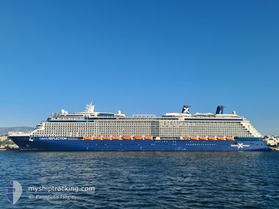
CELEBRITY REFLECTION
Passengers Ship
Current Trip
| Time Travelled | 2 days |
|---|---|
| Remaining Time | 7 h, 1 mins |
| Distance Travelled | 668.35 nm |
| Remaining Distance | 117.72 nm |
| AVG Speed | 12.4 Knop |
| MAX Speed | 20.7 Knop |
| AVG Wind | 14.1 knots |
| MAX Wind | 19.9 knots |
| MIN Temp | 23.1°C / 73.58°F |
| MAX Temp | 26°C / 78.8°F |
| Djupgående | 8.6 m |
| Position mottagen | 3 m sen |
Current Position
| Longitud | -85.45570° |
|---|---|
| Latitude | 21.78930° |
| Status | Under way using engine |
| Fart | 16.5 Knop |
| Kurs | 215.3° |
| Område | Gulf of Mexico |
| Station | T-AIS |
| Position mottagen | 3 m sen |
Info
Information
The current position of CELEBRITY REFLECTION is in Gulf of Mexico with coordinates 21.78930° / -85.45570° as reported on 2024-04-24 04:09 by AIS to our vessel tracker app. The vessel's current speed is 16.5 Knop and is heading at the port of COZUMEL. The estimated time of arrival as calculated by MyShipTracking vessel tracking app is 2024-04-24 11:13 LT
The vessel CELEBRITY REFLECTION (IMO: 9506459, MMSI: 229074000) is a Passengers Ship that was built in 2012 ( 12 År gammal ). It's sailing under the flag of [MT] Malta.
In this page you can find informations about the vessels current position, last detected port calls, and current voyage information. If the vessels is not in coverage by AIS you will find the latest position.
The current position of CELEBRITY REFLECTION is detected by our AIS receivers and we are not responsible for the reliability of the data. The last position was recorded while the vessel was in Coverage by the Ais receivers of our vessel tracking app.
The current draught of CELEBRITY REFLECTION as reported by AIS is 8.6 meters
Weather
| Temperature | 25.9°C / 78.62°F |
|---|---|
| Wind Speed | 10 knots |
| Direction | 48° NE |
| Pressure | 1018.2 hPa |
| Humidity | 73 % |
| Cloud Coverage | --- |
Featured Company
Last Port Calls
| Port | Arrival | Departure | Time In Port |
|---|---|---|---|
| 2024-04-21 10:27 | 2024-04-21 19:55 | 9 h | |
| 2024-04-19 15:32 | 2024-04-19 21:23 | 5 h | |
| 2024-04-18 10:48 | 2024-04-18 18:20 | 7 h | |
| 2024-04-17 11:20 | 2024-04-17 21:52 | 10 h | |
| 2024-04-15 19:41 | 2024-04-16 03:38 | 7 h | |
| 2024-04-13 08:53 | 2024-04-13 20:30 | 11 h | |
| 2024-04-13 08:37 | |||
| 2024-04-10 15:27 | 2024-04-10 23:56 | 8 h | |
| 2024-04-07 09:05 | 2024-04-07 20:31 | 11 h | |
| 2024-04-07 08:38 | 2024-04-07 08:59 | 21 m |
Most Visited Ports (Last year)
| Port | Arrivals | |
|---|---|---|
| 25 | ||
| 15 | ||
| 13 | ||
| 12 | ||
| 12 | ||
| 12 |
Last Trips
| Origin | Departure | Destination | Arrival | Distance | |
|---|---|---|---|---|---|
| 2024-04-19 17:23 | 2024-04-21 06:27 | 675.45 nm | |||
| 2024-04-18 14:20 | 2024-04-19 11:32 | 374.51 nm | |||
| 2024-04-17 17:52 | 2024-04-18 06:48 | 94.58 nm | |||
| 2024-04-15 23:38 | 2024-04-17 07:20 | 195.23 nm | |||
| 2024-04-13 16:30 | 2024-04-15 15:41 | 925.08 nm | |||
| 2024-04-10 18:56 | 2024-04-13 04:53 | 621.27 nm | |||
| 2024-04-10 18:56 | 2024-04-13 04:37 | 620.70 nm | |||
| 2024-04-07 16:31 | 2024-04-10 10:27 | 1008.15 nm | |||
| 2024-04-07 04:59 | 2024-04-07 05:05 | 0.08 nm | |||
| 2024-04-03 20:11 | 2024-04-07 04:38 | 1248.73 nm |
Events
| Tid | Event | Detaljer | Position / Dest | Information |
|---|---|---|---|---|
| 2024-04-24 04:09 | Byter havsområde | Cuban part of the Caribbean Sea Cuban part of the Gulf of Mexico |
21.78930 / -85.45570
Caribbean Sea
MX CZM
|
Fart: 16.5 kn Kurs: 215.3° |
| 2024-04-24 01:44 | Byter havsområde | Cuban part of the Gulf of Mexico United States part of the North Atlantic Ocean |
22.25941 / -84.95244
Gulf of Mexico
MX CZM
|
Fart: 16.6 kn Kurs: 231° |
| 2024-04-24 01:41 | Status ändrad | Under way using engine Default |
22.26579 / -84.94392
MX CZM
|
Fart: 16.7 kn Kurs: 231° |
| 2024-04-24 01:41 | I täckningsområde |
22.25941 / -84.95244
Gulf of Mexico
MX CZM
|
Fart: 16.6 kn Kurs: 231° |
|
| 2024-04-23 05:39 | Status ändrad | Default Under way using engine |
25.06115 / -80.14782
MX CZM
|
Fart: 18.4 kn Kurs: 212.3° |
| 2024-04-23 05:27 | UTANFÖR täckningsområde |
25.11310 / -80.11078
North Atlantic Ocean
MX CZM
|
Fart: 18.4 kn Kurs: 212.3° |
|
| 2024-04-23 03:29 | Byter havsområde | United States part of the North Atlantic Ocean Bahamas part of the North Atlantic Ocean |
25.57960 / -79.71518
North Atlantic Ocean
MX CZM
|
Fart: 17.3 kn Kurs: 218.2° |
| 2024-04-23 01:51 | Djupgående ändrat | 8.6 8 |
25.94798 / -79.40546
MX CZM
|
Fart: 17.3 kn Kurs: 215.2° |
| 2024-04-23 01:51 | Destination ändrad | MX CZM BS COC |
25.94798 / -79.40546
MX CZM
|
Fart: 17.3 kn Kurs: 215.2° |
| 2024-04-23 01:51 | ETA ändrat | 2024/04/24 11:15 |
25.94798 / -79.40546
MX CZM
|
Fart: 17.3 kn Kurs: 215.2° |