
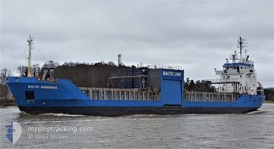
BALTIC MADONNA
General Cargo
Current Trip
| Time Travelled | 1 day |
|---|---|
| Remaining Time | 1 day |
| Distance Travelled | 314.61 nm |
| Remaining Distance | 452.91 nm |
| AVG Speed | 9.7 Knop |
| MAX Speed | 12.7 Knop |
| AVG Wind | 15.7 knots |
| MAX Wind | 28.2 knots |
| MIN Temp | -10.5°C / 13.1°F |
| MAX Temp | 7.6°C / 45.68°F |
| Djupgående | 5.3 m |
| Position mottagen | 1 m sen |
Current Position
| Longitud | 4.64910° |
|---|---|
| Latitude | 59.65561° |
| Status | Under way using engine |
| Fart | 11.6 Knop |
| Kurs | 177.1° |
| Område | North Sea |
| Station | T-AIS |
| Position mottagen | 1 m sen |
Info
Information
The current position of BALTIC MADONNA is in North Sea with coordinates 59.65561° / 4.64910° as reported on 2024-04-25 00:33 by AIS to our vessel tracker app. The vessel's current speed is 11.6 Knop and is heading at the port of NYBORG. The estimated time of arrival as calculated by MyShipTracking vessel tracking app is 2024-04-26 14:57 LT
The vessel BALTIC MADONNA (IMO: 9100138, MMSI: 230666000) is a General Cargo that was built in 1994 ( 30 År gammal ). It's sailing under the flag of [FI] Finland.
In this page you can find informations about the vessels current position, last detected port calls, and current voyage information. If the vessels is not in coverage by AIS you will find the latest position.
The current position of BALTIC MADONNA is detected by our AIS receivers and we are not responsible for the reliability of the data. The last position was recorded while the vessel was in Coverage by the Ais receivers of our vessel tracking app.
The current draught of BALTIC MADONNA as reported by AIS is 5.3 meters
Weather
| Temperature | 4.3°C / 39.74°F |
|---|---|
| Wind Speed | 6 knots |
| Direction | 27° NNE |
| Pressure | 1004.9 hPa |
| Humidity | 70.2 % |
| Cloud Coverage | 73 % |
Featured Company
Last Port Calls
| Port | Arrival | Departure | Time In Port |
|---|---|---|---|
| 2024-04-23 03:57 | 2024-04-23 11:06 | 7 h | |
| 2024-04-22 08:21 | 2024-04-22 12:22 | 4 h | |
| 2024-04-18 11:41 | 2024-04-19 15:01 | 1 d | |
| 2024-04-16 15:20 | 2024-04-17 09:48 | 18 h | |
| 2024-04-12 17:22 | 2024-04-13 07:17 | 13 h | |
| 2024-04-12 15:34 | 2024-04-12 17:11 | 1 h | |
| 2024-04-08 03:04 | 2024-04-09 21:11 | 1 d | |
| 2024-04-03 05:56 | 2024-04-05 13:24 | 2 d | |
| 2024-03-29 17:30 | 2024-04-02 09:39 | 3 d | |
| 2024-03-24 17:23 | 2024-03-25 15:42 | 22 h |
Last Trips
| Origin | Departure | Destination | Arrival | Distance | |
|---|---|---|---|---|---|
| 2024-04-22 14:22 | 2024-04-23 05:57 | 147.85 nm | |||
| 2024-04-19 18:01 | 2024-04-22 10:21 | 742.27 nm | |||
| 2024-04-17 12:48 | 2024-04-18 14:41 | 304.82 nm | |||
| 2024-04-13 09:17 | 2024-04-16 18:20 | 630.43 nm | |||
| 2024-04-12 19:11 | 2024-04-12 19:22 | 1.33 nm | |||
| 2024-04-10 00:11 | 2024-04-12 17:34 | 743.32 nm | |||
| 2024-04-05 15:24 | 2024-04-08 06:04 | 590.88 nm | |||
| 2024-04-02 11:39 | 2024-04-03 07:56 | 179.45 nm | |||
| 2024-03-25 16:42 | 2024-03-29 18:30 | 496.06 nm | |||
| 2024-03-22 15:35 | 2024-03-24 18:23 | 204.27 nm |
Events
| Tid | Event | Detaljer | Position / Dest | Information |
|---|---|---|---|---|
| 2024-04-24 16:30 | Byter havsområde | Norwegian part of the North Sea Norwegian part of the Norwegian Sea |
60.99829 / 4.91451
North Sea
NYBORG
|
Fart: 11.4 kn Kurs: 170.6° |
| 2024-04-24 11:59 | STARTAR förflyttning | 14.77 nm, North West of GUDVANGEN |
61.09392 / 6.58881
NYBORG
|
Fart: 6.4 kn Kurs: 340.6° |
| 2024-04-24 11:46 | Status ändrad | Under way using engine Moored |
61.09139 / 6.58988
NYBORG
|
Fart: Kurs: 15° |
| 2024-04-24 09:31 | ETA ändrat | 2024/04/26 14:00 2024/04/24 05:00 |
61.09132 / 6.58995
NYBORG
|
Fart: Kurs: 15° |
| 2024-04-24 09:17 | Destination ändrad | NYBORG NOVIS |
61.09137 / 6.58989
NYBORG
|
Fart: Kurs: 15° |
| 2024-04-24 04:59 | Status ändrad | Moored Under way using engine |
61.09136 / 6.58990
NOVIS
|
Fart: Kurs: 15° |
| 2024-04-24 04:47 | STOPPAR förflyttning | 14.62 nm, North West of GUDVANGEN |
61.09130 / 6.58980
NOVIS
|
Fart: 0.1 kn Kurs: 18° |
| 2024-04-23 23:21 | Byter havsområde | Norwegian part of the Norwegian Sea Norwegian part of the North Sea |
61.00252 / 4.81570
Norwegian Sea
NOVIS
|
Fart: 9.8 kn Kurs: 55.4° |
| 2024-04-23 11:06 | AVGÅTT HAMN |
|
59.33362 / 5.30984
NOVIS
|
Fart: 4.7 kn Kurs: 146° |
| 2024-04-23 11:05 | STARTAR förflyttning |
59.33471 / 5.30825
[NO] HUSOYA
|
Fart: 3.1 kn Kurs: 146° |