
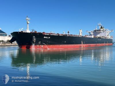
BALLA
Tanker
Current Trip
| Time Travelled | 14 days |
|---|---|
| Remaining Time | 2 days |
| Distance Travelled | 3945.00 nm |
| Remaining Distance | 644.54 nm |
| AVG Speed | 11.2 Knop |
| MAX Speed | 14.1 Knop |
| AVG Wind | 15.1 knots |
| MAX Wind | 28.8 knots |
| MIN Temp | 8.7°C / 47.66°F |
| MAX Temp | 25°C / 77°F |
| Djupgående | 8.5 m |
| Position mottagen | 17 h, 47 m sen |
Current Position
| Longitud | -81.72305° |
|---|---|
| Latitude | 24.20388° |
| Status | Under way using engine |
| Fart | 9.8 Knop |
| Kurs | 265.3° |
| Område | North Atlantic Ocean |
| Station | T-AIS |
| Position mottagen | 17 h, 47 m sen |
Info
Information
The current position of BALLA is in North Atlantic Ocean with coordinates 24.20388° / -81.72305° as reported on 2024-04-24 12:41 by AIS to our vessel tracker app. The vessel's current speed is 9.8 Knop and is heading at the port of GALVESTON. The estimated time of arrival as calculated by MyShipTracking vessel tracking app is 2024-04-27 12:28 LT
The vessel BALLA (IMO: 9749556, MMSI: 636021796) is a Tanker It's sailing under the flag of [LR] Liberia.
In this page you can find informations about the vessels current position, last detected port calls, and current voyage information. If the vessels is not in coverage by AIS you will find the latest position.
The current position of BALLA is detected by our AIS receivers and we are not responsible for the reliability of the data. The last position was recorded while the vessel was in Coverage by the Ais receivers of our vessel tracking app.
The current draught of BALLA as reported by AIS is 8.5 meters
Weather
| Temperature | 24.9°C / 76.82°F |
|---|---|
| Wind Speed | 10 knots |
| Direction | 89° E |
| Pressure | 1019.4 hPa |
| Humidity | 78.5 % |
| Cloud Coverage | 11 % |
Featured Company
Last Port Calls
| Port | Arrival | Departure | Time In Port |
|---|---|---|---|
| 2024-04-08 03:57 | 2024-04-10 10:33 | 2 d | |
| 2024-04-08 03:44 | 2024-04-08 03:53 | 9 m | |
| 2024-03-17 16:47 | 2024-03-19 18:43 | 2 d | |
| 2024-02-22 02:30 | 2024-02-23 04:14 | 1 d | |
| 2024-02-19 16:41 | 2024-02-21 02:19 | 1 d | |
| 2024-02-01 17:20 |
Most Visited Ports (Last year)
| Port | Arrivals | |
|---|---|---|
| 4 | ||
| 2 | ||
| 1 | ||
| 1 | ||
| 1 | ||
| 1 |
Last Trips
| Origin | Departure | Destination | Arrival | Distance | |
|---|---|---|---|---|---|
| 2024-04-08 04:53 | 2024-04-08 04:57 | 0.07 nm | |||
| 2024-03-19 13:43 | 2024-04-08 04:44 | 4878.35 nm | |||
| 2024-02-23 05:14 | 2024-03-17 11:47 | 5263.05 nm | |||
| 2024-02-21 03:19 | 2024-02-22 03:30 | 279.83 nm | |||
| 2024-02-01 11:20 | 2024-02-19 17:41 | 5069.02 nm |
Events
| Tid | Event | Detaljer | Position / Dest | Information |
|---|---|---|---|---|
| 2024-04-24 12:45 | Status ändrad | Default Under way using engine |
24.20299 / -81.73446
US GLS
|
Fart: 9.8 kn Kurs: 265.3° |
| 2024-04-24 12:41 | UTANFÖR täckningsområde |
24.20388 / -81.72305
North Atlantic Ocean
US GLS
|
Fart: 9.8 kn Kurs: 265.3° |
|
| 2024-04-24 12:34 | Status ändrad | Under way using engine Default |
24.20518 / -81.70343
US GLS
|
Fart: 9.3 kn Kurs: 252° |
| 2024-04-24 12:34 | I täckningsområde |
24.20518 / -81.70343
North Atlantic Ocean
US GLS
|
Fart: 9.7 kn Kurs: 266.1° |
|
| 2024-04-23 22:36 | Status ändrad | Default Under way using engine |
25.31426 / -79.72413
US GLS
|
Fart: 9.5 kn Kurs: 218.7° |
| 2024-04-23 22:27 | Byter havsområde | United States part of the North Atlantic Ocean Bahamas part of the North Atlantic Ocean |
25.33410 / -79.70708
North Atlantic Ocean
US GLS
|
Fart: 9.5 kn Kurs: 218.7° |
| 2024-04-23 22:27 | UTANFÖR täckningsområde |
25.33410 / -79.70708
North Atlantic Ocean
US GLS
|
Fart: 9.5 kn Kurs: 218.7° |
|
| 2024-04-23 16:39 | ETA ändrat | 2024/04/25 18:00 2024/04/21 08:00 |
26.13873 / -79.36406
US GLS
|
Fart: 10.1 kn Kurs: 244.2° |
| 2024-04-23 15:53 | Status ändrad | Under way using engine Default |
26.20650 / -79.23237
US GLS
|
Fart: 11.7 kn Kurs: 242° |
| 2024-04-23 15:53 | I täckningsområde |
26.20650 / -79.23237
North Atlantic Ocean
|
Fart: 11.8 kn Kurs: 240.9° |