
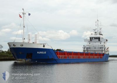
AURELIE
General Cargo
Current Trip
| Time Travelled | 2 days |
|---|---|
| Remaining Time | 22 h, 15 mins |
| Distance Travelled | 619.09 nm |
| Remaining Distance | 234.88 nm |
| AVG Speed | 9.9 Knop |
| MAX Speed | 11.1 Knop |
| AVG Wind | 13.6 knots |
| MAX Wind | 25.3 knots |
| MIN Temp | -2.9°C / 26.78°F |
| MAX Temp | 4.9°C / 40.82°F |
| Djupgående | 6 m |
| Position mottagen | Nu |
Current Position
| Longitud | 13.67445° |
|---|---|
| Latitude | 54.98434° |
| Status | Under way using engine |
| Fart | 10.5 Knop |
| Kurs | 250.2° |
| Område | Baltic Sea |
| Station | T-AIS |
| Position mottagen | Nu |
Info
Information
The current position of AURELIE is in Baltic Sea with coordinates 54.98434° / 13.67445° as reported on 2024-04-25 04:50 by AIS to our vessel tracker app. The vessel's current speed is 10.5 Knop and is heading at the port of HAMBURG. The estimated time of arrival as calculated by MyShipTracking vessel tracking app is 2024-04-26 03:06 LT
The vessel AURELIE (IMO: 9163647, MMSI: 230039000) is a General Cargo that was built in 1998 ( 26 År gammal ). It's sailing under the flag of [FI] Finland.
In this page you can find informations about the vessels current position, last detected port calls, and current voyage information. If the vessels is not in coverage by AIS you will find the latest position.
The current position of AURELIE is detected by our AIS receivers and we are not responsible for the reliability of the data. The last position was recorded while the vessel was in Coverage by the Ais receivers of our vessel tracking app.
The current draught of AURELIE as reported by AIS is 6 meters
Weather
| Temperature | 4.9°C / 40.82°F |
|---|---|
| Wind Speed | 15 knots |
| Direction | 91° E |
| Pressure | 1004.5 hPa |
| Humidity | 78.1 % |
| Cloud Coverage | 46 % |
Featured Company
Last Port Calls
| Port | Arrival | Departure | Time In Port |
|---|---|---|---|
| 2024-04-19 18:20 | 2024-04-22 16:10 | 2 d | |
| 2024-04-16 11:20 | 2024-04-18 20:49 | 2 d | |
| 2024-04-14 08:45 | 2024-04-15 14:06 | 1 d | |
| 2024-04-12 08:26 | 2024-04-13 12:58 | 1 d | |
| 2024-04-08 20:49 | 2024-04-11 10:13 | 2 d | |
| 2024-04-06 21:35 | 2024-04-07 15:36 | 18 h | |
| 2024-04-04 21:00 | 2024-04-05 17:16 | 20 h | |
| 2024-03-21 09:00 | 2024-03-26 01:17 | 4 d | |
| 2024-03-11 03:40 | 2024-03-18 10:09 | 7 d | |
| 2024-03-01 10:23 | 2024-03-06 13:47 | 5 d |
Last Trips
| Origin | Departure | Destination | Arrival | Distance | |
|---|---|---|---|---|---|
| 2024-04-18 23:49 | 2024-04-19 21:20 | 233.02 nm | |||
| 2024-04-15 17:06 | 2024-04-16 14:20 | 215.72 nm | |||
| 2024-04-13 15:58 | 2024-04-14 11:45 | 216.79 nm | |||
| 2024-04-11 13:13 | 2024-04-12 11:26 | 217.75 nm | |||
| 2024-04-07 18:36 | 2024-04-08 23:49 | 312.21 nm | |||
| 2024-04-05 20:16 | 2024-04-07 00:35 | 99.28 nm | |||
| 2024-03-26 03:17 | 2024-04-05 00:00 | 633.80 nm | |||
| 2024-03-18 11:09 | 2024-03-21 11:00 | 730.62 nm | |||
| 2024-03-06 14:47 | 2024-03-11 04:40 | 861.81 nm | |||
| 2024-02-15 10:05 | 2024-03-01 11:23 | 2494.64 nm |
Events
| Tid | Event | Detaljer | Position / Dest | Information |
|---|---|---|---|---|
| 2024-04-25 04:23 | Byter havsområde | German part of the Baltic Sea Swedish part of the Baltic Sea |
55.01062 / 13.80435
Baltic Sea
DEHAM
|
Fart: 10.4 kn Kurs: 250.7° |
| 2024-04-25 00:02 | Byter havsområde | Swedish part of the Baltic Sea Danish part of the Kattegat |
55.50424 / 14.75115
Baltic Sea
DEHAM
|
Fart: 10.3 kn Kurs: 243.7° |
| 2024-04-24 22:20 | Upptäckt i hav | Danish part of the Kattegat |
55.64788 / 15.20936
Kattegat
DEHAM
|
Fart: 10.3 kn Kurs: 240.9° |
| 2024-04-24 16:02 | Status ändrad | Under way using engine Default |
56.24905 / 16.78490
DEHAM
|
Fart: 10.4 kn Kurs: 201° |
| 2024-04-24 15:56 | Status ändrad | Default Under way using engine |
56.26479 / 16.79580
DEHAM
|
Fart: 10.3 kn Kurs: 201.2° |
| 2024-04-24 15:40 | Status ändrad | Under way using engine Default |
56.30778 / 16.82559
DEHAM
|
Fart: 10.3 kn Kurs: 202° |
| 2024-04-24 15:36 | Status ändrad | Default Under way using engine |
56.31848 / 16.83319
DEHAM
|
Fart: 10.2 kn Kurs: 201.8° |
| 2024-04-24 15:31 | Status ändrad | Under way using engine Default |
56.33173 / 16.84249
DEHAM
|
Fart: 10.2 kn Kurs: 201° |
| 2024-04-24 15:17 | I täckningsområde |
56.33124 / 16.84217
Baltic Sea
DEHAM
|
Fart: 10.2 kn Kurs: 201.2° |
|
| 2024-04-24 03:58 | UTANFÖR täckningsområde |
58.11135 / 18.35400
Baltic Sea
DEHAM
|
Fart: 9.8 kn Kurs: 212.1° |