
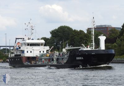
ANNIKA
Oil/Chemical Tanker
Current Trip
| Time Travelled | 22 h, 23 mins |
|---|---|
| Remaining Time | 6 h, 19 mins |
| Distance Travelled | 195.17 nm |
| Remaining Distance | 33.21 nm |
| AVG Speed | 8.7 Knop |
| MAX Speed | 10.1 Knop |
| AVG Wind | 18.2 knots |
| MAX Wind | 24.8 knots |
| MIN Temp | 3.2°C / 37.76°F |
| MAX Temp | 5°C / 41°F |
| Djupgående | 3.6 m |
| Position mottagen | Nu |
Current Position
| Longitud | 10.91826° |
|---|---|
| Latitude | 54.60178° |
| Status | Under way using engine |
| Fart | 6.2 Knop |
| Kurs | 262.6° |
| Område | Baltic Sea |
| Station | T-AIS |
| Position mottagen | Nu |
Info
Information
The current position of ANNIKA is in Baltic Sea with coordinates 54.60178° / 10.91826° as reported on 2024-04-20 10:20 by AIS to our vessel tracker app. The vessel's current speed is 6.2 Knop and is heading at the port of KIEL. The estimated time of arrival as calculated by MyShipTracking vessel tracking app is 2024-04-20 16:39 LT
The vessel ANNIKA (IMO: 9628489, MMSI: 218779000) is a Oil/Chemical Tanker that was built in 2012 ( 12 År gammal ). It's sailing under the flag of [DE] Germany.
In this page you can find informations about the vessels current position, last detected port calls, and current voyage information. If the vessels is not in coverage by AIS you will find the latest position.
The current position of ANNIKA is detected by our AIS receivers and we are not responsible for the reliability of the data. The last position was recorded while the vessel was in Coverage by the Ais receivers of our vessel tracking app.
The current draught of ANNIKA as reported by AIS is 3.6 meters
Weather
| Temperature | 5°C / 41°F |
|---|---|
| Wind Speed | 6 knots |
| Direction | 19° NNE |
| Pressure | 1017.4 hPa |
| Humidity | 58.7 % |
| Cloud Coverage | 87 % |
Featured Company
Last Port Calls
| Port | Arrival | Departure | Time In Port |
|---|---|---|---|
| 2024-04-19 09:06 | 2024-04-19 11:57 | 2 h | |
| 2024-04-18 07:46 | 2024-04-18 11:03 | 3 h | |
| 2024-04-17 15:45 | 2024-04-17 20:13 | 4 h | |
| 2024-04-17 03:51 | 2024-04-17 07:42 | 3 h | |
| 2024-04-15 03:30 | 2024-04-16 16:08 | 1 d | |
| 2024-04-14 07:29 | 2024-04-14 12:25 | 4 h | |
| 2024-04-13 15:30 | 2024-04-13 20:19 | 4 h | |
| 2024-04-13 10:05 | 2024-04-13 11:15 | 1 h | |
| 2024-04-13 05:34 | 2024-04-13 09:28 | 3 h | |
| 2024-04-12 16:08 | 2024-04-12 19:21 | 3 h |
Last Trips
| Origin | Departure | Destination | Arrival | Distance | |
|---|---|---|---|---|---|
| 2024-04-18 13:03 | 2024-04-19 11:06 | 232.62 nm | |||
| 2024-04-17 22:13 | 2024-04-18 09:46 | 82.67 nm | |||
| 2024-04-17 09:42 | 2024-04-17 17:45 | 85.65 nm | |||
| 2024-04-16 18:08 | 2024-04-17 05:51 | 87.34 nm | |||
| 2024-04-14 14:25 | 2024-04-15 05:30 | 81.82 nm | |||
| 2024-04-13 22:19 | 2024-04-14 09:29 | 83.19 nm | |||
| 2024-04-13 13:15 | 2024-04-13 17:30 | 45.76 nm | |||
| 2024-04-13 11:28 | 2024-04-13 12:05 | 4.14 nm | |||
| 2024-04-12 21:21 | 2024-04-13 07:34 | 88.58 nm | |||
| 2024-04-12 08:58 | 2024-04-12 18:08 | 83.37 nm |
Events
| Tid | Event | Detaljer | Position / Dest | Information |
|---|---|---|---|---|
| 2024-04-20 08:35 | Byter havsområde | German part of the Baltic Sea Danish part of the Baltic Sea |
54.60126 / 11.22467
Baltic Sea
DEKEL
|
Fart: 6.9 kn Kurs: 289.8° |
| 2024-04-20 00:08 | Byter havsområde | Danish part of the Baltic Sea German part of the Baltic Sea |
54.85310 / 12.95132
Baltic Sea
DEKEL
|
Fart: 8.2 kn Kurs: 248.5° |
| 2024-04-19 22:30 | Status ändrad | Under way using engine Default |
54.93712 / 13.33949
DEKEL
|
Fart: 9.1 kn Kurs: 251° |
| 2024-04-19 22:28 | Status ändrad | Default Under way using engine |
54.93820 / 13.34510
DEKEL
|
Fart: 9.1 kn Kurs: 251.2° |
| 2024-04-19 22:18 | Status ändrad | Under way using engine Default |
54.94638 / 13.38716
DEKEL
|
Fart: 9.1 kn Kurs: 250° |
| 2024-04-19 22:12 | Status ändrad | Default Under way using engine |
54.95142 / 13.41170
DEKEL
|
Fart: 9.6 kn Kurs: 251.4° |
| 2024-04-19 22:04 | Status ändrad | Under way using engine Default |
54.95849 / 13.44480
DEKEL
|
Fart: 9.6 kn Kurs: 247° |
| 2024-04-19 21:37 | Status ändrad | Default Under way using engine |
54.98554 / 13.56550
DEKEL
|
Fart: 9.5 kn Kurs: 246.1° |
| 2024-04-19 21:05 | Upptäckt i hav | German part of the Baltic Sea |
55.01717 / 13.70122
Baltic Sea
DEKEL
|
Fart: 9.5 kn Kurs: 249.8° |
| 2024-04-19 12:19 | Djupgående ändrat | 3.6 4 |
56.10077 / 14.83245
DEKEL
|
Fart: 9.1 kn Kurs: 151.3° |