
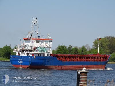
ANMIRO
General Cargo
Current Trip
| Time Travelled | 2 days |
|---|---|
| Remaining Time | 21 h, 11 mins |
| Distance Travelled | 500.17 nm |
| Remaining Distance | 192.16 nm |
| AVG Speed | 9.6 Knop |
| MAX Speed | 11.2 Knop |
| AVG Wind | 10.6 knots |
| MAX Wind | 18.3 knots |
| MIN Temp | 6.7°C / 44.06°F |
| MAX Temp | 12.5°C / 54.5°F |
| Djupgående | 5.4 m |
| Position mottagen | 8 h, 1 m sen |
Current Position
| Longitud | -4.28089° |
|---|---|
| Latitude | 49.26985° |
| Status | Under way using engine |
| Fart | 10.6 Knop |
| Kurs | 58.9° |
| Område | English Channel |
| Station | T-AIS |
| Position mottagen | 8 h, 1 m sen |
Info
Information
The current position of ANMIRO is in English Channel with coordinates 49.26985° / -4.28089° as reported on 2024-04-19 15:54 by AIS to our vessel tracker app. The vessel's current speed is 10.6 Knop and is heading at the port of DOVER. The estimated time of arrival as calculated by MyShipTracking vessel tracking app is 2024-04-20 21:07 LT
The vessel ANMIRO (IMO: 9434577, MMSI: 305322000) is a General Cargo that was built in 2009 ( 15 År gammal ). It's sailing under the flag of [AG] Antigua Barbuda.
In this page you can find informations about the vessels current position, last detected port calls, and current voyage information. If the vessels is not in coverage by AIS you will find the latest position.
The current position of ANMIRO is detected by our AIS receivers and we are not responsible for the reliability of the data. The last position was recorded while the vessel was in Coverage by the Ais receivers of our vessel tracking app.
The current draught of ANMIRO as reported by AIS is 5.4 meters
Weather
| Temperature | 11.4°C / 52.52°F |
|---|---|
| Wind Speed | 15 knots |
| Direction | 18° NNE |
| Pressure | 1023.4 hPa |
| Humidity | 77.8 % |
| Cloud Coverage | 7 % |
Featured Company
Last Port Calls
| Port | Arrival | Departure | Time In Port |
|---|---|---|---|
| 2024-04-17 20:22 | 2024-04-17 20:35 | 13 m | |
| 2024-04-15 14:40 | |||
| 2024-04-13 05:43 | 2024-04-15 11:16 | 2 d | |
| 2024-04-11 11:03 | 2024-04-12 15:35 | 1 d | |
| 2024-04-04 21:56 | 2024-04-06 04:46 | 1 d | |
| 2024-04-02 22:06 | 2024-04-03 20:22 | 22 h | |
| 2024-03-28 20:55 | 2024-03-29 19:45 | 22 h | |
| 2024-03-27 06:43 | 2024-03-27 14:22 | 7 h | |
| 2024-03-26 08:15 | 2024-03-26 16:32 | 8 h | |
| 2024-03-19 17:44 | 2024-03-21 12:02 | 1 d |
Last Trips
| Origin | Departure | Destination | Arrival | Distance | |
|---|---|---|---|---|---|
| 2024-04-15 13:16 | 2024-04-17 22:22 | 35.53 nm | |||
| 2024-04-15 13:16 | 2024-04-15 16:40 | 35.41 nm | |||
| 2024-04-12 17:35 | 2024-04-13 07:43 | 132.65 nm | |||
| 2024-04-06 06:46 | 2024-04-11 13:03 | 990.37 nm | |||
| 2024-04-03 22:22 | 2024-04-04 23:56 | 283.11 nm | |||
| 2024-03-29 20:45 | 2024-04-03 00:06 | 805.64 nm | |||
| 2024-03-27 15:22 | 2024-03-28 21:55 | 185.35 nm | |||
| 2024-03-26 17:32 | 2024-03-27 07:43 | 132.57 nm | |||
| 2024-03-21 13:02 | 2024-03-26 09:15 | 1018.34 nm | |||
| 2024-03-18 20:15 | 2024-03-19 18:44 | 244.36 nm |
Events
| Tid | Event | Detaljer | Position / Dest | Information |
|---|---|---|---|---|
| 2024-04-19 15:58 | Status ändrad | Default Under way using engine |
49.27544 / -4.26634
DOVER
|
Fart: 10.6 kn Kurs: 58.9° |
| 2024-04-19 15:54 | UTANFÖR täckningsområde |
49.26985 / -4.28089
English Channel
DOVER
|
Fart: 10.6 kn Kurs: 58.9° |
|
| 2024-04-19 13:57 | Upptäckt i hav | French part of the English Channel |
49.09138 / -4.74542
English Channel
DOVER
|
Fart: 10.5 kn Kurs: 59.2° |
| 2024-04-19 13:57 | I täckningsområde |
49.09138 / -4.74542
English Channel
DOVER
|
Fart: 10.5 kn Kurs: 59.2° |
|
| 2024-04-19 12:27 | UTANFÖR täckningsområde |
48.95244 / -5.10491
Celtic Sea
DOVER
|
Fart: 11.3 kn Kurs: 59.7° |
|
| 2024-04-19 10:21 | Status ändrad | Under way using engine Default |
48.75216 / -5.59070
DOVER
|
Fart: 9.9 kn Kurs: 31° |
| 2024-04-19 10:21 | I täckningsområde |
48.75262 / -5.59006
Celtic Sea
DOVER
|
Fart: 10.5 kn Kurs: 41.9° |
|
| 2024-04-19 09:21 | Status ändrad | Default Under way using engine |
48.60471 / -5.70967
DOVER
|
Fart: 9.9 kn Kurs: 29.7° |
| 2024-04-19 09:19 | UTANFÖR täckningsområde |
48.59980 / -5.71399
Celtic Sea
DOVER
|
Fart: 9.9 kn Kurs: 29.7° |
|
| 2024-04-19 05:01 | I täckningsområde |
47.95793 / -5.37694
Celtic Sea
DOVER
|
Fart: 9.7 kn Kurs: 340° |