
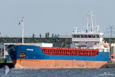
ANMARE
General Cargo
Current Trip
| Time Travelled | 10 days |
|---|---|
| Remaining Time | 16 h, 7 mins |
| Distance Travelled | 395.74 nm |
| Remaining Distance | 163.94 nm |
| AVG Speed | 9.1 Knop |
| MAX Speed | 12.7 Knop |
| AVG Wind | 17.2 knots |
| MAX Wind | 28 knots |
| MIN Temp | 6.2°C / 43.16°F |
| MAX Temp | 12.6°C / 54.68°F |
| Djupgående | 3.5 m |
| Position mottagen | 13 h, 0 m sen |
Current Position
| Longitud | 1.47768° |
|---|---|
| Latitude | 53.69098° |
| Status | Under way using engine |
| Fart | 7.9 Knop |
| Kurs | 112.7° |
| Område | North Sea |
| Station | T-AIS |
| Position mottagen | 13 h, 0 m sen |
Info
Information
The current position of ANMARE is in North Sea with coordinates 53.69098° / 1.47768° as reported on 2024-04-19 22:09 by AIS to our vessel tracker app. The vessel's current speed is 7.9 Knop and is heading at the port of CUXHAVEN. The estimated time of arrival as calculated by MyShipTracking vessel tracking app is 2024-04-21 03:17 LT
The vessel ANMARE (IMO: 9434589, MMSI: 305493000) is a General Cargo that was built in 2009 ( 15 År gammal ). It's sailing under the flag of [AG] Antigua Barbuda.
In this page you can find informations about the vessels current position, last detected port calls, and current voyage information. If the vessels is not in coverage by AIS you will find the latest position.
The current position of ANMARE is detected by our AIS receivers and we are not responsible for the reliability of the data. The last position was recorded while the vessel was in Coverage by the Ais receivers of our vessel tracking app.
The current draught of ANMARE as reported by AIS is 3.5 meters
Weather
| Temperature | 7.3°C / 45.14°F |
|---|---|
| Wind Speed | 28 knots |
| Direction | 355° N |
| Pressure | 1021.2 hPa |
| Humidity | 85.3 % |
| Cloud Coverage | 91 % |
Featured Company
Last Port Calls
| Port | Arrival | Departure | Time In Port |
|---|---|---|---|
| 2024-04-09 04:39 | 2024-04-09 21:41 | 17 h | |
| 2024-03-23 15:26 | 2024-03-25 12:41 | 1 d | |
| 2024-03-22 06:14 | 2024-03-23 06:30 | 1 d | |
| 2024-03-20 05:43 | 2024-03-21 14:01 | 1 d | |
| 2024-03-18 17:30 | |||
| 2024-03-13 11:07 | |||
| 2024-03-09 14:23 | |||
| 2024-02-21 16:09 | 2024-02-24 10:35 | 2 d | |
| 2024-02-17 14:14 | 2024-02-20 22:36 | 3 d | |
| 2024-02-15 20:00 | 2024-02-17 13:52 | 1 d |
Most Visited Ports (Last year)
| Port | Arrivals | |
|---|---|---|
| 12 | ||
| 4 | ||
| 2 | ||
| 2 | ||
| 2 | ||
| 2 |
Last Trips
| Origin | Departure | Destination | Arrival | Distance | |
|---|---|---|---|---|---|
| 2024-03-25 13:41 | 2024-04-09 06:39 | 3101.56 nm | |||
| 2024-03-23 07:30 | 2024-03-23 16:26 | 61.75 nm | |||
| 2024-03-21 15:01 | 2024-03-22 07:14 | 60.18 nm | |||
| 2024-03-18 18:30 | 2024-03-20 06:43 | 281.70 nm | |||
| 2024-02-20 23:36 | 2024-02-21 17:09 | 143.87 nm | |||
| 2024-02-17 14:52 | 2024-02-17 15:14 | 2.48 nm | |||
| 2024-02-14 21:10 | 2024-02-15 21:00 | 198.23 nm | |||
| 2024-02-10 23:32 | 2024-02-12 19:14 | 406.99 nm | |||
| 2024-02-07 11:12 | 2024-02-09 23:34 | 441.44 nm | |||
| 2024-02-06 16:54 | 2024-02-07 06:12 | 62.24 nm |
Events
| Tid | Event | Detaljer | Position / Dest | Information |
|---|---|---|---|---|
| 2024-04-19 22:17 | Status ändrad | Default Under way using engine |
53.68490 / 1.50834
CUXHAVEN
|
Fart: 7.9 kn Kurs: 112.7° |
| 2024-04-19 22:09 | UTANFÖR täckningsområde |
53.69098 / 1.47768
North Sea
CUXHAVEN
|
Fart: 7.9 kn Kurs: 112.7° |
|
| 2024-04-19 19:55 | Status ändrad | Under way using engine Default |
53.61366 / .95873
CUXHAVEN
|
Fart: 9.3 kn Kurs: 57° |
| 2024-04-19 19:55 | I täckningsområde |
53.61382 / .95964
North Sea
CUXHAVEN
|
Fart: 8.6 kn Kurs: 70.2° |
|
| 2024-04-19 17:08 | Status ändrad | Default Under way using engine |
53.54184 / .23879
CUXHAVEN
|
Fart: 10.5 kn Kurs: 88° |
| 2024-04-19 17:00 | UTANFÖR täckningsområde |
53.54247 / .20074
North Sea
CUXHAVEN
|
Fart: 10.5 kn Kurs: 88° |
|
| 2024-04-19 14:39 | STARTAR förflyttning | 1.97 nm, North East of NEW HOLLAND |
53.73557 / -.33600
CUXHAVEN
|
Fart: 3.9 kn Kurs: 83° |
| 2024-04-19 14:16 | Status ändrad | Under way using engine Moored |
53.73558 / -.34347
CUXHAVEN
|
Fart: Kurs: 68° |
| 2024-04-19 13:21 | Djupgående ändrat | 3.5 3.6 |
53.73559 / -.34347
CUXHAVEN
|
Fart: Kurs: 68° |
| 2024-04-19 12:07 | Status ändrad | Moored Default |
53.73557 / -.34348
CUXHAVEN
|
Fart: Kurs: 68° |