
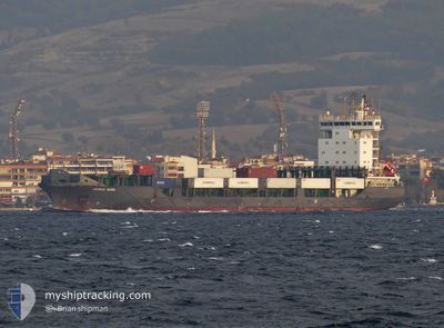
ADMIRAL MOON
Container Ship
Current Trip
| Trip Time | 4 days |
|---|---|
| Trip Distance | 752.05 nm |
| AVG Speed | 10 Knop |
| MAX Speed | 10 Knop |
| Djupgående | 7.4 m |
| AVG Wind | 10.7 knots |
| MAX Wind | 26 knots |
| MIN Temp | 12.1°C / 53.78°F |
| MAX Temp | 23.3°C / 73.94°F |
| Position mottagen | 3 m sen |
Current Position
| Longitud | 26.93182° |
|---|---|
| Latitude | 38.77965° |
| Status | Moored |
| Fart | |
| Kurs | --- |
| Område | Aegean Sea |
| Station | T-AIS |
| Position mottagen | 3 m sen |
Info
Information
The current position of ADMIRAL MOON is in Aegean Sea with coordinates 38.77965° / 26.93182° as reported on 2024-04-18 18:01 by AIS to our vessel tracker app. The vessel's current speed is 0 Knop and is currently inside the port of NEMRUT.
The vessel ADMIRAL MOON (IMO: 9437220, MMSI: 636020582) is a Container Ship that was built in 2008 ( 16 År gammal ). It's sailing under the flag of [LR] Liberia.
In this page you can find informations about the vessels current position, last detected port calls, and current voyage information. If the vessels is not in coverage by AIS you will find the latest position.
The current position of ADMIRAL MOON is detected by our AIS receivers and we are not responsible for the reliability of the data. The last position was recorded while the vessel was in Coverage by the Ais receivers of our vessel tracking app.
The current draught of ADMIRAL MOON as reported by AIS is 7.4 meters
Weather
| Temperature | 16.5°C / 61.7°F |
|---|---|
| Wind Speed | 8 knots |
| Direction | 195° SSW |
| Pressure | 1008.2 hPa |
| Humidity | 66.6 % |
| Cloud Coverage | 11 % |
Featured Company
Last Port Calls
| Port | Arrival | Departure | Time In Port |
|---|---|---|---|
| 2024-04-18 12:24 | |||
| 2024-04-11 22:21 | 2024-04-13 16:30 | 1 d | |
| 2024-04-05 16:45 | 2024-04-06 21:37 | 1 d | |
| 2024-04-02 02:57 | 2024-04-02 11:38 | 8 h | |
| 2024-03-29 14:09 | 2024-03-30 08:21 | 18 h | |
| 2024-03-25 14:55 | 2024-03-25 23:43 | 8 h | |
| 2024-03-12 00:01 | 2024-03-12 15:37 | 15 h | |
| 2024-03-09 11:25 | 2024-03-09 23:39 | 12 h | |
| 2024-03-07 21:09 | |||
| 2024-03-04 16:06 | 2024-03-05 08:38 | 16 h |
Most Visited Ports (Last year)
| Port | Arrivals | |
|---|---|---|
| 15 | ||
| 15 | ||
| 14 | ||
| 14 | ||
| 13 | ||
| 12 |
Last Trips
| Origin | Departure | Destination | Arrival | Distance | |
|---|---|---|---|---|---|
| 2024-04-13 19:30 | 2024-04-18 15:24 | 752.05 nm | |||
| 2024-04-07 00:37 | 2024-04-12 01:21 | 835.38 nm | |||
| 2024-04-02 14:38 | 2024-04-05 19:45 | 910.31 nm | |||
| 2024-03-30 10:21 | 2024-04-02 05:57 | 307.14 nm | |||
| 2024-03-26 02:43 | 2024-03-29 16:09 | 768.88 nm | |||
| 2024-03-12 18:37 | 2024-03-25 17:55 | 1128.17 nm | |||
| 2024-03-10 02:39 | 2024-03-12 03:01 | 336.14 nm | |||
| 2024-03-07 23:09 | 2024-03-09 14:25 | 518.06 nm | |||
| 2024-03-02 00:43 | 2024-03-04 18:06 | 915.89 nm | |||
| 2024-02-28 16:00 | 2024-03-01 18:10 | 533.78 nm |
Events
| Tid | Event | Detaljer | Position / Dest | Information |
|---|---|---|---|---|
| 2024-04-18 12:46 | Status ändrad | Moored Under way using engine |
38.77947 / 26.93174
[TR] NEMRUT
|
Fart: 0.2 kn Kurs: 511° |
| 2024-04-18 12:42 | STOPPAR förflyttning |
38.77945 / 26.93163
[TR] NEMRUT
|
Fart: 0.2 kn Kurs: 511° |
|
| 2024-04-18 12:24 | ANLÄNDER HAMN |
|
38.77356 / 26.91258
[TR] NEMRUT
|
Fart: 7.4 kn Kurs: 108.6° |
| 2024-04-18 12:08 | STARTAR förflyttning | 2.98 nm, North West of NEMRUT |
38.79172 / 26.86868
ALIAGA
|
Fart: 5.3 kn Kurs: 186.3° |
| 2024-04-18 11:32 | Status ändrad | Under way using engine At anchor |
38.80752 / 26.87290
ALIAGA
|
Fart: 1 kn Kurs: 511° |
| 2024-04-18 08:11 | Status ändrad | At anchor Default |
38.81075 / 26.87317
ALIAGA
|
Fart: Kurs: -1° |
| 2024-04-18 08:02 | Status ändrad | Default At anchor |
38.81095 / 26.87302
ALIAGA
|
Fart: 0.1 kn Kurs: 511° |
| 2024-04-18 07:29 | Status ändrad | At anchor Default |
38.81101 / 26.87317
ALIAGA
|
Fart: Kurs: -1° |
| 2024-04-18 06:53 | Status ändrad | Default At anchor |
38.81191 / 26.87196
ALIAGA
|
Fart: 0.4 kn Kurs: 511° |
| 2024-04-18 04:41 | Status ändrad | At anchor Default |
38.81218 / 26.87172
ALIAGA
|
Fart: Kurs: -1° |