
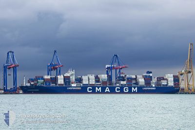
CMA CGM HOPE
Cargo
Current Trip
| Time Travelled | 11 days |
|---|---|
| Remaining Time | --- |
| Distance Travelled | 3959.20 nm |
| Remaining Distance | 2728.81 nm |
| AVG Speed | 14.2 Knop |
| MAX Speed | 20.7 Knop |
| AVG Wind | 14.4 knots |
| MAX Wind | 29.8 knots |
| MIN Temp | 16.8°C / 62.24°F |
| MAX Temp | 29.1°C / 84.38°F |
| Djupgående | 15 m |
| Position mottagen | 9 d sen |
Current Position
| Longitud | --- |
|---|---|
| Latitude | --- |
| Status | Under way using engine |
| Fart | 13.8 Knop |
| Kurs | 89.4° |
| Område | North Pacific Ocean |
| Station | T-AIS |
| Position mottagen | 9 d sen |
Info
Information
The current position of CMA CGM HOPE is in North Pacific Ocean with coordinates 41.63421° / 142.38081° as reported on 2024-09-18 11:42 by AIS to our vessel tracker app. The vessel's current speed is 13.8 Knop and is heading at the port of MANZANILLO. The estimated time of arrival as calculated by MyShipTracking vessel tracking app is 2024-10-06 03:00 LT
The vessel CMA CGM HOPE (IMO: 9897755, MMSI: 229326000) is a Cargo It's sailing under the flag of [MT] Malta.
In this page you can find informations about the vessels current position, last detected port calls, and current voyage information. If the vessels is not in coverage by AIS you will find the latest position.
The current position of CMA CGM HOPE is detected by our AIS receivers and we are not responsible for the reliability of the data. The last position was recorded while the vessel was in Coverage by the Ais receivers of our vessel tracking app.
The current draught of CMA CGM HOPE as reported by AIS is 15 meters
Weather
| Temperature | 19.7°C / 67.46°F |
|---|---|
| Wind Speed | 16 knots |
| Direction | 47° NE |
| Pressure | 1020.3 hPa |
| Humidity | 85.6 % |
| Cloud Coverage | 100 % |
Featured Company
Last Port Calls
| Port | Arrival | Departure | Time In Port |
|---|---|---|---|
| 2024-09-14 10:09 | 2024-09-16 03:44 | 1 d | |
| 2024-09-06 14:05 | 2024-09-07 16:28 | 1 d | |
| 2024-09-02 18:50 | 2024-09-03 11:31 | 16 h | |
| 2024-09-01 08:31 | 2024-09-01 22:59 | 14 h | |
| 2024-08-30 11:59 | 2024-09-01 06:36 | 1 d | |
| 2024-08-25 04:13 | 2024-08-27 02:35 | 1 d | |
| 2024-08-21 20:34 | 2024-08-22 19:52 | 23 h | |
| 2024-08-04 09:57 | 2024-08-07 17:10 | 3 d | |
| 2024-08-01 08:54 | 2024-08-03 00:38 | 1 d | |
| 2024-07-22 21:36 | 2024-07-22 22:02 | 26 m |
Most Visited Ports (Last year)
| Port | Arrivals | |
|---|---|---|
| 8 | ||
| 6 | ||
| 5 | ||
| 5 | ||
| 4 | ||
| 4 |
Last Trips
| Origin | Departure | Destination | Arrival | Distance | |
|---|---|---|---|---|---|
| 2024-09-08 00:28 | 2024-09-14 19:09 | 622.27 nm | |||
| 2024-09-03 19:31 | 2024-09-06 22:05 | 700.14 nm | |||
| 2024-09-02 06:59 | 2024-09-03 02:50 | 355.42 nm | |||
| 2024-09-01 14:36 | 2024-09-01 16:31 | 21.28 nm | |||
| 2024-08-27 11:35 | 2024-08-30 19:59 | 1238.00 nm | |||
| 2024-08-23 04:52 | 2024-08-25 13:13 | 878.14 nm | |||
| 2024-08-07 12:10 | 2024-08-22 05:34 | 6120.45 nm | |||
| 2024-08-02 19:38 | 2024-08-04 04:57 | 215.74 nm | |||
| 2024-07-22 17:02 | 2024-08-01 03:54 | 1761.75 nm | |||
| 2024-07-21 04:23 | 2024-07-22 16:36 | 594.29 nm |
Events
| Tid | Event | Detaljer | Position / Dest | Information |
|---|---|---|---|---|
| 2024-09-18 11:48 | Status ändrad | Default Under way using engine |
41.63421 / 142.41495
KRPUS-MXZLO
|
Fart: 13.8 kn Kurs: 89.4° |
| 2024-09-18 11:42 | UTANFÖR täckningsområde |
41.63421 / 142.38081
North Pacific Ocean
KRPUS-MXZLO
|
Fart: 13.8 kn Kurs: 89.4° |
|
| 2024-09-18 11:35 | Status ändrad | Under way using engine Default |
41.63435 / 142.34817
KRPUS-MXZLO
|
Fart: 13.8 kn Kurs: 88° |
| 2024-09-18 11:29 | Status ändrad | Default Under way using engine |
41.63356 / 142.31578
KRPUS-MXZLO
|
Fart: 13.9 kn Kurs: 88.4° |
| 2024-09-18 11:22 | Status ändrad | Under way using engine Default |
41.63269 / 142.28302
KRPUS-MXZLO
|
Fart: 13.9 kn Kurs: 89° |
| 2024-09-18 11:16 | Status ändrad | Default Under way using engine |
41.63204 / 142.25032
KRPUS-MXZLO
|
Fart: 13.9 kn Kurs: 87.2° |
| 2024-09-18 08:29 | Byter havsområde | Japanese part of the North Pacific Ocean Japanese part of the Japan Sea |
41.60928 / 141.31306
North Pacific Ocean
KRPUS-MXZLO
|
Fart: 17.5 kn Kurs: 86.9° |
| 2024-09-18 05:54 | Status ändrad | Under way using engine Default |
41.36433 / 140.39803
KRPUS-MXZLO
|
Fart: 17.6 kn Kurs: 58° |
| 2024-09-18 05:29 | Status ändrad | Default Under way using engine |
41.29692 / 140.26674
KRPUS-MXZLO
|
Fart: 15 kn Kurs: 57.5° |
| 2024-09-18 05:14 | Status ändrad | Under way using engine Default |
41.25974 / 140.19222
KRPUS-MXZLO
|
Fart: 15.9 kn Kurs: 59° |