
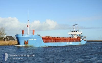
WILSON MAIN
General Cargo
Current Trip
CREEKSEA
| Time Travelled | 4 days |
|---|---|
| Remaining Time | --- |
| Distance Travelled | 376.88 морская миля |
| Remaining Distance | --- |
| AVG Speed | 8.6 Узлы |
| MAX Speed | 11 Узлы |
| AVG Wind | 13.8 knots |
| MAX Wind | 24.7 knots |
| MIN Temp | 2.5°C / 36.5°F |
| MAX Temp | 9.8°C / 49.64°F |
| Осадка | 4.6 м |
| Позиция Получена | 3 m тому назад |
Current Position
| Долгота | 0.79150° |
|---|---|
| Широта | 51.62344° |
| Статус | Moored |
| Скорость | |
| Курс | 120° |
| Район | North Sea |
| Станция | T-AIS |
| Позиция Получена | 3 m тому назад |
Info
Information
The current position of WILSON MAIN is in North Sea with coordinates 51.62344° / 0.79150° as reported on 2024-04-20 08:27 by AIS to our vessel tracker app. The vessel's current speed is 0 Узлы
The vessel WILSON MAIN (IMO: 8913485, MMSI: 314182000) is a General Cargo that was built in 1990 ( 34 лет ). It's sailing under the flag of [BB] Barbados.
In this page you can find informations about the vessels current position, last detected port calls, and current voyage information. If the vessels is not in coverage by AIS you will find the latest position.
The current position of WILSON MAIN is detected by our AIS receivers and we are not responsible for the reliability of the data. The last position was recorded while the vessel was in Coverage by the Ais receivers of our vessel tracking app.
The current draught of WILSON MAIN as reported by AIS is 4.6 meters
Weather
| Temperature | 6.2°C / 43.16°F |
|---|---|
| Wind Speed | 16 knots |
| Direction | 348° NNW |
| Pressure | 1027.4 hPa |
| Humidity | 70.1 % |
| Cloud Coverage | 10 % |
Featured Company
Last Port Calls
| Port | Arrival | Departure | Time In Port |
|---|---|---|---|
| 2024-04-11 12:34 | 2024-04-15 20:13 | 4 d | |
| 2024-04-07 16:04 | 2024-04-08 14:13 | 22 h | |
| 2024-04-03 00:54 | 2024-04-03 16:29 | 15 h | |
| 2024-03-23 19:29 | 2024-03-26 00:17 | 2 d | |
| 2024-03-21 14:11 | 2024-03-21 16:11 | 2 h | |
| 2024-03-19 22:01 | 2024-03-20 09:31 | 11 h | |
| 2024-03-19 09:24 | 2024-03-19 18:58 | 9 h | |
| 2024-03-15 15:37 | 2024-03-16 06:22 | 14 h | |
| 2024-03-14 23:25 | 2024-03-15 00:08 | 42 m | |
| 2024-03-14 16:50 | 2024-03-14 17:41 | 51 m |
Last Trips
| Origin | Departure | Destination | Arrival | Distance | |
|---|---|---|---|---|---|
| 2024-04-08 16:13 | 2024-04-11 14:34 | 481.15 морская миля | |||
| 2024-04-03 18:29 | 2024-04-07 18:04 | 611.04 морская миля | |||
| 2024-03-26 01:17 | 2024-04-03 02:54 | 1047.11 морская миля | |||
| 2024-03-21 17:11 | 2024-03-23 20:29 | 454.35 морская миля | |||
| 2024-03-20 10:31 | 2024-03-21 15:11 | 272.03 морская миля | |||
| 2024-03-19 19:58 | 2024-03-19 23:01 | 26.41 морская миля | |||
| 2024-03-16 07:22 | 2024-03-19 10:24 | 639.89 морская миля | |||
| 2024-03-15 01:08 | 2024-03-15 16:37 | 97.24 морская миля | |||
| 2024-03-14 18:41 | 2024-03-15 00:25 | 42.38 морская миля | |||
| 2024-03-14 15:51 | 2024-03-14 17:50 | 12.38 морская миля |
Events
| Время | Событие | Детали | Позиция / Направление | Информация |
|---|---|---|---|---|
| 2024-04-18 04:53 | Статус изменился | Moored Under way using engine |
51.62343 / .79150
CREEKSEA
|
Скорость: Курс: 120° |
| 2024-04-18 04:50 | Окончание движения | 0.87 nm, West of BURNHAM ON CROUCH |
51.62347 / .79137
CREEKSEA
|
Скорость: 0.3 kn Курс: 120° |
| 2024-04-18 01:02 | Начало движения | 8.05 nm, East of F HALLS COMPANY BOAT |
51.81752 / 1.48751
CREEKSEA
|
Скорость: 6.6 kn Курс: 224.8° |
| 2024-04-18 00:58 | Статус изменился | Under way using engine At anchor |
51.82017 / 1.49219
CREEKSEA
|
Скорость: 0.1 kn Курс: 293° |
| 2024-04-17 15:33 | Окончание движения | 8.1 nm, East of F HALLS COMPANY BOAT |
51.81893 / 1.48937
CREEKSEA
|
Скорость: Курс: 22° |
| 2024-04-17 15:25 | Статус изменился | At anchor Under way using engine |
51.81947 / 1.48989
CREEKSEA
|
Скорость: 1.9 kn Курс: 71° |
| 2024-04-17 12:13 | Изменение морского района | United Kingdom part of the North Sea Dutch part of the North Sea |
51.89777 / 2.12677
North Sea
CREEKSEA
|
Скорость: 8.7 kn Курс: 244.2° |
| 2024-04-17 12:13 | Статус изменился | Under way using engine Default |
51.89777 / 2.12677
CREEKSEA
|
Скорость: 8.6 kn Курс: 229° |
| 2024-04-17 12:04 | В покрытии |
51.89777 / 2.12677
North Sea
CREEKSEA
|
Скорость: 8.7 kn Курс: 244.2° |
|
| 2024-04-16 16:03 | Вне покрытия |
53.64799 / 5.47658
North Sea
CREEKSEA
|
Скорость: 8.1 kn Курс: 252° |