
SPAR INDUS
Cargo
Current Trip
| Time Travelled | 5 days |
|---|---|
| Remaining Time | --- |
| Distance Travelled | 933.67 морская миля |
| Remaining Distance | --- |
| AVG Speed | 8.7 Узлы |
| MAX Speed | 14.8 Узлы |
| AVG Wind | 9.7 knots |
| MAX Wind | 23.8 knots |
| MIN Temp | 20.9°C / 69.62°F |
| MAX Temp | 27.5°C / 81.5°F |
| Осадка | 11.7 м |
| Позиция Получена | 19 h, 34 m тому назад |
Current Position
| Долгота | 57.18333° |
|---|---|
| Широта | 24.81040° |
| Статус | Under way using engine |
| Скорость | 12.2 Узлы |
| Курс | 124.9° |
| Район | Gulf of Oman |
| Станция | T-AIS |
| Позиция Получена | 19 h, 34 m тому назад |
Info
Information
The current position of SPAR INDUS is in Gulf of Oman with coordinates 24.81040° / 57.18333° as reported on 2024-04-19 06:45 by AIS to our vessel tracker app. The vessel's current speed is 12.2 Узлы and is heading at the port of TOAMASINA. The estimated time of arrival as calculated by MyShipTracking vessel tracking app is 2024-04-30 20:00 LT
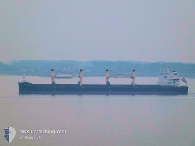
The vessel SPAR INDUS (IMO: 9734991, MMSI: 258775000) is a Cargo It's sailing under the flag of [NO] Norway.
In this page you can find informations about the vessels current position, last detected port calls, and current voyage information. If the vessels is not in coverage by AIS you will find the latest position.
The current position of SPAR INDUS is detected by our AIS receivers and we are not responsible for the reliability of the data. The last position was recorded while the vessel was in Coverage by the Ais receivers of our vessel tracking app.
The current draught of SPAR INDUS as reported by AIS is 11.7 meters
Weather
| Temperature | 26°C / 78.8°F |
|---|---|
| Wind Speed | 6 knots |
| Direction | 248° WSW |
| Pressure | 1009.1 hPa |
| Humidity | 72.9 % |
| Cloud Coverage | 17 % |
Featured Company
Last Port Calls
| Port | Arrival | Departure | Time In Port |
|---|---|---|---|
| 2024-04-08 17:53 | 2024-04-14 13:52 | 5 d | |
| 2024-02-05 18:22 | 2024-02-08 18:02 | 2 d |
Most Visited Ports (Last year)
| Port | Arrivals | |
|---|---|---|
| 2 | ||
| 1 | ||
| 1 | ||
| 1 | ||
| 1 | ||
| 1 |
Last Trips
| Origin | Departure | Destination | Arrival | Distance | |
|---|---|---|---|---|---|
| 2024-02-09 01:02 | 2024-04-08 20:53 | 4117.63 морская миля | |||
| 2023-12-18 06:59 | 2024-02-06 01:22 | 4857.33 морская миля |
Events
| Время | Событие | Детали | Позиция / Направление | Информация |
|---|---|---|---|---|
| 2024-04-19 06:45 | Вне покрытия |
24.81040 / 57.18333
Gulf of Oman
TAMATAVE
|
Скорость: 12.2 kn Курс: 124.9° |
|
| 2024-04-19 04:55 | Изменение морского района | Omani part of the Gulf of Oman United Arab Emirates part of the Gulf of Oman |
25.04703 / 56.87022
Gulf of Oman
TAMATAVE
|
Скорость: 11.9 kn Курс: 129.3° |
| 2024-04-19 02:24 | ETA изменился | 2024/04/30 20:00 2024/04/30 06:00 |
25.41597 / 56.54651
TAMATAVE
|
Скорость: 10.9 kn Курс: 90.3° |
| 2024-04-19 01:46 | Начало движения | 6.02 nm, East of KHORFAKKAN |
25.39038 / 56.46666
TAMATAVE
|
Скорость: 3.1 kn Курс: 38° |
| 2024-04-19 01:38 | Статус изменился | Under way using engine At anchor |
25.38762 / 56.46528
TAMATAVE
|
Скорость: 0.2 kn Курс: 44° |
| 2024-04-19 00:16 | Осадка изменилась | 11.7 11.8 |
25.38669 / 56.46511
TAMATAVE
|
Скорость: 0.1 kn Курс: 85° |
| 2024-04-19 00:16 | Пункт назначения изменился | TAMATAVE FOR ORDER |
25.38669 / 56.46511
TAMATAVE
|
Скорость: 0.1 kn Курс: 85° |
| 2024-04-19 00:16 | ETA изменился | 2024/04/30 06:00 2024/04/16 01:00 |
25.38669 / 56.46511
TAMATAVE
|
Скорость: 0.1 kn Курс: 85° |
| 2024-04-18 03:20 | Статус изменился | At anchor Default |
25.38785 / 56.46686
FOR ORDER
|
Скорость: Курс: 186° |
| 2024-04-18 03:11 | Статус изменился | Default At anchor |
25.38782 / 56.46682
FOR ORDER
|
Скорость: Курс: 186° |