
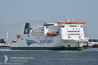
ISLE OF INISHMORE
Ro-Ro/Passenger Ship
Current Trip
| Time Travelled | 1 h, 6 mins |
|---|---|
| Remaining Time | 13 mins |
| Distance Travelled | 17.12 морская миля |
| Remaining Distance | 8.74 морская миля |
| AVG Speed | 16.7 Узлы |
| MAX Speed | 17.7 Узлы |
| AVG Wind | 19.6 knots |
| MAX Wind | 20 knots |
| MIN Temp | 11.6°C / 52.88°F |
| MAX Temp | 11.9°C / 53.42°F |
| Осадка | 0 м |
| Позиция Получена | Сейчас |
Current Position
| Долгота | --- |
|---|---|
| Широта | --- |
| Статус | Under way using engine |
| Скорость | 16.8 Узлы |
| Курс | 284.7° |
| Район | North Sea |
| Станция | T-AIS |
| Позиция Получена | Сейчас |
Info
Information
The current position of ISLE OF INISHMORE is in North Sea with coordinates 51.10785° / 1.43898° as reported on 2025-12-07 06:32 by AIS to our vessel tracker app. The vessel's current speed is 16.8 Узлы and is heading at the port of DOVER. The estimated time of arrival as calculated by MyShipTracking vessel tracking app is 2025-12-07 06:46 LT
The vessel ISLE OF INISHMORE (IMO: 9142605, MMSI: 209093000) is a Ro-Ro/Passenger Ship that was built in 1997 ( 28 лет ). It's sailing under the flag of [CY] Cyprus.
In this page you can find informations about the vessels current position, last detected port calls, and current voyage information. If the vessels is not in coverage by AIS you will find the latest position.
The current position of ISLE OF INISHMORE is detected by our AIS receivers and we are not responsible for the reliability of the data. The last position was recorded while the vessel was in Coverage by the Ais receivers of our vessel tracking app.
Weather
| Temperature | 11.9°C / 53.42°F |
|---|---|
| Wind Speed | 20 knots |
| Direction | 212° SSW |
| Pressure | 1004.6 hPa |
| Humidity | 90.4 % |
| Cloud Coverage | 100 % |
Featured Company
Last Port Calls
| Port | Arrival | Departure | Time In Port |
|---|---|---|---|
| 2025-12-07 05:16 | 2025-12-07 06:27 | 1 h | |
| 2025-12-07 01:55 | 2025-12-07 03:05 | 1 h | |
| 2025-12-07 00:40 | 2025-12-07 01:36 | 56 m | |
| 2025-12-06 21:37 | 2025-12-06 22:33 | 56 m | |
| 2025-12-06 20:22 | 2025-12-06 21:23 | 1 h | |
| 2025-12-06 17:02 | 2025-12-06 18:07 | 1 h | |
| 2025-12-06 15:38 | 2025-12-06 16:43 | 1 h | |
| 2025-12-06 12:14 | 2025-12-06 13:29 | 1 h | |
| 2025-12-06 10:35 | 2025-12-06 11:46 | 1 h | |
| 2025-12-06 07:05 | 2025-12-06 08:21 | 1 h |
Last Trips
| Origin | Departure | Destination | Arrival | Distance | |
|---|---|---|---|---|---|
| 2025-12-07 03:05 | 2025-12-07 05:16 | 20.99 морская миля | |||
| 2025-12-07 01:36 | 2025-12-07 01:55 | 21.34 морская миля | |||
| 2025-12-06 22:33 | 2025-12-07 00:40 | 21.33 морская миля | |||
| 2025-12-06 21:23 | 2025-12-06 21:37 | 21.78 морская миля | |||
| 2025-12-06 18:07 | 2025-12-06 20:22 | 21.82 морская миля | |||
| 2025-12-06 16:43 | 2025-12-06 17:02 | 21.31 морская миля | |||
| 2025-12-06 13:29 | 2025-12-06 15:38 | 21.14 морская миля | |||
| 2025-12-06 11:46 | 2025-12-06 12:14 | 21.97 морская миля | |||
| 2025-12-06 08:21 | 2025-12-06 10:35 | 22.08 морская миля | |||
| 2025-12-06 06:37 | 2025-12-06 07:05 | 22.09 морская миля |
Events
| Время | Событие | Детали | Позиция / Направление | Информация |
|---|---|---|---|---|
| 2025-12-07 06:10 | Изменение морского района | United Kingdom part of the North Sea French part of the North Sea |
51.05717 / 1.57252
North Sea
DOVER-CALAIS-DOVER
|
Скорость: 16.2 kn Курс: 315.5° |
| 2025-12-07 05:27 | ПОРТ ОТПРАВЛЕНИЯ |
|
50.97275 / 1.83710
DOVER-CALAIS-DOVER
|
Скорость: 13.1 kn Курс: 289° |
| 2025-12-07 05:22 | Начало движения |
50.96806 / 1.85506
[FR] CALAIS
|
Скорость: 3.1 kn Курс: 236° |
|
| 2025-12-07 05:08 | Статус изменился | Under way using engine Moored |
50.96814 / 1.86127
[FR] CALAIS
|
Скорость: Курс: 86° |
| 2025-12-07 04:28 | Окончание движения |
50.96815 / 1.86128
[FR] CALAIS
|
Скорость: Курс: 85° |
|
| 2025-12-07 04:23 | ETA изменился | 2025/12/07 07:00 2025/12/07 04:30 |
50.96823 / 1.86002
[FR] CALAIS
|
Скорость: 1.7 kn Курс: 91° |
| 2025-12-07 04:23 | Статус изменился | Moored Under way using engine |
50.96825 / 1.85990
[FR] CALAIS
|
Скорость: 1.9 kn Курс: 92° |
| 2025-12-07 04:16 | Порт |
|
50.97214 / 1.84043
[FR] CALAIS
|
Скорость: 12 kn Курс: 119.8° |
| 2025-12-07 03:41 | Изменение морского района | French part of the North Sea French part of the English Channel |
51.00887 / 1.59780
North Sea
DOVER-CALAIS-DOVER
|
Скорость: 17.4 kn Курс: 123.1° |
| 2025-12-07 03:32 | Изменение морского района | French part of the English Channel United Kingdom part of the English Channel |
51.03133 / 1.54136
English Channel
DOVER-CALAIS-DOVER
|
Скорость: 17.2 kn Курс: 124° |