
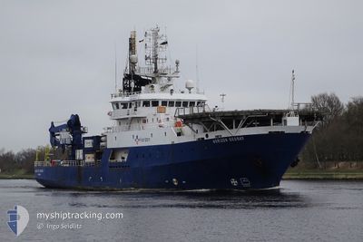
HORIZON GEOBAY
Research/Survey Vessel
Current Trip
CALEDONIA WIND
| Time Travelled | 8 days |
|---|---|
| Remaining Time | --- |
| Distance Travelled | 240.04 морская миля |
| Remaining Distance | --- |
| AVG Speed | 8.1 Узлы |
| MAX Speed | 10 Узлы |
| AVG Wind | 22.8 knots |
| MAX Wind | 28 knots |
| MIN Temp | 3.8°C / 38.84°F |
| MAX Temp | 11.5°C / 52.7°F |
| Осадка | 6.9 м |
| Позиция Получена | 5 d тому назад |
Current Position
| Долгота | -2.45061° |
|---|---|
| Широта | 57.74224° |
| Статус | Restricted manoeuverability |
| Скорость | 0.7 Узлы |
| Курс | 297° |
| Район | North Sea |
| Станция | T-AIS |
| Позиция Получена | 5 d тому назад |
Info
Information
The current position of HORIZON GEOBAY is in North Sea with coordinates 57.74224° / -2.45061° as reported on 2024-04-14 05:58 by AIS to our vessel tracker app. The vessel's current speed is 0.7 Узлы
The vessel HORIZON GEOBAY (IMO: 7801556, MMSI: 354641000) is a Research/Survey Vessel that was built in 1978 ( 46 лет ). It's sailing under the flag of [PA] Panama.
In this page you can find informations about the vessels current position, last detected port calls, and current voyage information. If the vessels is not in coverage by AIS you will find the latest position.
The current position of HORIZON GEOBAY is detected by our AIS receivers and we are not responsible for the reliability of the data. The last position was recorded while the vessel was in Coverage by the Ais receivers of our vessel tracking app.
The current draught of HORIZON GEOBAY as reported by AIS is 6.9 meters
Weather
| Temperature | 3.4°C / 38.12°F |
|---|---|
| Wind Speed | 18 knots |
| Direction | 335° NNW |
| Pressure | 1015.8 hPa |
| Humidity | 76.1 % |
| Cloud Coverage | 100 % |
Featured Company
Events
| Время | Событие | Детали | Позиция / Направление | Информация |
|---|---|---|---|---|
| 2024-04-18 16:30 | Окончание движения | 7.92 nm, East of HELMSDALE |
58.13092 / -3.40379
CALEDONIA WIND
|
Скорость: Курс: 311° |
| 2024-04-18 11:57 | Начало движения |
58.09051 / -2.52757
CALEDONIA WIND
|
Скорость: 7.7 kn Курс: 231° |
|
| 2024-04-17 08:22 | Окончание движения |
58.10649 / -2.49407
CALEDONIA WIND
|
Скорость: 0.3 kn Курс: 355° |
|
| 2024-04-17 03:33 | Начало движения | 7.77 nm, East of HELMSDALE |
58.13192 / -3.40858
CALEDONIA WIND
|
Скорость: 3.8 kn Курс: 148° |
| 2024-04-16 10:09 | Окончание движения | 7.92 nm, East of HELMSDALE |
58.13585 / -3.40500
CALEDONIA WIND
|
Скорость: 0.3 kn Курс: 332° |
| 2024-04-16 09:17 | Начало движения | 11.1 nm, South of LYBSTER |
58.11200 / -3.23614
CALEDONIA WIND
|
Скорость: 7.4 kn Курс: 284° |
| 2024-04-15 23:33 | Окончание движения | 11.32 nm, South of LYBSTER |
58.10971 / -3.22170
CALEDONIA WIND
|
Скорость: 0.1 kn Курс: 340° |
| 2024-04-15 19:21 | Начало движения |
58.08360 / -2.50388
CALEDONIA WIND
|
Скорость: 3.2 kn Курс: 282° |
|
| 2024-04-14 08:56 | Окончание движения |
58.08435 / -2.49883
CALEDONIA WIND
|
Скорость: 0.3 kn Курс: 251° |
|
| 2024-04-14 05:58 | Вне покрытия |
57.74224 / -2.45061
North Sea
|
Скорость: 0.7 kn Курс: 67° |