
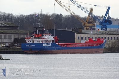
EEMS CARRIER
General Cargo
Current Trip
| Time Travelled | 1 day |
|---|---|
| Remaining Time | --- |
| Distance Travelled | 150.72 морская миля |
| Remaining Distance | --- |
| AVG Speed | 8.4 Узлы |
| MAX Speed | 10.8 Узлы |
| AVG Wind | 7.1 knots |
| MAX Wind | 10.6 knots |
| MIN Temp | 3.5°C / 38.3°F |
| MAX Temp | 9.9°C / 49.82°F |
| Осадка | 2.6 м |
| Позиция Получена | 1 m тому назад |
Current Position
| Долгота | 12.23925° |
|---|---|
| Широта | 55.16890° |
| Статус | Under way using engine |
| Скорость | 8.9 Узлы |
| Курс | 128.8° |
| Район | Baltic Sea |
| Станция | T-AIS |
| Позиция Получена | 1 m тому назад |
Info
Information
The current position of EEMS CARRIER is in Baltic Sea with coordinates 55.16890° / 12.23925° as reported on 2024-04-18 14:15 by AIS to our vessel tracker app. The vessel's current speed is 8.9 Узлы and is heading at the port of AABENRAA. The estimated time of arrival as calculated by MyShipTracking vessel tracking app is 2024-04-18 03:30 LT
The vessel EEMS CARRIER (IMO: 9148142, MMSI: 245257000) is a General Cargo that was built in 1996 ( 28 лет ). It's sailing under the flag of [NL] Netherlands.
In this page you can find informations about the vessels current position, last detected port calls, and current voyage information. If the vessels is not in coverage by AIS you will find the latest position.
The current position of EEMS CARRIER is detected by our AIS receivers and we are not responsible for the reliability of the data. The last position was recorded while the vessel was in Coverage by the Ais receivers of our vessel tracking app.
The current draught of EEMS CARRIER as reported by AIS is 2.6 meters
Weather
| Temperature | 9.5°C / 49.1°F |
|---|---|
| Wind Speed | 10 knots |
| Direction | 306° NW |
| Pressure | 1012.2 hPa |
| Humidity | 56.2 % |
| Cloud Coverage | 56 % |
Featured Company
Last Port Calls
| Port | Arrival | Departure | Time In Port |
|---|---|---|---|
| 2024-04-17 06:13 | 2024-04-17 11:35 | 5 h | |
| 2024-04-14 05:47 | 2024-04-15 09:22 | 1 d | |
| 2024-04-12 05:23 | 2024-04-12 09:32 | 4 h | |
| 2024-04-07 04:17 | 2024-04-07 13:33 | 9 h | |
| 2024-04-05 06:12 | 2024-04-05 10:41 | 4 h | |
| 2024-03-30 13:25 | 2024-03-31 00:37 | 11 h | |
| 2024-03-28 08:09 | 2024-03-28 19:41 | 11 h | |
| 2024-03-25 13:16 | 2024-03-25 17:35 | 4 h | |
| 2024-03-22 05:47 | 2024-03-22 12:08 | 6 h | |
| 2024-03-17 14:03 | 2024-03-19 13:45 | 1 d |
Last Trips
| Origin | Departure | Destination | Arrival | Distance | |
|---|---|---|---|---|---|
| 2024-04-15 11:22 | 2024-04-17 08:13 | 324.26 морская миля | |||
| 2024-04-12 11:32 | 2024-04-14 07:47 | 331.59 морская миля | |||
| 2024-04-07 15:33 | 2024-04-12 07:23 | 477.02 морская миля | |||
| 2024-04-05 12:41 | 2024-04-07 06:17 | 440.03 морская миля | |||
| 2024-03-31 01:37 | 2024-04-05 08:12 | 476.77 морская миля | |||
| 2024-03-28 20:41 | 2024-03-30 14:25 | 426.34 морская миля | |||
| 2024-03-25 18:35 | 2024-03-28 09:09 | 321.28 морская миля | |||
| 2024-03-22 13:08 | 2024-03-25 14:16 | 311.18 морская миля | |||
| 2024-03-19 14:45 | 2024-03-22 06:47 | 359.99 морская миля | |||
| 2024-03-16 12:51 | 2024-03-17 15:03 | 196.59 морская миля |
Events
| Время | Событие | Детали | Позиция / Направление | Информация |
|---|---|---|---|---|
| 2024-04-18 14:13 | ETA изменился | 2024/04/19 06:30 2024/04/18 03:30 |
55.17147 / 12.23371
DKAAB
|
Скорость: 8.9 kn Курс: 127.9° |
| 2024-04-18 14:13 | Статус изменился | Under way using engine Moored |
55.17147 / 12.23371
DKAAB
|
Скорость: 8.9 kn Курс: 127.6° |
| 2024-04-18 13:45 | Начало движения | 11.93 nm, South West of STERN |
55.21195 / 12.16569
DKAAB
|
Скорость: 3.5 kn Курс: 169° |
| 2024-04-18 09:58 | Пункт назначения изменился | DKAAB DKFAK |
55.21410 / 12.16217
DKAAB
|
Скорость: Курс: 76° |
| 2024-04-18 04:29 | Статус изменился | Moored Under way using engine |
55.21409 / 12.16205
DKFAK
|
Скорость: Курс: 75° |
| 2024-04-18 04:03 | Окончание движения | 11.88 nm, South West of STERN |
55.21376 / 12.16524
DKFAK
|
Скорость: 0.3 kn Курс: 338° |
| 2024-04-18 03:48 | Начало движения | 11.87 nm, South West of STERN |
55.20024 / 12.18237
DKFAK
|
Скорость: 4.7 kn Курс: 284° |
| 2024-04-18 03:44 | Окончание движения | 11.81 nm, South West of STERN |
55.19963 / 12.18567
DKFAK
|
Скорость: 0.3 kn Курс: 334° |
| 2024-04-18 01:44 | Обнаружено в море | Danish part of the Baltic Sea |
55.29054 / 12.48498
Baltic Sea
DKFAK
|
Скорость: 7.7 kn Курс: 204.3° |
| 2024-04-17 23:42 | ETA изменился | 2024/04/18 03:30 2024/04/18 04:00 |
55.54686 / 12.70231
DKFAK
|
Скорость: 9.1 kn Курс: 204.5° |