
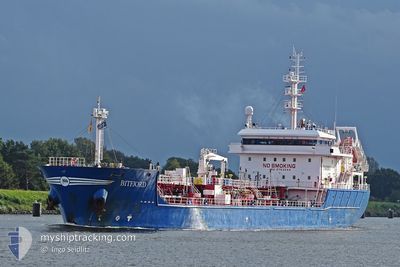
BITFJORD
Tanker
Current Trip
| Time Travelled | 8 h, 9 mins |
|---|---|
| Remaining Time | 1 h, 48 mins |
| Distance Travelled | 100.28 морская миля |
| Remaining Distance | 25.57 морская миля |
| AVG Speed | 11.4 Узлы |
| MAX Speed | 14.1 Узлы |
| AVG Wind | 7.7 knots |
| MAX Wind | 13.5 knots |
| MIN Temp | 6.8°C / 44.24°F |
| MAX Temp | 9.4°C / 48.92°F |
| Осадка | 5.6 м |
| Позиция Получена | 1 m тому назад |
Current Position
| Долгота | -5.53982° |
|---|---|
| Широта | 53.42235° |
| Статус | Under way using engine |
| Скорость | 10.5 Узлы |
| Курс | 256.4° |
| Район | Irish Sea and St. George's Channel |
| Станция | T-AIS |
| Позиция Получена | 1 m тому назад |
Info
Information
The current position of BITFJORD is in Irish Sea and St. George's Channel with coordinates 53.42235° / -5.53982° as reported on 2024-04-20 03:58 by AIS to our vessel tracker app. The vessel's current speed is 10.5 Узлы and is heading at the port of DUBLIN. The estimated time of arrival as calculated by MyShipTracking vessel tracking app is 2024-04-20 05:47 LT
The vessel BITFJORD (IMO: 9753844, MMSI: 244090224) is a Tanker It's sailing under the flag of [NL] Netherlands.
In this page you can find informations about the vessels current position, last detected port calls, and current voyage information. If the vessels is not in coverage by AIS you will find the latest position.
The current position of BITFJORD is detected by our AIS receivers and we are not responsible for the reliability of the data. The last position was recorded while the vessel was in Coverage by the Ais receivers of our vessel tracking app.
The current draught of BITFJORD as reported by AIS is 5.6 meters
Weather
| Temperature | 8.4°C / 47.12°F |
|---|---|
| Wind Speed | 11 knots |
| Direction | 6° N |
| Pressure | 1027.6 hPa |
| Humidity | 73.9 % |
| Cloud Coverage | 44 % |
Featured Company
Last Port Calls
| Port | Arrival | Departure | Time In Port |
|---|---|---|---|
| 2024-04-17 19:17 | 2024-04-19 19:50 | 2 d | |
| 2024-04-17 06:50 | 2024-04-17 16:13 | 9 h | |
| 2024-04-15 11:44 | 2024-04-16 19:53 | 1 d | |
| 2024-04-10 07:05 | 2024-04-10 10:38 | 3 h | |
| 2024-04-07 13:30 | 2024-04-08 10:14 | 20 h | |
| 2024-03-26 14:14 | 2024-03-27 12:05 | 21 h | |
| 2024-03-25 05:51 | 2024-03-26 13:35 | 1 d | |
| 2024-03-20 09:31 | 2024-03-20 20:44 | 11 h | |
| 2024-03-17 05:26 | 2024-03-17 23:12 | 17 h | |
| 2024-03-16 00:43 | 2024-03-17 04:50 | 1 d |
Most Visited Ports (Last year)
| Port | Arrivals | |
|---|---|---|
| 21 | ||
| 9 | ||
| 7 | ||
| 6 | ||
| 4 | ||
| 4 |
Last Trips
| Origin | Departure | Destination | Arrival | Distance | |
|---|---|---|---|---|---|
| 2024-04-16 20:53 | 2024-04-17 20:17 | 149.70 морская миля | |||
| 2024-04-16 20:53 | 2024-04-17 07:50 | 122.33 морская миля | |||
| 2024-04-10 12:38 | 2024-04-15 12:44 | 1350.72 морская миля | |||
| 2024-04-08 12:14 | 2024-04-10 09:05 | 490.32 морская миля | |||
| 2024-03-27 13:05 | 2024-04-07 15:30 | 2465.27 морская миля | |||
| 2024-03-26 14:35 | 2024-03-26 15:14 | 4.15 морская миля | |||
| 2024-03-20 21:44 | 2024-03-25 06:51 | 619.56 морская миля | |||
| 2024-03-18 00:12 | 2024-03-20 10:31 | 509.43 морская миля | |||
| 2024-03-17 05:50 | 2024-03-17 06:26 | 2.17 морская миля | |||
| 2024-03-13 11:47 | 2024-03-16 01:43 | 233.38 морская миля |
Events
| Время | Событие | Детали | Позиция / Направление | Информация |
|---|---|---|---|---|
| 2024-04-20 03:11 | Изменение морского района | Irish part of the Irish Sea and St. George's Channel United Kingdom part of the Irish Sea and St. George's Channel |
53.45197 / -5.31496
Irish Sea and St. George's Channel
GBEAM>IEDUB
|
Скорость: 10.7 kn Курс: 258.1° |
| 2024-04-20 02:57 | Статус изменился | Under way using engine Default |
53.46086 / -5.24716
GBEAM>IEDUB
|
Скорость: 11.5 kn Курс: 254° |
| 2024-04-20 02:22 | Статус изменился | Default Under way using engine |
53.49293 / -5.05071
GBEAM>IEDUB
|
Скорость: 13.2 kn Курс: 255.3° |
| 2024-04-20 01:59 | Статус изменился | Under way using engine Default |
53.51574 / -4.91528
GBEAM>IEDUB
|
Скорость: 13.5 kn Курс: 253° |
| 2024-04-20 01:58 | Статус изменился | Default Under way using engine |
53.51687 / -4.90930
GBEAM>IEDUB
|
Скорость: 13.6 kn Курс: 252.6° |
| 2024-04-20 01:51 | Статус изменился | Under way using engine Default |
53.52566 / -4.86303
GBEAM>IEDUB
|
Скорость: 13.6 kn Курс: 252° |
| 2024-04-20 01:22 | Статус изменился | Default Under way using engine |
53.55323 / -4.68853
GBEAM>IEDUB
|
Скорость: 13.9 kn Курс: 260° |
| 2024-04-20 01:02 | Статус изменился | Under way using engine Default |
53.56397 / -4.55913
GBEAM>IEDUB
|
Скорость: 14 kn Курс: 270° |
| 2024-04-20 00:58 | Статус изменился | Default Under way using engine |
53.56413 / -4.53284
GBEAM>IEDUB
|
Скорость: 14 kn Курс: 269.7° |
| 2024-04-20 00:51 | Статус изменился | Under way using engine Default |
53.56431 / -4.48822
GBEAM>IEDUB
|
Скорость: 14 kn Курс: 270° |