
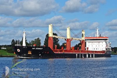
YM EVEREST
General Cargo
Current Trip
| Time Travelled | 11 days |
|---|---|
| Remaining Time | 9 days |
| Distance Travelled | 2613.32 nm |
| Remaining Distance | 2165.49 nm |
| AVG Speed | 10.2 Knopen |
| MAX Speed | 13.3 Knopen |
| AVG Wind | 15.9 knots |
| MAX Wind | 34.8 knots |
| MIN Temp | -10.9°C / 12.38°F |
| MAX Temp | 14.2°C / 57.56°F |
| Diepgang | 8.3 M |
| Positie ontvangen | Nu |
Current Position
| Lengtegraad | --- |
|---|---|
| Breedtegraat | --- |
| Status | Under way using engine |
| Snelheid | 10.5 Knopen |
| Koers | 180.4° |
| Gebied | North Atlantic Ocean |
| Station | T-AIS |
| Positie ontvangen | Nu |
Info
Information
The current position of YM EVEREST is in North Atlantic Ocean with coordinates 39.13736° / -10.10847° as reported on 2025-02-27 09:11 by AIS to our vessel tracker app. The vessel's current speed is 10.5 Knopen and is heading at the port of ALEXANDRIA. The estimated time of arrival as calculated by MyShipTracking vessel tracking app is 2025-03-08 12:55 LT
The vessel YM EVEREST (IMO: 9653812, MMSI: 229941000) is a General Cargo that was built in 2014 ( 11 Jaar oud ). It's sailing under the flag of [MT] Malta.
In this page you can find informations about the vessels current position, last detected port calls, and current voyage information. If the vessels is not in coverage by AIS you will find the latest position.
The current position of YM EVEREST is detected by our AIS receivers and we are not responsible for the reliability of the data. The last position was recorded while the vessel was in Coverage by the Ais receivers of our vessel tracking app.
The current draught of YM EVEREST as reported by AIS is 8.3 meters
Weather
| Temperature | 14.2°C / 57.56°F |
|---|---|
| Wind Speed | 21 knots |
| Direction | 185° S |
| Pressure | 1016.1 hPa |
| Humidity | 84.8 % |
| Cloud Coverage | 100 % |
Featured Company
Last Port Calls
| Port | Arrival | Departure | Time In Port |
|---|---|---|---|
| 2025-02-13 08:31 | 2025-02-15 21:08 | 2 d | |
| 2025-02-08 12:33 | 2025-02-12 19:27 | 4 d | |
| 2025-02-04 14:58 | 2025-02-07 22:41 | 3 d | |
| 2025-01-11 10:31 | 2025-01-17 07:59 | 5 d | |
| 2024-12-31 16:49 | 2025-01-08 07:37 | 7 d | |
| 2024-12-08 14:52 | 2024-12-13 08:33 | 4 d | |
| 2024-12-02 05:24 | 2024-12-06 15:41 | 4 d |
Most Visited Ports (Last year)
| Port | Arrivals | |
|---|---|---|
| 2 | ||
| 2 | ||
| 2 | ||
| 1 | ||
| 1 | ||
| 1 |
Last Trips
| Origin | Departure | Destination | Arrival | Distance | |
|---|---|---|---|---|---|
| 2025-02-12 19:27 | 2025-02-13 08:31 | 105.76 nm | |||
| 2025-02-07 22:41 | 2025-02-08 12:33 | 95.64 nm | |||
| 2025-01-17 07:59 | 2025-02-04 14:58 | 4393.78 nm | |||
| 2025-01-08 07:37 | 2025-01-11 10:31 | 454.36 nm | |||
| 2024-12-13 08:33 | 2024-12-31 16:49 | 4314.57 nm | |||
| 2024-12-06 15:41 | 2024-12-08 14:52 | 520.80 nm | |||
| 2024-11-28 16:24 | 2024-12-02 05:24 | 980.47 nm |
Events
| Tijd | Evenement | Details | Positie / Bestemming | Info |
|---|---|---|---|---|
| 2025-02-27 05:15 | ETA Changed | 2025/03/07 14:00 2025/03/07 07:00 |
39.81066 / -10.10779
EGALY
|
Snelheid: 10.4 kn Koers: 176.8° |
| 2025-02-27 04:51 | Wijzig zee gebeid | Portuguese part of the North Atlantic Ocean French part of the Celtic Sea |
39.88238 / -10.11078
North Atlantic Ocean
EGALY
|
Snelheid: 10.4 kn Koers: 178.3° |
| 2025-02-27 04:51 | Status Changed | Under way using engine Default |
39.88238 / -10.11078
EGALY
|
Snelheid: 10.3 kn Koers: 180° |
| 2025-02-27 04:39 | Binnenbereik |
39.88238 / -10.11078
North Atlantic Ocean
EGALY
|
Snelheid: 10.4 kn Koers: 178.3° |
|
| 2025-02-24 19:50 | Status Changed | Default Under way using engine |
48.35561 / -6.25404
EGALY
|
Snelheid: 9 kn Koers: 213.5° |
| 2025-02-24 19:49 | Status Changed | Under way using engine Default |
48.35742 / -6.25243
EGALY
|
Snelheid: 9.3 kn Koers: 214° |
| 2025-02-24 19:49 | Buitenbereik |
48.35742 / -6.25243
Celtic Sea
EGALY
|
Snelheid: 9 kn Koers: 213.5° |
|
| 2025-02-24 19:35 | Status Changed | Default Under way using engine |
48.38708 / -6.22369
EGALY
|
Snelheid: 9.3 kn Koers: 210.8° |
| 2025-02-24 18:40 | Status Changed | Under way using engine Default |
48.49974 / -6.11075
EGALY
|
Snelheid: 8.6 kn Koers: 212° |
| 2025-02-24 18:05 | Status Changed | Default Under way using engine |
48.57160 / -6.04103
EGALY
|
Snelheid: 8.2 kn Koers: 211.4° |