
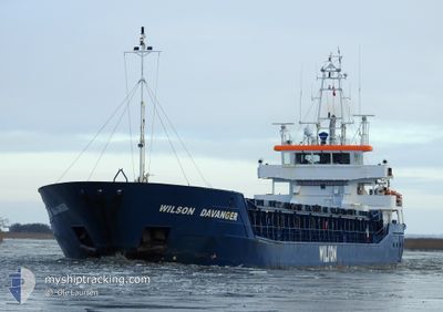
WILSON DAVANGER
General Cargo
Current Trip
FRLLG
| Time Travelled | 8 days |
|---|---|
| Remaining Time | --- |
| Distance Travelled | 1404.84 nm |
| Remaining Distance | --- |
| AVG Speed | 8.6 Knopen |
| MAX Speed | 13.1 Knopen |
| AVG Wind | 11.7 knots |
| MAX Wind | 34.5 knots |
| MIN Temp | 0.4°C / 32.72°F |
| MAX Temp | 9.9°C / 49.82°F |
| Diepgang | 4.6 M |
| Positie ontvangen | 3 h, 29 m geleden |
Current Position
| Lengtegraad | 8.55025° |
|---|---|
| Breedtegraat | 53.96961° |
| Status | Under way using engine |
| Snelheid | 6.9 Knopen |
| Koers | 280.1° |
| Gebied | North Sea |
| Station | T-AIS |
| Positie ontvangen | 3 h, 29 m geleden |
Info
Information
The current position of WILSON DAVANGER is in North Sea with coordinates 53.96961° / 8.55025° as reported on 2024-04-20 09:41 by AIS to our vessel tracker app. The vessel's current speed is 6.9 Knopen
The vessel WILSON DAVANGER (IMO: 9390111, MMSI: 314618000) is a General Cargo that was built in 2008 ( 16 Jaar oud ). It's sailing under the flag of [BB] Barbados.
In this page you can find informations about the vessels current position, last detected port calls, and current voyage information. If the vessels is not in coverage by AIS you will find the latest position.
The current position of WILSON DAVANGER is detected by our AIS receivers and we are not responsible for the reliability of the data. The last position was recorded while the vessel was in Coverage by the Ais receivers of our vessel tracking app.
The current draught of WILSON DAVANGER as reported by AIS is 4.6 meters
Weather
| Temperature | 6.9°C / 44.42°F |
|---|---|
| Wind Speed | 8 knots |
| Direction | 12° NNE |
| Pressure | 1018.8 hPa |
| Humidity | 66.2 % |
| Cloud Coverage | 100 % |
Featured Company
Last Port Calls
| Port | Arrival | Departure | Time In Port |
|---|---|---|---|
| 2024-04-10 05:05 | 2024-04-11 20:02 | 1 d | |
| 2024-04-09 06:25 | 2024-04-09 11:21 | 4 h | |
| 2024-04-05 05:24 | 2024-04-07 00:05 | 1 d | |
| 2024-03-31 07:44 | 2024-03-31 07:47 | 3 m | |
| 2024-03-26 02:23 | 2024-03-28 15:48 | 2 d | |
| 2024-03-19 00:12 | 2024-03-23 13:46 | 4 d | |
| 2024-03-15 08:26 | 2024-03-17 15:45 | 2 d | |
| 2024-03-12 05:19 | 2024-03-14 05:42 | 2 d | |
| 2024-03-07 19:52 | 2024-03-08 20:36 | 1 d | |
| 2024-03-07 00:21 | 2024-03-07 19:37 | 19 h |
Last Trips
| Origin | Departure | Destination | Arrival | Distance | |
|---|---|---|---|---|---|
| 2024-04-09 13:21 | 2024-04-10 07:05 | 125.81 nm | |||
| 2024-04-07 03:05 | 2024-04-09 08:25 | 462.50 nm | |||
| 2024-03-31 09:47 | 2024-04-05 08:24 | 800.79 nm | |||
| 2024-03-28 16:48 | 2024-03-31 09:44 | 605.57 nm | |||
| 2024-03-23 14:46 | 2024-03-26 03:23 | 485.12 nm | |||
| 2024-03-17 16:45 | 2024-03-19 01:12 | 269.99 nm | |||
| 2024-03-14 06:42 | 2024-03-15 09:26 | 280.05 nm | |||
| 2024-03-08 21:36 | 2024-03-12 06:19 | 646.27 nm | |||
| 2024-03-07 20:37 | 2024-03-07 20:52 | 0.97 nm | |||
| 2024-03-04 06:15 | 2024-03-07 01:21 | 624.68 nm |
Events
| Tijd | Evenement | Details | Positie / Bestemming | Info |
|---|---|---|---|---|
| 2024-04-20 09:48 | Status Changed | Default Under way using engine |
53.97229 / 8.52686
FRLLG
|
Snelheid: 6.9 kn Koers: 280.1° |
| 2024-04-20 09:41 | Status Changed | Under way using engine Default |
53.96961 / 8.55025
FRLLG
|
Snelheid: 6.9 kn Koers: 280° |
| 2024-04-20 09:41 | Buitenbereik |
53.96961 / 8.55025
North Sea
FRLLG
|
Snelheid: 6.9 kn Koers: 280.1° |
|
| 2024-04-20 09:40 | Status Changed | Default Under way using engine |
53.96932 / 8.55293
FRLLG
|
Snelheid: 6.9 kn Koers: 280.7° |
| 2024-04-20 09:40 | Status Changed | Under way using engine Default |
53.96926 / 8.55346
FRLLG
|
Snelheid: 6.7 kn Koers: 283° |
| 2024-04-20 09:32 | Status Changed | Default Under way using engine |
53.96630 / 8.57840
FRLLG
|
Snelheid: 6.6 kn Koers: 290.1° |
| 2024-04-20 07:17 | Status Changed | Under way using engine Default |
53.84533 / 8.91273
FRLLG
|
Snelheid: 8.2 kn Koers: 262° |
| 2024-04-20 07:16 | Status Changed | Default Under way using engine |
53.84556 / 8.91547
FRLLG
|
Snelheid: 8 kn Koers: 259.3° |
| 2024-04-20 07:09 | Wijzig zee gebeid | German part of the North Sea German part of the Baltic Sea |
53.84898 / 8.94297
North Sea
FRLLG
|
Snelheid: 8 kn Koers: 259.3° |
| 2024-04-20 07:09 | Status Changed | Under way using engine Default |
53.84898 / 8.94297
FRLLG
|
Snelheid: 8.2 kn Koers: 260° |