
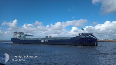
VERTOM JOYCE
Cargo
Current Trip
| Time Travelled | 13 h, 5 mins |
|---|---|
| Remaining Time | 16 h, 47 mins |
| Distance Travelled | 123.50 nm |
| Remaining Distance | 170.06 nm |
| AVG Speed | 9.5 Knopen |
| MAX Speed | 11.4 Knopen |
| AVG Wind | 12.6 knots |
| MAX Wind | 18.7 knots |
| MIN Temp | 4.7°C / 40.46°F |
| MAX Temp | 6.1°C / 42.98°F |
| Diepgang | 4.1 M |
| Positie ontvangen | 1 m geleden |
Current Position
| Lengtegraad | --- |
|---|---|
| Breedtegraat | --- |
| Status | Under way using engine |
| Snelheid | 10.2 Knopen |
| Koers | 177.8° |
| Gebied | Kattegat |
| Station | T-AIS |
| Positie ontvangen | 1 m geleden |
Info
Information
The current position of VERTOM JOYCE is in Kattegat with coordinates 55.76802° / 12.69670° as reported on 2025-12-07 04:12 by AIS to our vessel tracker app. The vessel's current speed is 10.2 Knopen and is heading at the port of SZCZECIN. The estimated time of arrival as calculated by MyShipTracking vessel tracking app is 2025-12-07 22:00 LT
The vessel VERTOM JOYCE (IMO: 9993365, MMSI: 244549000) is a Cargo It's sailing under the flag of [NL] Netherlands.
In this page you can find informations about the vessels current position, last detected port calls, and current voyage information. If the vessels is not in coverage by AIS you will find the latest position.
The current position of VERTOM JOYCE is detected by our AIS receivers and we are not responsible for the reliability of the data. The last position was recorded while the vessel was in Coverage by the Ais receivers of our vessel tracking app.
The current draught of VERTOM JOYCE as reported by AIS is 4.1 meters
Weather
| Temperature | 6.1°C / 42.98°F |
|---|---|
| Wind Speed | 12 knots |
| Direction | 150° SSE |
| Pressure | 1006.4 hPa |
| Humidity | 90.6 % |
| Cloud Coverage | 100 % |
Featured Company
Last Port Calls
| Port | Arrival | Departure | Time In Port |
|---|---|---|---|
| 2025-11-30 11:49 | 2025-12-06 16:08 | 6 d | |
| 2025-11-02 11:05 | |||
| 2025-10-10 09:49 | 2025-10-11 04:42 | 18 h | |
| 2025-10-01 20:31 | 2025-10-04 13:11 | 2 d |
Events
| Tijd | Evenement | Details | Positie / Bestemming | Info |
|---|---|---|---|---|
| 2025-12-07 03:08 | Wijzig zee gebeid | Danish part of the Kattegat Swedish part of the Kattegat |
55.93491 / 12.65143
Kattegat
PLSZZ
|
Snelheid: 11 kn Koers: 199.3° |
| 2025-12-07 02:29 | Wijzig zee gebeid | Swedish part of the Kattegat Danish part of the Kattegat |
56.04354 / 12.65334
Kattegat
PLSZZ
|
Snelheid: 8.7 kn Koers: 166° |
| 2025-12-06 23:35 | Binnenbereik |
56.28752 / 12.07506
Kattegat
PLSZZ
|
Snelheid: 10 kn Koers: 122.6° |
|
| 2025-12-06 17:05 | Buitenbereik |
56.89530 / 10.52059
Kattegat
PLSZZ
|
Snelheid: 9.7 kn Koers: 140.9° |
|
| 2025-12-06 15:08 | Vertrekhaven |
|
57.06017 / 10.04920
PLSZZ
|
Snelheid: 11.5 kn Koers: 148° |
| 2025-12-06 14:45 | Start beweging |
57.06762 / 9.97012
[DK] AALBORG
|
Snelheid: 3.1 kn Koers: 22° |
|
| 2025-12-06 14:45 | Status Changed | Under way using engine Moored |
57.06748 / 9.97018
[DK] AALBORG
|
Snelheid: 1.7 kn Koers: 294° |
| 2025-12-06 07:37 | Draught Changed | 4.1 6.3 |
57.06661 / 9.97331
[DK] AALBORG
|
Snelheid: Koers: 199° |
| 2025-12-06 07:37 | Destination Changed | PLSZZ DKAAL |
57.06661 / 9.97331
[DK] AALBORG
|
Snelheid: Koers: 199° |
| 2025-12-06 07:37 | ETA Changed | 2025/12/07 18:00 2026/11/30 09:00 |
57.06661 / 9.97331
[DK] AALBORG
|
Snelheid: Koers: 199° |