
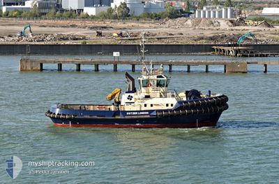
SVITZER LONDON
Tug
Current Trip
Current Position
| Lengtegraad | --- |
|---|---|
| Breedtegraat | --- |
| Status | At anchor |
| Snelheid | |
| Koers | 270° |
| Gebied | North Sea |
| Station | T-AIS |
| Positie ontvangen | Nu |
Info
Information
The current position of SVITZER LONDON is in North Sea with coordinates 51.44667° / 0.38340° as reported on 2025-02-27 21:48 by AIS to our vessel tracker app. The vessel's current speed is 0 Knopen and is currently inside the port of GRAVESEND.
The vessel SVITZER LONDON (IMO: 9695511, MMSI: 235103697) is a Tug It's sailing under the flag of [GB] United Kingdom.
In this page you can find informations about the vessels current position, last detected port calls, and current voyage information. If the vessels is not in coverage by AIS you will find the latest position.
The current position of SVITZER LONDON is detected by our AIS receivers and we are not responsible for the reliability of the data. The last position was recorded while the vessel was in Coverage by the Ais receivers of our vessel tracking app.
The current draught of SVITZER LONDON as reported by AIS is 5.5 meters
Weather
| Temperature | 3.1°C / 37.58°F |
|---|---|
| Wind Speed | 6 knots |
| Direction | 340° NNW |
| Pressure | 1025.4 hPa |
| Humidity | 89.5 % |
| Cloud Coverage | 8 % |
Featured Company
Last Port Calls
| Port | Arrival | Departure | Time In Port |
|---|---|---|---|
| 2025-02-27 16:13 | |||
| 2025-02-27 14:31 | 2025-02-27 15:29 | 57 m | |
| 2025-02-26 23:06 | 2025-02-27 12:28 | 13 h | |
| 2025-02-26 22:02 | 2025-02-26 22:45 | 43 m | |
| 2025-02-26 13:15 | 2025-02-26 21:21 | 8 h | |
| 2025-02-26 12:04 | 2025-02-26 12:33 | 29 m | |
| 2025-02-26 09:56 | 2025-02-26 10:58 | 1 h | |
| 2025-02-25 02:55 | 2025-02-26 09:13 | 1 d | |
| 2025-02-25 01:38 | 2025-02-25 02:20 | 41 m | |
| 2025-02-25 00:35 | 2025-02-25 00:49 | 13 m |
Most Visited Ports (Last year)
| Port | Arrivals | |
|---|---|---|
| 426 | ||
| 245 | ||
| 180 | ||
| 100 | ||
| 59 | ||
| 35 |
Last Trips
| Origin | Departure | Destination | Arrival | Distance | |
|---|---|---|---|---|---|
| 2025-02-27 15:29 | 2025-02-27 16:13 | 5.20 nm | |||
| 2025-02-27 12:28 | 2025-02-27 14:31 | 9.83 nm | |||
| 2025-02-26 22:45 | 2025-02-26 23:06 | 2.82 nm | |||
| 2025-02-26 21:21 | 2025-02-26 22:02 | 3.05 nm | |||
| 2025-02-26 12:33 | 2025-02-26 13:15 | 5.90 nm | |||
| 2025-02-26 10:58 | 2025-02-26 12:04 | 6.28 nm | |||
| 2025-02-26 09:13 | 2025-02-26 09:56 | 2.12 nm | |||
| 2025-02-25 02:20 | 2025-02-25 02:55 | 4.88 nm | |||
| 2025-02-25 00:49 | 2025-02-25 01:38 | 3.25 nm | |||
| 2025-02-24 23:31 | 2025-02-25 00:35 | 7.65 nm |
Events
| Tijd | Evenement | Details | Positie / Bestemming | Info |
|---|---|---|---|---|
| 2025-02-27 16:24 | Status Changed | At anchor Under way using engine |
51.44635 / .38454
[GB] GRAVESEND
|
Snelheid: 0.2 kn Koers: 95° |
| 2025-02-27 16:14 | Stop beweging |
51.44640 / .38451
[GB] GRAVESEND
|
Snelheid: 0.2 kn Koers: 94° |
|
| 2025-02-27 16:13 | Aankomsthaven |
|
51.44657 / .38476
[GB] GRAVESEND
|
Snelheid: 0.9 kn Koers: 343° |
| 2025-02-27 15:29 | Vertrekhaven |
|
51.49934 / .48295
THAMES
|
Snelheid: 6.5 kn Koers: 255° |
| 2025-02-27 15:24 | Start beweging |
51.50238 / .49496
[GB] THAMES
|
Snelheid: 3.3 kn Koers: 9° |
|
| 2025-02-27 14:32 | Stop beweging |
51.50246 / .49788
[GB] THAMES
|
Snelheid: 0.3 kn Koers: 322° |
|
| 2025-02-27 14:31 | Aankomsthaven |
|
51.50246 / .49802
[GB] THAMES
|
Snelheid: 0.6 kn Koers: 311° |
| 2025-02-27 13:51 | Start beweging | 0.22 nm, South of CANVEY ISLAND |
51.50334 / .56241
THAMES
|
Snelheid: 7.9 kn Koers: 276.4° |
| 2025-02-27 13:43 | Stop beweging | 0.29 nm, South of CANVEY ISLAND |
51.50254 / .56569
THAMES
|
Snelheid: 0.3 kn Koers: 106° |
| 2025-02-27 13:29 | Start beweging | 0.55 nm, West of CANVEY ISLAND |
51.50554 / .54854
THAMES
|
Snelheid: 4.4 kn Koers: 94° |