
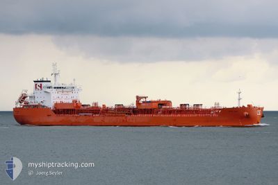
STOLT APAL
Tanker C
Current Trip
| Time Travelled | 30 days |
|---|---|
| Remaining Time | 11 days |
| Distance Travelled | 9625.24 nm |
| Remaining Distance | 3642.62 nm |
| AVG Speed | 12.8 Knopen |
| MAX Speed | 16.1 Knopen |
| AVG Wind | 11 knots |
| MAX Wind | 30 knots |
| MIN Temp | 13.2°C / 55.76°F |
| MAX Temp | 29.4°C / 84.92°F |
| Diepgang | 10.3 M |
| Positie ontvangen | 6 d geleden |
Current Position
| Lengtegraad | 18.98378° |
|---|---|
| Breedtegraat | -35.02088° |
| Status | Under way using engine |
| Snelheid | 13.1 Knopen |
| Koers | 114.5° |
| Gebied | South Atlantic Ocean |
| Station | T-AIS |
| Positie ontvangen | 6 d geleden |
Info
Information
The current position of STOLT APAL is in South Atlantic Ocean with coordinates -35.02088° / 18.98378° as reported on 2024-04-18 14:13 by AIS to our vessel tracker app. The vessel's current speed is 13.1 Knopen and is heading at the port of SINGAPORE. The estimated time of arrival as calculated by MyShipTracking vessel tracking app is 2024-05-06 02:01 LT
The vessel STOLT APAL (IMO: 9719240, MMSI: 255806419) is a Tanker C It's sailing under the flag of [PT] Portugal.
In this page you can find informations about the vessels current position, last detected port calls, and current voyage information. If the vessels is not in coverage by AIS you will find the latest position.
The current position of STOLT APAL is detected by our AIS receivers and we are not responsible for the reliability of the data. The last position was recorded while the vessel was in Coverage by the Ais receivers of our vessel tracking app.
The current draught of STOLT APAL as reported by AIS is 10.3 meters
Weather
| Temperature | 24.6°C / 76.28°F |
|---|---|
| Wind Speed | 10 knots |
| Direction | 113° ESE |
| Pressure | 1016.6 hPa |
| Humidity | 82 % |
| Cloud Coverage | 1 % |
Featured Company
Last Port Calls
| Port | Arrival | Departure | Time In Port |
|---|---|---|---|
| 2024-03-23 15:12 | 2024-03-24 20:26 | 1 d | |
| 2024-03-19 00:08 | 2024-03-20 04:22 | 1 d | |
| 2024-03-16 08:24 | 2024-03-17 04:44 | 20 h | |
| 2024-03-09 20:40 | 2024-03-13 19:44 | 3 d | |
| 2024-03-05 03:19 | 2024-03-08 07:17 | 3 d | |
| 2024-02-29 14:03 | 2024-03-01 14:24 | 1 d | |
| 2024-02-27 13:59 | 2024-02-28 17:05 | 1 d | |
| 2024-02-20 14:41 | 2024-02-22 01:59 | 1 d | |
| 2024-02-09 00:50 | 2024-02-12 11:18 | 3 d | |
| 2024-02-04 13:33 | 2024-02-07 02:04 | 2 d |
Most Visited Ports (Last year)
| Port | Arrivals | |
|---|---|---|
| 7 | ||
| 6 | ||
| 3 | ||
| 3 | ||
| 3 | ||
| 2 |
Last Trips
| Origin | Departure | Destination | Arrival | Distance | |
|---|---|---|---|---|---|
| 2024-03-19 23:22 | 2024-03-23 10:12 | 53.85 nm | |||
| 2024-03-16 23:44 | 2024-03-18 19:08 | 50.66 nm | |||
| 2024-03-13 14:44 | 2024-03-16 03:24 | 62.94 nm | |||
| 2024-03-08 01:17 | 2024-03-09 14:40 | 437.11 nm | |||
| 2024-03-01 09:24 | 2024-03-04 21:19 | 1111.14 nm | |||
| 2024-02-28 12:05 | 2024-02-29 09:03 | 44.95 nm | |||
| 2024-02-21 20:59 | 2024-02-27 08:59 | 781.20 nm | |||
| 2024-02-12 05:18 | 2024-02-20 09:41 | 1588.81 nm | |||
| 2024-02-06 20:04 | 2024-02-08 18:50 | 514.74 nm | |||
| 2024-02-01 08:42 | 2024-02-04 07:33 | 68.10 nm |
Events
| Tijd | Evenement | Details | Positie / Bestemming | Info |
|---|---|---|---|---|
| 2024-04-18 14:23 | Status Changed | Default Under way using engine |
-35.03651 / 19.02487
SGSIN
|
Snelheid: 13.1 kn Koers: 114.5° |
| 2024-04-18 14:13 | Status Changed | Under way using engine Default |
-35.02088 / 18.98378
SGSIN
|
Snelheid: 12 kn Koers: 116° |
| 2024-04-18 14:13 | Binnenbereik |
-35.02088 / 18.98378
South Atlantic Ocean
SGSIN
|
Snelheid: 13.1 kn Koers: 114.5° |
|
| 2024-04-18 14:13 | Buitenbereik |
-35.02088 / 18.98378
South Atlantic Ocean
SGSIN
|
Snelheid: 13.1 kn Koers: 114.5° |
|
| 2024-04-18 12:28 | Status Changed | Default Under way using engine |
-34.83535 / 18.58977
SGSIN
|
Snelheid: 13.7 kn Koers: 126.3° |
| 2024-04-18 12:15 | Buitenbereik |
-34.80506 / 18.54615
South Atlantic Ocean
SGSIN
|
Snelheid: 13.7 kn Koers: 126.3° |
|
| 2024-04-18 09:32 | Status Changed | Under way using engine Default |
-34.37671 / 18.15696
SGSIN
|
Snelheid: 13 kn Koers: 171° |
| 2024-04-18 09:29 | Status Changed | Default Under way using engine |
-34.36666 / 18.15333
SGSIN
|
Snelheid: 13.6 kn Koers: 170.8° |
| 2024-04-18 09:21 | Status Changed | Under way using engine Default |
-34.33647 / 18.14875
SGSIN
|
Snelheid: 13.3 kn Koers: 169° |
| 2024-04-18 09:12 | Status Changed | Default Under way using engine |
-34.30355 / 18.14180
SGSIN
|
Snelheid: 13.4 kn Koers: 168.1° |