
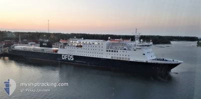
SIRENA SEAWAYS
Ro-Ro/Passenger Ship
Current Trip
| Trip Time | 9 h, 45 mins |
|---|---|
| Trip Distance | 156.72 nm |
| AVG Speed | 16.4 Knopen |
| MAX Speed | 19 Knopen |
| Diepgang | 6 M |
| AVG Wind | 12.8 knots |
| MAX Wind | 18.3 knots |
| MIN Temp | -1.4°C / 29.48°F |
| MAX Temp | 1.5°C / 34.7°F |
| Positie ontvangen | 1 m geleden |
Current Position
| Lengtegraad | 24.05043° |
|---|---|
| Breedtegraat | 59.34833° |
| Status | Moored |
| Snelheid | |
| Koers | 151° |
| Gebied | Gulf of Finland |
| Station | T-AIS |
| Positie ontvangen | 1 m geleden |
Info
Information
The current position of SIRENA SEAWAYS is in Gulf of Finland with coordinates 59.34833° / 24.05043° as reported on 2024-04-20 09:42 by AIS to our vessel tracker app. The vessel's current speed is 0 Knopen and is currently inside the port of PALDISKI.
The vessel SIRENA SEAWAYS (IMO: 9212163, MMSI: 277569000) is a Ro-Ro/Passenger Ship that was built in 2003 ( 21 Jaar oud ). It's sailing under the flag of [LT] Lithuania.
In this page you can find informations about the vessels current position, last detected port calls, and current voyage information. If the vessels is not in coverage by AIS you will find the latest position.
The current position of SIRENA SEAWAYS is detected by our AIS receivers and we are not responsible for the reliability of the data. The last position was recorded while the vessel was in Coverage by the Ais receivers of our vessel tracking app.
The current draught of SIRENA SEAWAYS as reported by AIS is 6 meters
Weather
| Temperature | 0.7°C / 33.26°F |
|---|---|
| Wind Speed | 7 knots |
| Direction | 283° WNW |
| Pressure | 1007.2 hPa |
| Humidity | 68.1 % |
| Cloud Coverage | 99 % |
Featured Company
Last Port Calls
| Port | Arrival | Departure | Time In Port |
|---|---|---|---|
| 2024-04-20 04:40 | |||
| 2024-04-19 16:50 | 2024-04-19 18:55 | 2 h | |
| 2024-04-19 04:39 | 2024-04-19 06:46 | 2 h | |
| 2024-04-18 16:46 | 2024-04-18 18:51 | 2 h | |
| 2024-04-18 04:39 | 2024-04-18 06:55 | 2 h | |
| 2024-04-17 05:21 | 2024-04-17 19:24 | 14 h | |
| 2024-04-16 16:39 | 2024-04-16 19:23 | 2 h | |
| 2024-04-16 05:16 | 2024-04-16 06:58 | 1 h | |
| 2024-04-15 16:41 | 2024-04-15 18:54 | 2 h | |
| 2024-04-15 05:15 | 2024-04-15 07:08 | 1 h |
Most Visited Ports (Last year)
| Port | Arrivals | |
|---|---|---|
| 297 | ||
| 265 |
Last Trips
| Origin | Departure | Destination | Arrival | Distance | |
|---|---|---|---|---|---|
| 2024-04-19 20:55 | 2024-04-20 07:40 | 156.72 nm | |||
| 2024-04-19 09:46 | 2024-04-19 18:50 | 156.15 nm | |||
| 2024-04-18 20:51 | 2024-04-19 07:39 | 156.90 nm | |||
| 2024-04-18 09:55 | 2024-04-18 18:46 | 156.27 nm | |||
| 2024-04-17 21:24 | 2024-04-18 07:39 | 156.86 nm | |||
| 2024-04-16 22:23 | 2024-04-17 07:21 | 156.73 nm | |||
| 2024-04-16 08:58 | 2024-04-16 19:39 | 153.74 nm | |||
| 2024-04-15 21:54 | 2024-04-16 07:16 | 156.12 nm | |||
| 2024-04-15 09:08 | 2024-04-15 19:41 | 156.32 nm | |||
| 2024-04-14 22:55 | 2024-04-15 07:15 | 156.94 nm |
Events
| Tijd | Evenement | Details | Positie / Bestemming | Info |
|---|---|---|---|---|
| 2024-04-20 04:53 | ETA Changed | 2024/04/21 05:30 2024/04/20 05:00 |
59.34833 / 24.05049
[EE] PALDISKI
|
Snelheid: Koers: 151° |
| 2024-04-20 04:53 | Status Changed | Moored Under way using engine |
59.34835 / 24.05048
[EE] PALDISKI
|
Snelheid: Koers: 151° |
| 2024-04-20 04:46 | Stop beweging |
59.34824 / 24.04997
[EE] PALDISKI
|
Snelheid: 0.2 kn Koers: 140° |
|
| 2024-04-20 04:40 | Aankomsthaven |
|
59.35084 / 24.03948
[EE] PALDISKI
|
Snelheid: 7.7 kn Koers: 118.6° |
| 2024-04-20 04:11 | Status Changed | Under way using engine Default |
59.39876 / 23.82352
EE PLN <=> SE KPS
|
Snelheid: 15.7 kn Koers: 108° |
| 2024-04-20 03:23 | Status Changed | Default Under way using engine |
59.46314 / 23.42479
EE PLN <=> SE KPS
|
Snelheid: 15.9 kn Koers: 107.8° |
| 2024-04-20 02:56 | Wijzig zee gebeid | Estonian part of the Gulf of Finland Estonian part of the Baltic Sea |
59.50034 / 23.20320
Gulf of Finland
EE PLN <=> SE KPS
|
Snelheid: 15.8 kn Koers: 107.6° |
| 2024-04-20 02:47 | Wijzig zee gebeid | Estonian part of the Baltic Sea Finnish part of the Baltic Sea |
59.51208 / 23.13095
Baltic Sea
EE PLN <=> SE KPS
|
Snelheid: 15.9 kn Koers: 107.1° |
| 2024-04-20 01:05 | Status Changed | Under way using engine Default |
59.56719 / 22.27016
EE PLN <=> SE KPS
|
Snelheid: 15.8 kn Koers: 86° |
| 2024-04-20 00:45 | Status Changed | Default Under way using engine |
59.56049 / 22.09923
EE PLN <=> SE KPS
|
Snelheid: 15.8 kn Koers: 85.3° |