
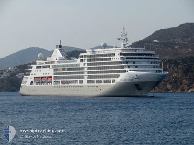
SILVER SPIRIT
Passengers Ship
Current Trip
| Time Travelled | 19 h, 24 mins |
|---|---|
| Remaining Time | 11 h, 33 mins |
| Distance Travelled | 198.48 nm |
| Remaining Distance | 140.02 nm |
| AVG Speed | 12.7 Knopen |
| MAX Speed | 17.5 Knopen |
| AVG Wind | 7.8 knots |
| MAX Wind | 15.4 knots |
| MIN Temp | 10.3°C / 50.54°F |
| MAX Temp | 19.7°C / 67.46°F |
| Diepgang | 6.6 M |
| Positie ontvangen | 1 h, 24 m geleden |
Current Position
| Lengtegraad | 25.18286° |
|---|---|
| Breedtegraat | 39.66457° |
| Status | Under way using engine |
| Snelheid | 10.8 Knopen |
| Koers | 270.8° |
| Gebied | Aegean Sea |
| Station | T-AIS |
| Positie ontvangen | 1 h, 24 m geleden |
Info
Information
The current position of SILVER SPIRIT is in Aegean Sea with coordinates 39.66457° / 25.18286° as reported on 2024-04-19 14:19 by AIS to our vessel tracker app. The vessel's current speed is 10.8 Knopen and is heading at the port of THESSALONIKI. The estimated time of arrival as calculated by MyShipTracking vessel tracking app is 2024-04-20 03:17 LT
The vessel SILVER SPIRIT (IMO: 9437866, MMSI: 311022500) is a Passengers Ship that was built in 2009 ( 15 Jaar oud ). It's sailing under the flag of [BS] Bahamas.
In this page you can find informations about the vessels current position, last detected port calls, and current voyage information. If the vessels is not in coverage by AIS you will find the latest position.
The current position of SILVER SPIRIT is detected by our AIS receivers and we are not responsible for the reliability of the data. The last position was recorded while the vessel was in Coverage by the Ais receivers of our vessel tracking app.
The current draught of SILVER SPIRIT as reported by AIS is 6.6 meters
Weather
| Temperature | 16.5°C / 61.7°F |
|---|---|
| Wind Speed | 8 knots |
| Direction | 35° NE |
| Pressure | 1007.6 hPa |
| Humidity | 69.1 % |
| Cloud Coverage | 6 % |
Featured Company
Last Port Calls
| Port | Arrival | Departure | Time In Port |
|---|---|---|---|
| 2024-04-17 03:39 | 2024-04-18 20:20 | 1 d | |
| 2024-04-15 04:32 | 2024-04-15 20:02 | 15 h | |
| 2024-04-14 04:21 | 2024-04-14 15:27 | 11 h | |
| 2024-04-13 04:20 | 2024-04-13 15:07 | 10 h | |
| 2024-04-12 04:32 | 2024-04-12 18:26 | 13 h | |
| 2024-04-11 03:44 | 2024-04-11 16:06 | 12 h | |
| 2024-04-10 03:09 | 2024-04-10 16:06 | 12 h | |
| 2024-04-09 03:58 | 2024-04-09 19:10 | 15 h | |
| 2024-04-08 04:31 | 2024-04-08 16:04 | 11 h | |
| 2024-04-07 04:25 | 2024-04-07 19:59 | 15 h |
Last Trips
| Origin | Departure | Destination | Arrival | Distance | |
|---|---|---|---|---|---|
| 2024-04-15 23:02 | 2024-04-17 06:39 | 354.19 nm | |||
| 2024-04-14 18:27 | 2024-04-15 07:32 | 191.37 nm | |||
| 2024-04-13 18:07 | 2024-04-14 07:21 | 169.66 nm | |||
| 2024-04-12 21:26 | 2024-04-13 07:20 | 81.24 nm | |||
| 2024-04-11 19:06 | 2024-04-12 07:32 | 138.27 nm | |||
| 2024-04-10 19:06 | 2024-04-11 06:44 | 154.31 nm | |||
| 2024-04-09 22:10 | 2024-04-10 06:09 | 98.91 nm | |||
| 2024-04-08 19:04 | 2024-04-09 06:58 | 149.05 nm | |||
| 2024-04-07 22:59 | 2024-04-08 07:31 | 75.77 nm | |||
| 2024-04-05 23:08 | 2024-04-07 07:25 | 393.16 nm |
Events
| Tijd | Evenement | Details | Positie / Bestemming | Info |
|---|---|---|---|---|
| 2024-04-19 14:19 | Buitenbereik |
39.66457 / 25.18286
Aegean Sea
TRIST>>GRSKG
|
Snelheid: 10.8 kn Koers: 270.8° |
|
| 2024-04-19 11:06 | Wijzig zee gebeid | Greek part of the Aegean Sea Turkish part of the Aegean Sea |
39.92099 / 25.81140
Aegean Sea
TRIST>>GRSKG
|
Snelheid: 10.8 kn Koers: 228.4° |
| 2024-04-19 09:32 | Gevonden in zee | Turkish part of the Aegean Sea |
40.02273 / 26.12986
Aegean Sea
TRIST>>GRSKG
|
Snelheid: 10.6 kn Koers: 265.1° |
| 2024-04-19 07:31 | Binnenbereik |
40.30169 / 26.57470
Sea of Marmara
TRIST>>GRSKG
|
Snelheid: 15.8 kn Koers: 228.5° |
|
| 2024-04-19 05:07 | Buitenbereik |
40.55015 / 27.03562
Sea of Marmara
TRIST>>GRSKG
|
Snelheid: 10.3 kn Koers: 241.7° |
|
| 2024-04-18 20:20 | Vertrekhaven |
|
41.00028 / 28.99130
TRIST>>GRSKG
|
Snelheid: 12 kn Koers: 185° |
| 2024-04-18 20:11 | Start beweging |
41.02450 / 28.98792
[TR] ISTANBUL
|
Snelheid: 3.5 kn Koers: 133° |
|
| 2024-04-18 20:03 | Status Changed | Under way using engine Moored |
41.02661 / 28.98570
[TR] ISTANBUL
|
Snelheid: Koers: 60° |
| 2024-04-18 18:13 | Destination Changed | TRIST>>GRSKG TRKUS>>>TRIST |
41.02661 / 28.98570
[TR] ISTANBUL
|
Snelheid: Koers: 59° |
| 2024-04-18 18:13 | ETA Changed | 2024/04/20 04:15 2024/04/17 04:00 |
41.02661 / 28.98570
[TR] ISTANBUL
|
Snelheid: Koers: 59° |